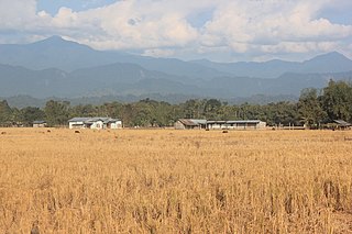
Dhemaji is a City in Assam and it is the headquarters of Dhemaji district, Assam, India.

Dhubri is an old town and headquarter of Dhubri district in Indian state of Assam. It is an old town on the bank of the Brahmaputra river, with historical significance. In 1883, the town was first constituted as a Municipal Board under the British regime. It is situated about 277.4 kilometres (172 mi) west from Dispur, the state capital of Assam.

Dhemaji district is an administrative district in the state of Assam in India. The district headquarters are located at Dhemaji and commercial headquarters being located Silapathar. The district occupies an area of 3237 km² and has a population of 686,133. Main religions are Hindus 548,780, Muslims 10,533, Christians 6,390.
Barpathar is a town and a municipality board in Golaghat district in the state of Assam, India.
Bhatpar Rani is a town and tehsil in Deoria District in the state of Uttar Pradesh in India. It belongs to Gorakhpur Division. It is located 48 km towards East from District headquarters Deoria.The Member of Legislative Council of Bhatpar Rani Constituency is Shri. Sabhakunwar Kushwaha In Bhatpar Rani, the block number of village is 127. The biggest village in this tehsil is Sarayan. Khan Sir(Teacher), Shilpi Raj(Singer) were born here.
Rani is a town and municipality and tehsil of Pali district in the Indian state of Rajasthan. It lies on the banks of Sukri River, a tributary of the Luni River. It is an important railway station on Ahmedabad-Delhi railway line. Some nearby villages are Beejowa,Itendra Medtian,etc.
Peth or Peint is the smallest tehsil of Nashik subdivision of Nashik district in Maharashtra, India. It belongs to Northern Maharashtra region. It belongs to Nashik Division. Peth is a Taluka headquarter. It is located 54 km to the West of Nashik District headquarters. It is also called as Peint. Pin code of Peth is 422208 and postal head office is Peth.
Kavathe-Mahankalpronunciation (help·info) is a tehsil in Miraj subdivision of Sangli district in the Indian state of Maharashtra. This is famous for Mahankali Devi temple and Mallikarjun Temple. There is also a Sugar Factory, named after the same Goddess Mahankali Sugar Factory.

Samba is a town, municipal committee in the Samba Tehsil of the Samba District in the Union Territory of Jammu and Kashmir, India. It is the administrative headquarter of Samba district. Samba has his own railway station are Samba railway station on Jammu-Delhi railway line.

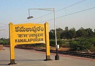
Kamalapuram is a Town and Nagara Panchayat in YSR Kadapa district of the Indian state of Andhra Pradesh. It is located in Kamalapuram mandal of Kadapa revenue division and is the Thaluka headquarter of Kamalapuram assembly constituency.
Dimow is a Medium-sized village in Sissiborgaon tehsil, Dhemaji district in the Indian state of Assam. It is situated at a distance of 48 km from its district headquarters Dhemaji and 16 km from nearest town Silapathar.

Kaimri is a village in Karauli district of Rajasthan State in India.
Bagor is a town with Sub-Tehsil in Mandal tehsil of Bhilwara district of Rajasthan State, India.
Saloli is a large village located in Reni Tehsil of Alwar district, Rajasthan with total 550 families residing. The Saloli village has population of 2807 of which 1488 are males while 1319 are females as per Population Census 2011.
Barni (Barhni) is a small village of Baliah Panchyat of Barsar District Hamirpur, Himachal Pradesh. According to Census 2011 information the location code or village code of Barni village is 017512. Barni village is located in Barsar Tehsil of Hamirpur district in Himachal Pradesh, India. It is situated 35 km away from district headquarter hamirpur. Barsar is the sub-district headquarter of Barni village.
Udharbond is a Tehsil or Block in Cachar district in the state of Assam, India. It is located 17 km from District headquarters Silchar.
Sani Udiyar is a village situated in Kanda Tehsil in Bageshwar district in the State of Uttarakhand, India. It is located at a distance of 15 kilometres (9.3 mi) from Kanda and 36 kilometres (22 mi) from Bageshwar. Sani Udiyar is a medium-sized village with total 88 families residing. It has substantial population of people belonging to Schedule Caste.
Shahzadpur is a Town in Shahzadpur Tehsil in Ambala District of Haryana State, India. It belongs to Ambala Division. It is located 30 km towards East from District headquarters Ambala. It is a Tehsil headquarter. Shahzadpur Pin code is 134202 and postal head office is Shahzadpur.

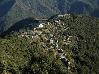
Khamlang village is situated on the southern part of Ukhrul District, Manipur, India. It is inhabited by Khameon a Tangkhul Naga tribe. It is situated 2 km away from headquarter of Sub-Division, Kasom Khullen, 137 km away from district headquarter Ukhrul and 59 km from state capital Imphal, Manipur.
Sanay is a village in Budaun district, Uttar Pradesh. Its village code is 128237. It is located on the right side of river Sot. Sanai is a medium size village located in Budaun of Budaun district, Uttar Pradesh with total 118 families residing. The Sanai village has population of 683 of which 366 are males while 317 are females as per Population Census 2011.


