Sivia District

Last updated
Sivia
Sivia (2).jpg
Sivia
Sivia District
Country Flag of Peru.svg  Peru
Region Ayacucho
Province Huanta
FoundedNovember 6, 1992
Capital Sivia
Government
   Mayor Alejandro Gutierrez Escajadillo
Area
  Total
723.39 km2 (279.30 sq mi)
Elevation
551 m (1,808 ft)
Population
 (2007 census)
  Total
11,956
  Density17/km2 (43/sq mi)
Time zone UTC-5 (PET)
UBIGEO 050407
Website desa.inei.gob.pe

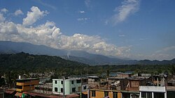
Sivia District is located in the Huanta Province in the Ayacucho Region of Peru. The district was created by "legislative decree" 25845 on November 6, 1992. Its capital, Sivia, is located at an altitude of 551 m. The district had a population of 11,956 inhabitants as of the 2007 census, with an area of 723.39 km2 (279.30 sq mi).

Contents

Capital

Sivia is the capital of the district with a 2010 population of 6,000 inhabitants, according to INEI 2007 Census it had only 3,319 inhabitants, this growth is due to migration receives from the Andean part of the Ayacucho Region those in search of better opportunities for development have been established in the city of Sivia.

Geography

One of the highest peaks of the district is Allpa Chaka at approximately 4,400 m (14,400 ft). Other mountains are listed below: [1]

Ethnic groups

The people in the district are mainly indigenous citizens of Quechua descent. Quechua is the language which the majority of the population (67.11%) learnt to speak in childhood, 32.68% of the residents started speaking using the Spanish language (2007 Peru Census). [2]

References

  1. escale.minedu.gob.pe/ UGEL map Huanta Province (Ayacucho Region)
  2. inei.gob.pe Archived 2013-01-27 at the Wayback Machine INEI, Peru, Censos Nacionales 2007, Frequencias: Preguntas de Población: Idioma o lengua con el que aprendió hablar (in Spanish)

12°30′42″S73°51′32″W / 12.5116°S 73.8588°W / -12.5116; -73.8588