
Quesnel is a city located in the Cariboo Regional District of British Columbia, Canada. Located nearly evenly between the cities of Prince George and Williams Lake, it is on the main route to northern British Columbia and the Yukon. Quesnel is located at the confluence of the Fraser and Quesnel Rivers. Quesnel's metropolitan area has a population of 23,146 making it the largest urban center between Prince George and Kamloops.
Thompson Rivers University is a public teaching and research university offering undergraduate and graduate degrees and vocational training. Its main campus is in Kamloops, British Columbia, Canada, and its name comes from the two rivers which converge in Kamloops, the North Thompson and South Thompson. The university has a satellite campus in Williams Lake, BC and a distance education division called TRU-Open Learning. It also has several international partnerships through its TRU World division.

Williams Lake is a city in the Central Interior of British Columbia, in the central part of a region known as the Cariboo. Williams Lake is the second largest city, by population of metropolitan area, in the Cariboo after neighbouring Quesnel. The city is famous for its Williams Lake Stampede, the second largest professional rodeo in Canada after only the Calgary Stampede.
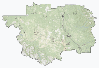
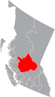
The Cariboo Regional District spans the Cities and Districts of Quesnel, Williams Lake, 100 Mile House, and Wells in the Central Interior of British Columbia.
Cariboo—Prince George is a federal electoral district in the province of British Columbia, Canada, that has been represented in the House of Commons of Canada since 2004.
Junction Sheep Range Provincial Park is a provincial park in British Columbia, Canada, located near the confluence of the Chilcotin and Fraser Rivers on the west bank of the latter river.
School District 27 Cariboo-Chilcotin is a school district in central British Columbia. It covers a large geographic area in the Chilcotin and Cariboo districts, from 100 Mile House in the south to Williams Lake in the north.
Lake City Secondary School is a public Middle school in Williams Lake in the Canadian province of British Columbia. The school is administered as part of School District 27 Cariboo-Chilcotin. It is a grade 7-9 facility enrolling approximately 808 students. The principal is Gregg Gaylord.
Peter Skene Ogden Secondary is a public high school in 100 Mile House in the Canadian province of British Columbia. The school is administered as part of School District 27 Cariboo-Chilcotin. It is a grade 8 to 12 facility enrolling approximately 650 students. The principal is Mr G Butcher.
Williams Lake Secondary School was a public high school in Williams Lake in the Canadian province of British Columbia. The school was administered as part of School District 27 Cariboo-Chilcotin. It was a grade 8 to 12 facility enrolling approximately 600 students. The principal is Silvia Dubray.

Soda Creek is a rural subdivision 38 km north of Williams Lake in British Columbia, Canada. Located on the east bank of the Fraser River, Soda Creek was originally the home of the Xat'sull First Nation. Soda Creek Indian Reserve No. 1 is located on the left (E) bank of the Fraser River, one mile south of the Soda Creek BCR (CN) station, 431.10 ha. 52°19′00″N122°16′00″W

The British Columbia Interior, popularly referred to as the BC Interior or simply the Interior, is a geographic region of the Canadian province of British Columbia. While the exact boundaries are variously defined, the British Columbia Interior is generally defined to include the 14 regional districts that do not have coastline along the Pacific Ocean or Salish Sea, and are not part of the Lower Mainland. Other boundaries may exclude parts of or even entire regional districts, or expand the definition to include the regional districts of Fraser Valley, Squamish-Lillooet, and Kitimat-Stikine.
The Williams Lake First Nation is a First Nations government of the Secwepemc (Shuswap) Nation, located in the Cariboo region of the Central Interior region of the Canadian province of British Columbia, at the city of Williams Lake. It was created when the government of the then-Colony of British Columbia established an Indian Reserve system in the 1860s. It is a member government of the Northern Shuswap Tribal Council. Its main Indian Reserve is Williams Lake Indian Reserve No. 1, a.k.a. "Sugarcane" or "The Cane" or "SCB".
The High Bar First Nation is a First Nations government of the Secwepemc (Shuswap) Nation, located in the Fraser Canyon-Cariboo region of the Central Interior of the Canadian province of British Columbia. It was created when the government of the then-Colony of British Columbia established an Indian Reserve system in the 1860s. It is one of three Secwepemc bands that is not a member of either the Shuswap Nation Tribal Council or the Northern Shuswap Tribal Council. The High Bar people are also partly Tsilhqot'in and have links with some Chilcotin First Nations.
The Tl'etinqox-t'in Government Office is a First Nations government located in the Chilcotin District in the western Central Interior region of the Canadian province of British Columbia. Governing a reserve communities near Alexis Creek known as Anaham Reserve First Nations or Anaham, it is a member of the Tsilhqot'in Tribal Council aka known as the Tsilhqot'in National Government. The main reserve is officially known as Anahim's Flat No. 1, and is more commonly as Anaham. Other reserves are Anahim's Meadow No. 2 and 2A, and Anahim Indian Reserves Nos. 3 through 18. Anaham, or Anahim and Alexis were chiefs of the Tsilhqot'in during the Chilcotin War of 1864, although they and their people did not take part in the hostilities.

The Bridge River Country is a historic geographic region and mining district in the Interior of British Columbia, Canada, lying between the Fraser Canyon and the valley of the Lillooet River, south of the Chilcotin Plateau and north of the Lillooet Ranges. "The Bridge River" can mean the Bridge River Country as opposed to the Bridge River itself, and is considered to be part of the Lillooet Country, but has a distinct history and identity within the larger region. As Lillooet is sometimes considered to be the southwest limit of the Cariboo, some efforts were made to refer to the Bridge River as the "West Cariboo" but this never caught on.

Alexandria or Fort Alexandria is a National Historic Site of Canada on the Fraser River in British Columbia, and was the end of the Old Cariboo Road and the Cariboo Wagon Road. It is located on Highway 97, 103 miles (166 km) north of 100 Mile House and 28 miles (45 km) south of Quesnel.

Eastlake High School is a four-year public high school in Sammamish, Washington, a suburb east of Seattle. Opened in 1993, it is one of four traditional high schools in the Lake Washington School District, serving its eastern portion.
The Lillooet Land District is one of the 59 cadastral subdivisions of British Columbia, which were created by the Lands Act of the Colony of British Columbia in 1859, defined as "a territorial division with legally defined boundaries for administrative purposes". The land district's boundaries came to be used as the boundary of the initial Lillooet riding for the provincial Legislature from 1871, when the colony became a province. In addition to use in descriptions of land titles and lot surveys, the Land District was also the basis of the Lillooet Mining District.
There are 20 lakes named Long Lake in British Columbia, Canada.
