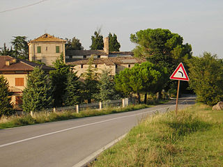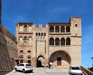
Montano Lucino is a comune (municipality) in the Province of Como in the Italian region Lombardy, located about 35 kilometres (22 mi) north of Milan and about 5 km southwest of Como.

San Fermo della Battaglia is a comune (municipality) in the Province of Como in the Italian region Lombardy, located about 40 kilometres (25 mi) north of Milan and about 3 kilometres (2 mi) southwest of Como. As of 31 December 2004, it had a population of 4,255 and an area of 3.1 square kilometres (1.2 sq mi).

Altidona is a comune (municipality) in the Province of Fermo in the Italian region Marche, located about 60 kilometres (37 mi) southeast of Ancona and about 35 kilometres (22 mi) northeast of Ascoli Piceno.

Amandola is a comune (municipality) in the Province of Fermo in the Italian region Marche, located about 70 kilometres (43 mi) south of Ancona, about 25 kilometres (16 mi) northwest of Ascoli Piceno and about 35 kilometres (22 mi) west of Fermo. The city was founded in 1248 by the union of the castles of Agello Leone and Marrubbione, which formed a free municipality.

Belmonte Piceno is a comune (municipality) in the Province of Fermo in the Italian region Marche, located about 60 kilometres (37 mi) south of Ancona and about 30 kilometres (19 mi) north of Ascoli Piceno.

Francavilla d'Ete is a comune (municipality) in the Province of Fermo in the Italian region Marche, located about 50 kilometres (31 mi) south of Ancona and about 35 kilometres (22 mi) north of Ascoli Piceno.

Lapedona is a comune (municipality) in the Province of Fermo in the Italian region Marche, located about 60 kilometres (37 mi) southeast of Ancona and about 35 kilometres (22 mi) northeast of Ascoli Piceno. As of 31 December 2004, it had a population of 1,157 and an area of 14.8 square kilometres (5.7 sq mi).

Magliano di Tenna is a comune (municipality) in the Province of Fermo in the Italian region Marche, located about 50 kilometres (31 mi) south of Ancona and about 30 kilometres (19 mi) north of Ascoli Piceno. As of 31 December 2004, it had a population of 1,312 and an area of 7.8 square kilometres (3.0 sq mi).

Massa Fermana is a comune (municipality) in the Province of Fermo in the Italian region Marche, located about 50 kilometres (31 mi) south of Ancona and about 35 kilometres (22 mi) northwest of Ascoli Piceno.

Monsampietro Morico is a comune (municipality) in the Province of Fermo in the Italian region Marche, located about 70 kilometres (43 mi) south of Ancona, about 35 kilometres (22 mi) north of Ascoli Piceno and 20 kilometres (12 mi) of Fermo. It was founded in 1061 as a castle under a Norman count from Apulia. Later it was part of the de Varano seigniory and, from 1415 to 1416, of Carlo Malatesta's lands. It is also home to a 13th-century Romanesque church, dedicated to St. Paul.

Montappone is a comune (municipality) in the Province of Fermo in the Italian region Marche, located about 50 kilometres (31 mi) south of Ancona and about 35 kilometres (22 mi) northwest of Ascoli Piceno. It is a very important centre for hat production. As of 31 December 2004, it had a population of 1,780 and an area of 10.4 square kilometres (4.0 sq mi).

Montefalcone Appennino is a comune (municipality) in the Province of Fermo in the Italian region Marche, located about 85 kilometres (53 mi) south of Ancona, about 30 kilometres (19 mi) northwest of Ascoli Piceno and about 35 kilometres (22 mi) east of Fermo. It occupies a spur between the rivers Aso and Tenna.

Montefortino is a comune (municipality) in the Province of Fermo in the Italian region Marche, located about 80 kilometres (50 mi) south of Ancona, about 35 kilometres (22 mi) northwest of Ascoli Piceno and about 45 kilometres (28 mi) west of Fermo.

Monteleone di Fermo is a comune (municipality) in the Province of Fermo in the Italian region Marche, located about 70 kilometres (43 mi) south of Ancona, about 35 kilometres (22 mi) north of Ascoli Piceno and 25 kilometres (16 mi) of Fermo. As of 31 December 2004, it had a population of 449 and an area of 8.1 square kilometres (3.1 sq mi).

Montelparo is a comune (municipality) in the Province of Fermo in the Italian region Marche, located about 75 kilometres (47 mi) south of Ancona, about 30 kilometres (19 mi) north of Ascoli Piceno and 35 kilometres (22 mi) of Fermo. As of 31 December 2004, it had a population of 929 and an area of 21.6 square kilometres (8.3 sq mi).

Monte San Pietrangeli is a comune (municipality) in the Province of Fermo in the Italian region Marche, located about 50 kilometres (31 mi) south of Ancona and about 35 kilometres (22 mi) north of Ascoli Piceno.

Pedaso is a comune (municipality) in the Province of Fermo in the Italian region Marche, located about 60 kilometres (37 mi) southeast of Ancona and about 35 kilometres (22 mi) northeast of Ascoli Piceno. As of 31 December 2004, it had a population of 2,093 and an area of 3.6 square kilometres (1.4 sq mi).

Ponzano di Fermo is a comune (municipality) in the Province of Fermo in the Italian region Marche, located about 60 kilometres (37 mi) south of Ancona and about 30 kilometres (19 mi) north of Ascoli Piceno. As of 31 December 2004, it had a population of 1,623 and an area of 14.4 square kilometres (5.6 sq mi).

Rapagnano is a comune (municipality) in the Province of Fermo in the Italian region Marche, located about 50 kilometres (31 mi) south of Ancona and about 35 kilometres (22 mi) north of Ascoli Piceno.

Torre San Patrizio is a commune or municipality in the Province of Fermo in the Italian region Marche, located about 50 kilometres (31 mi) south of Ancona and about 35 kilometres (22 mi) north of Ascoli Piceno.


