San Luis Obispo County, officially the County of San Luis Obispo, is a county located in the southern region of the U.S. state of California. As of the 2010 census, the population was 269,637. The county seat is San Luis Obispo.

The Central Coast is an area of California, United States, roughly spanning the coastal region between Point Mugu and Monterey Bay. It lies northwest of Los Angeles County and south of San Francisco and San Mateo counties. Six counties make up the Central Coast: from south-to north, Ventura, Santa Barbara, San Luis Obispo, Monterey, San Benito, and Santa Cruz.

The Governor Edmund G. Brown California Aqueduct is a system of canals, tunnels, and pipelines that conveys water collected from the Sierra Nevada Mountains and valleys of Northern and Central California to Southern California. Named after California Governor Edmund Gerald "Pat" Brown Sr., the over 400-mile (640 km) aqueduct is the principal feature of the California State Water Project.

Area codes 805 and 820 are California telephone area codes; 805 was originally split from area code 213 in 1957. They include most or all of the California counties of San Luis Obispo, Santa Barbara, Ventura, plus southernmost portions of Monterey County.

Estero Bay is a bay located on the Pacific Coast in San Luis Obispo County, central California. It is about 15 miles (24 km) from its south end at Point Buchon/Montana de Oro State Park, to its north end at Point Estero, which is about 5 miles (8 km) northwest of Cayucos. It is indented about 5 miles (8 km) into the California coast.
Sycamore Mineral Springs Resort is a resort located in San Luis Obispo County, California. It is located near Avila Beach. This resort is mostly known for its mineral springs, but also has several different activities.

Arevalillo is a municipality located in the province of Ávila, Castile and León, Spain. According to the 2004 census (INE), the municipality has a population of 120 inhabitants.

The Pereira Octagon Barn of San Luis Obispo is a historically and culturally important structure on the Central Coast of California. It was built in 1906 by Henri LaFranchi, John Damaso, and a third, unknown man. Since there were no other octagonal barns in the area, the builders may have worked from patterns of octagonal construction in farm journals or catalogs.

Point Sal State Beach is a beach on the Pacific coast of California, located near the city of Guadalupe, in the northwestern part of Santa Barbara County. There are approximately 80 acres (320,000 m2) of property with 1.5 miles (2.4 km) of ocean frontage. The rocks around the headland constitute part of the Coast Range Ophiolite, one of the largest ophiolite terranes in the world. This beach is at risk of landslides as there are rocky shorelines and extremely steep slopes.
The Hosgri Fault is an offshore fault zone located near the Central Coast of California in San Luis Obispo County. The main fault stretches for about 87 miles (140 km), and is located nearest to the coastal communities of Cambria, San Simeon, Morro Bay, Baywood Park-Los Osos and Avila Beach. The fault system is some 260 mi (420 km) long, and is a right-lateral strand of the San Andreas Fault system.
Rancho San Miguelito was a 14,198-acre (57.46 km2) Mexican land grant in present-day San Luis Obispo County, California given in 1842 by Governor Juan Alvarado to Miguel Ávila, and an addition granted in 1846 by Governor Pio Pico. The grant extended along the Pacific coast, and included Point San Luis, San Luis Obispo Bay, and present day Avila Beach.

Cambria State Marine Conservation Area (SMCA) is a marine protected area located off the coast of the city of Cambria, California on California’s central coast in San Luis Obispo County, California. The marine protected area covers 6.26 square miles (16.2 km2). Within the SMCA recreational fishing and take is allowed while commercial fishing and take of all living marine resources is prohibited.

Vandenberg State Marine Reserve (SMR) is a marine protected area located offshore of Vandenberg Air Force Base, near the city of Lompoc on California’s central coast. The marine protected area covers 32.84 square miles (85.1 km2). Vandenberg SMR protects all marine life within its boundaries. Fishing and take of all living marine resources is prohibited.

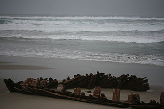
Sibyl Marston was a wooden schooner cargo ship built by W.A. Boole & Sons of Oakland, California and belonging to the Sibyl Marston Co. Sibyl Marston sank off the coast of Lompoc, California on 12 January 1909.
Crystal Cove State Marine Conservation Area (SMCA) is one of a cluster of four adjoining marine protected areas that extend offshore of Newport Beach in Orange County on California’s south coast. The SMCA covers 3.45 square miles of near shore waters. Crystal Cove protects marine life by limiting the removal of marine wildlife from within its borders, including tide pools. Take of all living marine resources is prohibited except: recreational take of finfish by hook-and-line or by spearfishing, and lobster and sea urchin is allowed. Commercial take of coastal pelagic species by round haul net, spiny lobster by trap, and sea urchin is allowed.

The San Luis Obispo County Fire Department provides fire protection and emergency response services for the unincorporated areas of San Luis Obispo County, California as well as the communities of Los Osos, Pismo Beach and Avila Beach. CAL FIRE a California state agency, functions as the Fire Department for San Luis Obispo under a contract with the County, and has done so since 1930. The department has 180 full-time employees in the Department. These full-time employees are supplemented by up to 100 seasonal fire fighters, 300 County paid-call and reserve fire fighters, and 120 state inmate fire fighters.
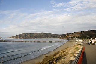
San Luis Obispo Bay is a bay on the Pacific Ocean coast of San Luis Obispo County, California, about 160 miles (257 km) northwest of Los Angeles, and about 200 miles (320 km) south of San Francisco. The bay is located between Point San Luis and Shell Beach. The community of Avila Beach is located on the bay. San Luis Obispo Creek has its mouth on the bay west of Avila Beach.

Pillar Rock is a steep rocky island adjacent to the much larger Morro Rock in Morro Bay, California. Made from the same volcanic material as Morro Rock, Pillar Rock is home to numerous seabirds as evidenced by its coating of bird droppings.


