Smith Mountain (Death Valley)

Last updated
Smith Mountain
Relief map of California.png
Red triangle with thick white border.svg
Smith Mountain
Location in California
Usa edcp relief location map.png
Red triangle with thick white border.svg
Smith Mountain
Smith Mountain (the US)
Highest point
Elevation 5,915 ft (1,803 m)  NAVD 88 [1]
Prominence 1,593 ft (486 m) [2]
Listing Desert Peaks Section List [3]
Coordinates 36°01′05″N116°41′21″W / 36.0180573°N 116.6892424°W / 36.0180573; -116.6892424 Coordinates: 36°01′05″N116°41′21″W / 36.0180573°N 116.6892424°W / 36.0180573; -116.6892424 [1]
Geography
Location Death Valley National Park, Inyo County, California, U.S.
Parent range Black Mountains,
Topo map USGS, Gold Valley, CA
Climbing
Easiest route Cross country hike class 1 [3]

Smith Mountain, 5,915 feet (1,803 m), is a peak in the Black Mountains of the Amargosa Range in Death Valley National Park in California.
Black Mountains (California) mountain range in Inyo County, California, United States

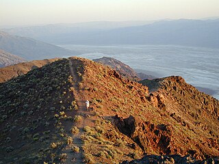
The Black Mountains are a mountain range located in the southeastern part of Inyo County, California, within southeastern Death Valley National Park.

Amargosa Range mountain range in California and Nevada

The Amargosa Range is a mountain range in Inyo County, California and Nye County, Nevada. The 110-mile (180 km) range runs along most of the eastern side of California's Death Valley, separating it from Nevada's Amargosa Desert. The U-shaped Amargosa River flows clockwise around the perimeter of the range, ending 279 feet (85 m) below sea level in the Badwater Basin.

Death Valley National Park US national park in the state of California

Death Valley National Park is an American national park that straddles the California—Nevada border, east of the Sierra Nevada. The park boundaries include Death Valley, the northern section of Panamint Valley, the southern section of Eureka Valley, and most of Saline Valley. The park occupies an interface zone between the arid Great Basin and Mojave deserts, protecting the northwest corner of the Mojave Desert and its diverse environment of salt-flats, sand dunes, badlands, valleys, canyons, and mountains. Death Valley is the largest national park in the lower 48 states, and the hottest, driest and lowest of all the national parks in the United States. The second-lowest point in the Western Hemisphere is in Badwater Basin, which is 282 feet (86 m) below sea level. Approximately 91% of the park is a designated wilderness area. The park is home to many species of plants and animals that have adapted to this harsh desert environment. Some examples include creosote bush, bighorn sheep, coyote, and the Death Valley pupfish, a survivor from much wetter times. UNESCO included Death Valley as the principal feature of its Mojave and Colorado Deserts Biosphere Reserve in 1984.

Contents

It is named after Francis Marion "Borax" Smith, of the local Pacific Coast Borax Company enterprise. [4]
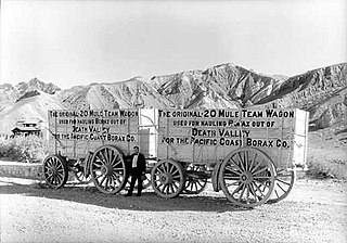
Pacific Coast Borax Company

The Pacific Coast Borax Company (PCB) was a United States mining company founded in 1890 by the American borax magnate Francis "Borax" Smith, the "Borax King".

See also

20 Mule Team Borax

20 Mule Team Borax is a brand of cleaner manufactured in the United States by The Dial Corporation, a subsidiary of Henkel. The product is named after the 20-mule teams that were used by William Tell Coleman's company to move borax out of Death Valley, California, to the nearest rail spur between 1883 and 1889.

Harmony Borax Works former industrial facility in Death Valley, California, United States

The Harmony Borax Works is located in Death Valley at Furnace Creek Springs, then called Greenland. It is now located within Death Valley National Park in Inyo County, California. It is on the National Register of Historic Places.

Francis Marion Smith American businessman

Francis Marion Smith was an American miner, business magnate and civic builder in the Mojave Desert, the San Francisco Bay Area, and Oakland, California.

Related Research Articles

San Jacinto Peak mountain in United States of America

San Jacinto Peak is the highest peak of the San Jacinto Mountains, and of Riverside County, California. It lies within Mount San Jacinto State Park. Naturalist John Muir wrote of San Jacinto Peak, "The view from San Jacinto is the most sublime spectacle to be found anywhere on this earth!"

Baker, California Census designated place in California, United States

Baker is a census-designated place located in San Bernardino County, California, US. As of the 2010 census, the CDP had a total population of 735. Baker's ZIP Code is 92309 and the community is within area codes 442 and 760.

Daggett, California Unincorporated community in California, United States

Daggett is an unincorporated community located in San Bernardino County, California in the United States. The town is located on Interstate 40 ten miles (16 km) east of Barstow. The town has a population of about 200. The ZIP code is 92327 and the community is inside area code 760.

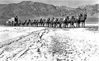
Twenty-mule team

Twenty-mule teams were teams of eighteen mules and two horses attached to large wagons that transported borax out of Death Valley from 1883 to 1889. They traveled from mines across the Mojave Desert to the nearest railroad spur, 165 miles (275 km) away in Mojave. The routes were from the Harmony and Amargosa Borax Works to Daggett, California, and later Mojave, California. After Harmony and Amargosa shut down in 1888, the mule team's route was moved to the mines at Borate, 3 miles east of Calico, back to Daggett. There they worked from 1891 until 1898 when they were replaced by the Borate and Daggett Railroad.

Tonopah and Tidewater Railroad

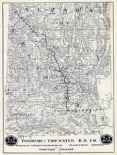
The Tonopah and Tidewater Railroad was a former class II railroad that ran within the locale of eastern California and southwestern Nevada.

Telescope Peak mountain

Telescope Peak is the highest point within Death Valley National Park, in the U.S. state of California. It is also the highest point of the Panamint Range, and lies in Inyo County. From atop this desert mountain one can see for over one hundred miles in many directions, including west to Mount Whitney, and east to Charleston Peak. The mountain was named for the great distance visible from the summit.

Borate and Daggett Railroad

The Borate and Daggett Railroad was a 3 ft narrow gauge railroad built to carry borax in the Mojave Desert. The railroad ran about 11 miles from Daggett, California, US, to the mining camp of Borate, three miles to the east of Calico.

William Tell Coleman American pioneer

William Tell Coleman (1824–1893) was an American pioneer in the settlement of California. Born in Cynthiana in Harrison County, Kentucky, he was educated at St. Louis University in Missouri.

Oasis at Death Valley

The Oasis at Death Valley, formerly called Furnace Creek Inn and Ranch Resort, is a luxury resort in Furnace Creek, on private land within the boundaries of California's Death Valley National Park. It is owned and operated by Xanterra Parks and Resorts.

Deserts of California

The Deserts of California have unique ecosystems and habitats, a sociocultural and historical "Old West" collection of legends, districts, and communities, and they also form a popular tourism region of dramatic natural features and recreational development. All of the deserts are located in eastern Southern California, in the Western United States.

Candelaria Hills

The Candelaria Hills are a mountain range in Mineral County, Nevada. The highest peak is Miller Mountain which was the location of "Borax" Smith's board-and-batten cabin where he lived when he discovered a rich borax deposit at nearby Teel's Marsh.

Bakerite nesosilicate mineral, datolite variety

Bakerite is the common name given to hydrated calcium boro-silicate hydroxide, a borosilicate mineral (chemical formula Ca4B4(BO4)(SiO4)3(OH)3·(H2O)) that occurs in volcanic rocks in the Baker, California area. Discredited mineral: IMA2016-A.

Lila C, California Former settlement in California, United States

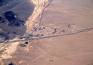
Lila C is a former settlement in Inyo County, California. It was located 6.25 miles (10 km) southwest of Death Valley Junction, at an elevation of 2562 feet.

Ryan, California Unincorporated community in California, United States

Ryan (formerly known as Devar is an unincorporated community in Inyo County, California. A former mining community and company town, Ryan is situated at an elevation of 3,045 feet in the Amargosa Range, 8 miles northeast of Dante's View and 15 miles southeast of Furnace Creek.

Thomas Thorkildsen (1869-1950) was an American businessman. He became known as the "Borax King" after his ownership of borax mines in California made him a millionaire.

References

  1. 1 2 "Smith Mountain". NGS data sheet. U.S. National Geodetic Survey . Retrieved 2009-05-03.
  2. "Smith Mountain, California". Peakbagger.com. Retrieved 2014-02-23.
  3. 1 2 "Desert Peaks Section List" (PDF). Angeles Chapter, Sierra Club . Retrieved 2014-02-23.
  4. Hanna, Phil Townsend (1951). The dictionary of California land names. Los Angeles: Automobile Club of Southern California. p. 309. OCLC   866109152.