Smoo Cave

Last updated
Smoo Cave
Entrance to Smoo Cave.jpg
Smoo Cave entrance
Scotland location map.svg
Red pog.svg
United Kingdom adm location map.svg
Red pog.svg
Europe blank laea location map.svg
Red pog.svg
Location Durness in Sutherland, Highland, Scotland
Coordinates 58°33′47″N4°43′12″W / 58.56306°N 4.72000°W / 58.56306; -4.72000
GeologyEarly Ordovician / dolomites

Smoo Cave is a large combined sea cave and freshwater cave in Durness in Sutherland, Highland, Scotland. The cave name is thought to originate from the Norse 'smjugg' or 'smuga', meaning a hole or hiding-place. [1]

Contents

Geology

Smoo Cave was formed within Early Ordovician dolomites of the Durness Group (also known as the Durness Limestone). The cave has formed along the boundary between the light grey Sangomore Formation and the dark grey, mottled Sailmhor Formation (sometimes called Leopard Rock), both of which form part of the Durness Group succession. These horizons close to the formation boundary are characterised by large and abundant chert nodules which can be found all along the inner stream chamber where they have been left behind after dissolution of the surrounding dolomite.

The cave was formed along two geological lines of weakness by a combination of erosion from the sea and an inland underground stream which has formed the innermost chambers. Upstream of the Allt Smoo which runs into the cave, impermeable quartzites have been faulted against the Durness Limestone, causing the stream to sink down into the carbonate rock soon after it has crossed the contact between the two different rock types.

Physical description

Outer chamber of Smoo Cave. The main entrance is to the right; the covered walkway leads to the second (inner) cave that has the waterfall. Smoo Cave Outer Chamber GCR 8722.jpg
Outer chamber of Smoo Cave. The main entrance is to the right; the covered walkway leads to the second (inner) cave that has the waterfall.
The Smoo burn drops into the cave through a sink hole. Smoo Cave-Second Chamber.jpg
The Smoo burn drops into the cave through a sink hole.

The cave is unique within the UK [ citation needed ] in that the first chamber has been formed by the action of the sea, whereas the inner chambers are freshwater passages, formed from rainwater dissolving the carbonate dolomites. Partway through the cave the waters of Allt Smoo also drop in as a 20 metres (66 ft) high waterfall. This is mainly due to the nearby dolomite–quartzite geological boundary where the Allt Smoo stream crosses the impermeable quartzites and sinks on meeting the permeable dolomites.

The cave can be thought of as two caves formed by different mechanisms that have joined together over time. The cave is composed of three main sections: a large sea cave entrance chamber, a waterfall chamber and a short freshwater passage which leads to a terminal sump chamber with some flowstone formations at the rear.

The cave entrance and main chamber have been considerably enlarged by sea action to approximately 40 metres (130 ft) wide and 15 metres (49 ft) high, the largest sea cave entrance in Britain. The entrance is located at the end of a 600 metres (660 yd) long tidal gorge (Geodha Smoo) which was once part of the cave, now collapsed. Several remnant pillars can be seen along the eastern side of the Geodh along with a large section of the previous roof which has been partly buried by the grassy slope (normally covered by rocks spelling out the names of visitors to the cave). The sea rarely enters the sea cave nowadays (only during spring tides) as the area has undergone isostatic uplift.

The present-day cave is 83 metres (272 ft) long up to the terminal sump at the rear of the third chamber/passage. The cave travels further, however, as an active stream of notable size resurges here at all times. Previous dye-testing has linked an underwater passage to an initial sink point in the Allt Smoo stream about 100 metres (330 ft) upstream from the main waterfall, implying that the cave system is at least twice as long as once thought.

Cave divers from the Grampian Speleological Group have dived this sump for a distance of about 40 metres (130 ft), although large volumes of silt and peat in the water have prevented further exploration. It is worth noting that the main waterfall is often dry and will only become active once this upstream sink overflows.

Smoo Cave and Geodha Smoo 01.jpg
Smoo Cave with its gorge Geodha Smoo.

Archaeology

Archaeological investigations in 1995 turned up Neolithic, Norse and Iron Age artifacts but the majority of the artifacts from the cave were related to Viking/Norse or medieval activity. Fish bones, marine shells, plant remains and mammal and bird bones indicated the processing and consumption of marine and terrestrial foods. Iron slag and boat nails led the archaeologists to surmise that boats were repaired in the sheltered inlet. Four radiocarbon dates from Smoo Cave and Glassknapper's Cave provide evidence for use of these sites between the eighth and 11th centuries AD. [2] The cave complex is protected as a scheduled monument. [3]

Tourism

The cave is located 2 kilometres (1.2 mi) east of the village of Durness and is presently served by a car park, toilets, stairs and walkways. Plans are being considered for access improvements for the estimated 40,000 visitors it receives annually. Tours of the cave also operate during the summer, taking visitors to the inner chamber by boat.

Related Research Articles

<span class="mw-page-title-main">Durness</span> Human settlement in Scotland

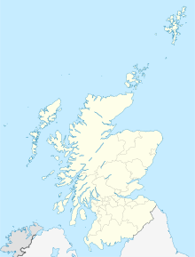
Durness is a village and civil parish in the north-west Highlands of Scotland. It lies on the north coast of the country in the traditional county of Sutherland, around 120 miles north of Inverness. The area is remote, and the parish is huge and sparsely populated, covering an area from east of Loch Eriboll to Cape Wrath, the most north-westerly point of the Scottish mainland.

<span class="mw-page-title-main">Swildon's Hole</span> Cave in Somerset, England

Swildon's Hole is an extensive cave in Priddy, Somerset. At 9,144 metres (30,000 ft) in length, it is the longest cave on the Mendip Hills. It has been found to be connected to Priddy Green Sink and forms part of the Priddy Caves Site of Special Scientific Interest (SSSI).

<span class="mw-page-title-main">Marble Arch Caves</span> Limestone caves in Northern Ireland

The Marble Arch Caves are a series of natural limestone caves located near the village of Florencecourt in County Fermanagh, Northern Ireland. The caves are named after the nearby Marble Arch, a natural limestone arch at the upstream end of Cladagh Glen under which the Cladagh River flows. The caves are formed from three rivers draining off the northern slopes of Cuilcagh mountain, which combine underground to form the Cladagh. On the surface, the river emerges from the largest karst resurgence in Ireland, and one of the largest in the United Kingdom. At 11.5 kilometres (7.1 mi) the Marble Arch Caves form the longest known cave system in Northern Ireland, and the karst is considered to be among the finest in the British Isles.

<span class="mw-page-title-main">Rumbling Hole</span> Cave in Lancashire, England

Rumbling Hole is a cave on Leck Fell, in Lancashire, England. Its entrance is a 50-metre (160 ft) deep fenced shaft, and it rapidly descends a series of pitches to a low aqueous passage that has been connected to Lost Johns' Cave. It is part of the Three Counties System, an 87-kilometre (54 mi) cave system that spans the borders of Cumbria, Lancashire, and North Yorkshire.

<span class="mw-page-title-main">North West Highlands Geopark</span>

The North West Highlands Geopark is a geopark in the Scottish Highlands. Awarded UNESCO geopark status in 2004, it was Scotland's first geopark, featuring some of the oldest rocks in Europe, around 3,000 million years old. The park contains many notable geological features, such as the Moine Thrust Belt and Smoo Cave and covers an area of around 2,000 square kilometres (770 sq mi).

<span class="mw-page-title-main">Langcliffe Pot</span> Cave system in North Yorkshire

Langcliffe Pot is a cave system on the slopes of Great Whernside in Upper Wharfedale, about 3 kilometres (1.9 mi) SSE of Kettlewell in North Yorkshire. It is part of the Black Keld Site of Special Scientific Interest where the "underground drainage system which feeds the stream resurgence at Black Keld is one of the largest and deepest in Britain, although only a small proportion of its cave passages are accessible at present." Mossdale Caverns is also part of the Black Keld SSSI. Although a considerable length of passage has been explored in Langcliffe Pot, the current end is over 170 metres (560 ft) above the resurgence, and over 4 kilometres (2.5 mi) in distance. A trip to the far end has been described as "one of the most serious undertakings in British caving".

<span class="mw-page-title-main">Shannon Cave</span> Cave in the island of Ireland that feeds Shannon Pot

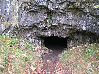
Shannon Cave is an active stream passage cave which straddles the border of County Fermanagh, Northern Ireland and County Cavan in the Republic of Ireland.

The Caves of the Tullybrack and Belmore hills are a collection of caves in southwest County Fermanagh, Northern Ireland. The region is also described as the West Fermanagh Scarplands by environmental agencies and shares many similar karst features with the nearby Marble Arch Caves Global Geopark.

<span class="mw-page-title-main">Aquamole Pot</span> Cave in North Yorkshire, England

Aquamole Pot is a limestone cave in West Kingsdale, North Yorkshire, England. It was originally discovered by cave divers who negotiated 168 metres (551 ft) of sump passage from Rowten Pot in 1974, to enter a high aven above the river passage. All subsequent major explorations were undertaken from below before an entrance was opened up from the surface. It is part of a 27-kilometre (17 mi) long cave system that drains both flanks of Kingsdale.
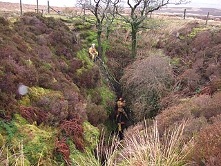
The Nidderdale Caves are a series of caves in Upper Nidderdale in North Yorkshire, England. There are two cave systems and most of the caves are in some way linked with one or the other. The smaller system is the Eglin cave system in the valley of How Stean Beck, a tributary of the River Nidd, associated with How Stean Gorge. The larger system is the Goyden cave system under the valley of the River Nidd, which flows east from Scar House Reservoir, then south, and shortly after disappears underground down several sink holes to reappear at the rising just beyond the village of Lofthouse. Cavers are able to access several sections of this system via the different entrances.

<span class="mw-page-title-main">Short Drop Cave - Gavel Pot System</span>

Short Drop Cave and Gavel Pot are different entrances into the same cave system on Leck Fell, in Lancashire, England. The main top entrance, Short Drop Cave, is a small hole in a fenced off shakehole near the main stream sink; Gavel Pot, a window into the system, is a large fenced shakehole some 40-metre (130 ft) deep requiring tackle to descend. There are two other smaller entrances into Short Drop Cave. At its base the system links via a sump with Lost Johns' Cave, and is part of the Three Counties System, an 87 kilometres (54 mi) cave system which spans the borders of Cumbria, Lancashire, and North Yorkshire.

<span class="mw-page-title-main">Disappointment Pot</span>

Disappointment Pot is one of the entrances to the Gaping Gill cave system, located in a steep grassy shakehole some 120 metres (130 yd) south-east of Gaping Gill Main Shaft. Its mainly narrow stream passage descends a number of small shafts to enter the main system as a major inlet of Hensler's Master Cave. It lies within the designated Ingleborough Site of Special Scientific Interest.

<span class="mw-page-title-main">Stream Passage Pot</span>

Stream Passage Pot is one of the entrances to the Gaping Gill system being located about 320 metres (350 yd) ESE of Gaping Gill Main Shaft. It is a popular and sporting entrance into the system, featuring three well-watered big shafts. It is the highest entrance of the Gaping Gill system, so the full depth of the system, 198 metres (650 ft), is measured from its entrance. It lies within the designated Ingleborough Site of Special Scientific Interest.

<span class="mw-page-title-main">Rat Hole, Gaping Gill</span> Cave entrance in North Yorkshire, England

Rat Hole is one of the entrances to the Gaping Gill cave system, located in the north bank of Fell Beck 30 metres (33 yd) upstream of Gaping Gill Main Shaft. A small, awkward, tube-like passage descends into a stream passage, and hence to a 100-metre (330 ft) shaft into Gaping Gill Main Chamber. The sharp and loose nature of the rock, and the quantity of water prevented full exploration for over 80 years, but the current route is described in one guide book as "a technical and exhilarating adventure". It lies within the designated Ingleborough Site of Special Scientific Interest.

<span class="mw-page-title-main">Skirwith Cave</span> Cave in North Yorkshire, England

Skirwith Cave is a major resurgence solutional cave on Ingleborough in Chapel-le-Dale, North Yorkshire, England; it was a show cave between 1964 and 1974. It is no longer open to the public but is still visited by cavers. It lies within the designated Ingleborough Site of Special Scientific Interest.

<span class="mw-page-title-main">Yordas Cave</span> Cave in North Yorkshire, England

Yordas Cave is a solutional cave in Kingsdale, North Yorkshire, England. It has been renowned since the eighteenth century as a natural curiosity, and was a show cave during the nineteenth century. It is now a popular destination for cavers, walkers, and outdoor activity groups.

<span class="mw-page-title-main">Death's Head Hole</span> Cave in Lancashire, England

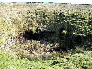
Death's Head Hole is a cave on Leck Fell, in Lancashire, England. Its entrance is a 64-metre (210 ft) deep shaft. It leads into Lost Johns' Cave and is part of the Three Counties System, an 87-kilometre (54 mi) cave system which spans the borders of Cumbria, Lancashire, and North Yorkshire.

Long Drop Cave is a cave on Leck Fell, in Lancashire, England. It leads into Death's Head Hole, and is part of the Three Counties System, an 87-kilometre (54 mi) cave system which spans the borders of Cumbria, Lancashire, and North Yorkshire.

<span class="mw-page-title-main">Long Kin East Cave - Rift Pot System</span> Cave system in North Yorkshire, England

The Long Kin East Cave - Rift Pot system is a limestone cave system on the southern flanks of Ingleborough, North Yorkshire in England lying within the designated Ingleborough Site of Special Scientific Interest. Long Kin East Cave starts as a long meandering stream passage but then plummets down a 58-metre (190 ft) deep shaft when it meets a shattered fault into which Rift Pot also descends. At the bottom, the stream flows through some low canals and sumps, to eventually emerge at Austwick Beck Head in Crummackdale.

<span class="mw-page-title-main">Gournier Cave</span>

The Gournier Cave is located near Choranche in the Vercors Massif in south-eastern France. The entrance is at an altitude of 572 m (1,877 ft) at the base of a cliff on the Presles plateau. It is one of the exsurgences of the Coulmes massif, and the cave is considered by many speleologists to be the most beautiful underground river in the Alps.

References

  1. "Smoo Cave Feature Page on Undiscovered Scotland". www.undiscoveredscotland.co.uk. Retrieved 28 July 2021.
  2. "Vol 18 (2005): The excavation of four caves in the Geodha Smoo near Durness, Sutherland | Scottish Archaeological Internet Reports". journals.socantscot.org. Retrieved 28 July 2021.
  3. Historic Environment Scotland. "Smoo Cave, prehistoric occupation site (SM5482)" . Retrieved 24 February 2019.