
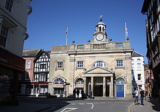
Bishop's Castle is a market town in the south west of Shropshire, England. According to the 2011 Census it had a population of 1,893.

Montgomery is a town and community in Powys, Wales. It is the traditional county town of the historic county of Montgomeryshire to which it gives its name and is within the Welsh Marches border area. The town centre lies about 1 mile (1.6 km) west of the England–Wales border. Montgomery Castle was started in 1223 and its parish church in 1227. Other locations in the town include The Old Bell Museum, the Offa's Dyke Path, the Robber's Grave and the town wall. The large Iron Age hill fort of Ffridd Faldwyn is sited northwest of the town and west of the Castle.
Shropshire was established during the division of Saxon Mercia into shires in the 10th century. It is first mentioned in 1006. After the Norman Conquest it experienced significant development, following the granting of the principal estates of the county to eminent Normans, such as Roger De Montgomery and his son Robert de Bellême.

Churchstoke or Church Stoke is a village, community and electoral ward in Montgomeryshire, Powys, Wales. Located in the southeast of the Vale of Montgomery, it is overlooked by Todleth Hill, Roundton Hill and Corndon Hill. The rivers Caebitra and Camlad have their confluence just outside the village. The nearest town is Montgomery. In the 2011 census the village had a population of 708.

Chirbury is a village and former civil parish, now in the parish of Chirbury with Brompton, in the Shropshire district, in west Shropshire, England. It is situated in the Vale of Montgomery, close to the Wales–England border, which is to its north, west and south. The A490 and B4386 routes cross at Chirbury.
Caus Castle is a ruin of a hill fort and medieval castle in the civil parish of Westbury in the English county of Shropshire. It is situated up on the eastern foothills of the Long Mountain guarding the route from Shrewsbury, Shropshire to Montgomery, Powys, on the border between England and Wales. It was destroyed during the English Civil War and has been in ruins since.

Llanfyllin is a market town and community in Powys, Wales. The town population in 2021 was 1,586 and the town's name means church or parish (llan) of St Myllin. The community includes the settlements of Bodfach, Ty Crwyn, Abernaint and several farms.

Llanfechain is a village and community in Powys, Wales, on the B4393 road between Llanfyllin and Llansantffraid-ym-Mechain. Historically it belonged to Montgomeryshire. The River Cain runs through. The population of 465 at the 2011 Census was estimated at 476 in 2019.

St Chad's Church in Shrewsbury is traditionally understood to be founded in Saxon times, and King Offa is believed to have founded the church, though it is possible it has an earlier foundation even than that.
National Cycle Network Route 44, part of the National Cycle Network, connects Shrewsbury, Shropshire with Cinderford, Gloucestershire. The part of the route from Shrewsbury to Bromfield is signed - the remainder of the route is currently unsigned.

Marton, also known as Marton-in-Chirbury, is a small village in Shropshire, England, 8 km (5.0 mi) southeast of Welshpool. There is another Marton in Shropshire, near Baschurch, at OS grid reference SJ443239, which also has a nearby Marton Pool.

St Mary's Church is in the village of Acton Burnell, Shropshire, England, and stands near the ruins of Acton Burnell Castle. It is an active Anglican parish church in the deanery of Condover, the archdeaconry of Ludlow, and the diocese of Hereford. Its benefice is united with those of St Andrew and St Mary, Condover, St Mark, Frodesley, and St Michael and All Angels, Pitchford. The church is recorded in the National Heritage List for England as a designated Grade I listed building.

Edward Haycock Sr. was an English architect working in the West Midlands and in central and southern Wales in the late Georgian and early Victorian periods.

Frank Hearn Shayler (1867–1954) was a Shrewsbury-based architect who worked in an Arts and Crafts style. He was in partnership with Thomas Ridge, and they also had offices in Oswestry and Welshpool.
William Baker of Audlem (1705–1771) was an architect, surveyor and building contractor, working in Shropshire and the adjacent counties in the middle years of the 18th century.

Hyssington is a parish in the South-Eastern corner of the historic county of Montgomeryshire in Wales and borders the county of Shropshire in England. It is now within the area of the Church Stoke community council in Powys. It is dominated by Corndon Hill. The church which is in the Diocese of Hereford lies just the north of a small village and is sited just to the west of a medieval Motte-and-bailey castle. This area was also the source of late Neolithic and Early Bronze Age battle-axes and axe-hammers, made from picrite that were widely traded around 2000 BC.

The Anglican Church of St Catherine at Montacute within the English county of Somerset was first built in the 12th century. It is a Grade II* listed building.

Morville Priory was a small Benedictine monastery in Shropshire, England, a cell of Shrewsbury Abbey.

Oliver Mathews was a Welsh apothecary and chronicler. He wrote the first history of Shrewsbury, the county town of Shropshire, England, on the River Severn, although as Hugh Owen and John Brickdale Blakeway point out, it contains "strange and unauthorised assertions", and is not considered reliable.

