Moscow is a city in northern Idaho along the state border with Washington, with a population of 23,800 at the 2010 census. The county seat and largest city of Latah County, Moscow is the home of the University of Idaho, the state's land-grant institution and primary research university.

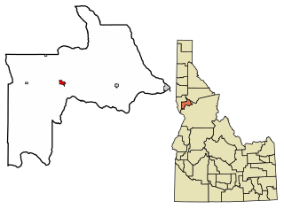
Cottonwood is a city in Idaho County, Idaho. On the Camas Prairie in north central Idaho, the population was 900 at the 2010 census, down from 944 in 2000. It is just west of U.S. Route 95, between Grangeville and Lewiston.

Grangeville is the largest city in and the county seat of Idaho County, Idaho, United States, in the north central part of the state. Its population was 3,141 at the 2010 census, down from 3,228 in 2000.

Craigmont is a city in the northwest United States in Lewis County, Idaho. Located on the Camas Prairie in north central Idaho, it is within the Nez Perce Indian Reservation. The population was 501 at the 2010 census, down from 556 in 2000.

Leonard Beck Jordan was an American politician who served as the 23rd governor of Idaho and a United States Senator for over ten years.

Bogus Basin Mountain Recreation Area is a ski area in the western United States, located in southwest Idaho in Boise County, sixteen road miles (26 km) north-northeast of the city of Boise.

Camas Prairie Railroad Company was a short line railroad in northern Idaho jointly owned and operated by Northern Pacific Railway and Union Pacific Railroad. The Camas Prairie Railroad was known as the "railroad on stilts" due to the many wooden trestles along its route.

Mount Idaho is a ghost town in Idaho County, Idaho, United States. The town served as county seat of Idaho County from 1875 to 1902.

Brundage Mountain Resort is an alpine ski area in the western United States, located in west central Idaho in the Payette National Forest. Brundage first opened in November 1961 and is eight miles (13 km) northwest of McCall, a twenty-minute drive in average winter conditions.

The Little Ski Hill is a modest ski area in the western United States, located in west central Idaho, two miles west of McCall. Adjacent to Highway 55, immediately west of the county line in Adams County, it was formerly known as the "Payette Lakes Ski Area."

Ski Bluewood, formerly known as "Bluewood Ski Area," is an alpine ski area in the northwestern United States, in southeastern Washington. Located in Columbia County, at the northern end of the Blue Mountains in the Umatilla National Forest, the elevation at the base area is 4,545 feet (1,385 m) above sea level, with a summit of 5,670 feet (1,728 m) for a vertical drop of 1,125 feet (343 m). The northward-facing slopes are about four miles (6.5 km) north of the Oregon border and fifty miles (80 km) west of Idaho, part of the headwaters of the Touchet River, the main tributary of the Walla Walla River.

Bald Mountain Ski Area is a small ski area in north central Idaho, located ten miles (16 km) northwest of Pierce in Clearwater County. The area first opened 61 years ago in January 1960, with a cotton rope tow powered by a gasoline engine. Originally for employees of the Potlatch Corporation in the village of Headquarters, it opened to the public in the 1960s.

Cottonwood Butte is a mountain and modest ski area in the western United States, located in north central Idaho, west of nearby Cottonwood. Its summit elevation is 5,730 feet (1,747 m) above sea level and is the highest point on the Camas Prairie, 2,100 feet (640 m) above Cottonwood.
In the U.S. state of Idaho, U.S. Route 95 (US-95) is a north–south highway near the western border of the state, stretching from Oregon to British Columbia for over 538 miles (866 km); it was earlier known in the state as the North and South Highway.

White Bird Hill Summit is a mountain pass in the northwest United States, located in north central Idaho on U.S. Highway 95. In Idaho County, it is midway between White Bird and Grangeville. The summit elevation of the highway is 4,245 feet (1,294 m) above sea level, through a substantial cut.

Fenn is an unincorporated community in Idaho County, Idaho, United States. It is located on U.S. Route 95 on the Camas Prairie, seven miles (11 km) northwest of Grangeville and eight miles (13 km) south of Cottonwood. Fenn had a post office with ZIP code 83531.

North–South Ski Bowl was a modest ski area in the western United States, located in northern Idaho in the Hoodoo Mountains of southern Benewah County.

Tamarack Ski Area is a former ski area in the western United States, located in north central Idaho, seven miles (11 km) northwest of Troy in Latah County.

Mount Sniktau is a high mountain summit in the Front Range of the Rocky Mountains of North America. The 13,240-foot (4,036 m) thirteener is located in Arapaho National Forest, 1.6 miles (2.5 km) northeast of Loveland Pass in Clear Creek County, Colorado, United States.

The White Bird Grade is a historic mountain highway along a former section of U.S. Route 95 near White Bird, Idaho, United States. It is listed on the National Register of Historic Places as an engineering accomplishment, a "marvel" which was an achievement of the early good roads movement.


