
Route 18 is a 42.8-mile-long (68.9 km) state highway in the central part of the US state of New Jersey. It begins at an intersection with Route 138 in Wall Township, Monmouth County and ends at Interstate 287 (I-287) in Piscataway Township, Middlesex County. Route 18 is a major route through central New Jersey that connects the Jersey Shore to the Raritan Valley region, connecting the county seats of Monmouth (Freehold) and Middlesex respectively. The route runs through Ocean Township, Marlboro Township, East Brunswick, and is the main thoroughfare for Rutgers University. Much of the route is a freeway. The remainder of the route is an arterial road with traffic lights in the East Brunswick and Old Bridge areas, and a boulevard in the remainder of Piscataway. Route 18 was designated in 1939 as a proposed freeway from Old Bridge to Eatontown. The section west of Old Bridge was formerly designated as part Route S28, a prefixed spur of State Highway Route 28 from Middlesex to Matawan. The designation, assigned in the 1927 renumbering, remained until a second renumbering in 1953. At that point, Route S28 was redesignated as Route 18, though the section from Old Bridge to Matawan was signed as TEMP 18, as this section would be decommissioned when the Route 18 freeway was built.
Route 28 is a state highway in the central part of New Jersey, United States that is 26.44 mi (42.55 km) long. Its western terminus is at U.S. Route 22 in Bridgewater Township, Somerset County while its eastern terminus is at Route 27 in Elizabeth, Union County. From its western terminus, Route 28 heads east through Raritan, intersecting County Route 567 and then U.S. Route 202 and U.S. Route 206 at the Somerville Circle before heading through the central part of Somerville. Past Somerville, the route interchanges with Interstate 287 in Bridgewater Township before intersecting many 500-series county roads including County Route 525 and County Route 527 in Bound Brook, County Route 529 in Dunellen, Middlesex County, County Route 531 in Plainfield, Union County, and County Route 509 in Westfield. Route 28 continues east, intersecting Route 59 and the Garden State Parkway in Cranford before heading to Elizabeth, where it crosses Route 439 before ending at Route 27. Route 28 is a two- to four-lane road its entire length that passes through suburban areas and runs within a close distance of New Jersey Transit’s Raritan Valley Line for much of its length.

Route 12 is a state highway located in Hunterdon County, New Jersey, United States. It runs 11.69 mi (18.81 km) from the Uhlerstown–Frenchtown Bridge at the Delaware River border with Pennsylvania in Frenchtown east to an intersection with U.S. Route 202 and Route 31 at the Flemington Circle in Flemington. The route is mostly a two-lane undivided road that passes through rural areas of woodland and farmland. It intersects Route 29 and County Route 513 in Frenchtown, CR 519 in Kingwood Township, CR 579 on the border of Delaware Township and Raritan Township, and CR 523 in Raritan Township.

Route 29 is a state highway in the U.S. state of New Jersey. Signed north-south, it runs 34.76 mi (55.94 km) from an interchange with Interstate 295 (I-295) in Hamilton Township in Mercer County, where the road continues east as I-195, northwest to Route 12 in Frenchtown, Hunterdon County. Between the southern terminus and I-295 in Ewing Township, the route is a mix of freeway and expressway that runs along the Delaware River through Trenton. This section includes a truck-restricted tunnel that was built along the river near historic houses and Riverview Cemetery. North of I-295, Route 29 turns into a scenic and mostly two-lane highway. North of the South Trenton Tunnel, it is designated the Delaware River Scenic Byway, a New Jersey Scenic Byway and National Scenic Byway, that follows the Delaware River in mostly rural sections of Mercer County and Hunterdon County. The obsolete Delaware & Raritan Canal usually stands between the river and the highway. Most sections of this portion of Route 29 are completely shaded due to the tree canopy. Route 29 also has a spur, Route 129, which connects Route 29 to U.S. Route 1 (US 1) in Trenton.

Route 31 is a state highway in New Jersey, United States. It runs 48.93 mi (78.75 km) from U.S. Route 1 Business /US 206 in Trenton, Mercer County, north to an intersection with US 46 in Buttzville in White Township, Warren County. Along the way, Route 31 heads through the communities of Flemington, Clinton, and Washington. Most of the highway is state-maintained; however, the section within the city limits of Trenton is maintained by the city. Much of Route 31 is a two-lane highway that passes through farmland, woodland, and mountainous areas. Two portions of the route—from Trenton to Pennington and from Ringoes to Clinton—consist of more development.

Route 33 is a state highway in the central part of the US state of New Jersey. The highway extends 42.03 miles (67.64 km), from an interchange with U.S. Route 1 (US 1) in Trenton, Mercer County, east to an intersection with Route 71 in Neptune, Monmouth County. Route 33 is a major route through central New Jersey, as it runs from the greater state capital area in the Delaware Valley region, through a mixture of farmland, housing, and commercial developments in the lower Raritan Valley region, en route to the greater Asbury Park area on the Jersey Shore. The route traverses through historic towns such as Hightstown, Monroe, Manalapan, Freehold, and Tinton Falls. There are several intersections on Route 33 with future developments.
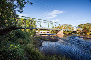
Raritan is a borough in Somerset County, in the U.S. state of New Jersey. As of the 2020 United States census, the borough's population was 7,835, an increase of 954 (+13.9%) from the 2010 census count of 6,881, which in turn reflected an increase of 543 (+8.6%) from the 6,338 counted in the 2000 census.

U.S. Route 206 is a 130.23-mile-long (209.58 km) north–south United States highway in New Jersey and Pennsylvania, United States. Only about a half a mile of its length is in Pennsylvania; the Milford–Montague Toll Bridge carries it over the Delaware River into New Jersey, where it connects to the remainder of the route. Its southern terminus is at an intersection with US 30 and Route 54 in Hammonton. The highway's northern terminus is at an intersection with US 209 near Milford, Pennsylvania; some sources and signs show an overlap with US 209 to end at its parent route US 6. For much of its length, US 206 is a rural two-lane undivided road that passes through the Pine Barrens, agricultural areas, and the Appalachian Mountains of northwestern New Jersey, with some urban and suburban areas. The route connects several cities and towns, including Bordentown, Trenton, Princeton, Somerville, Roxbury, Netcong, and Newton. The road is known as the Disabled American Veterans Highway for much of its length.

Route 172 is a short state highway in New Brunswick, New Jersey, United States. The designation runs along the southernmost leg of George Street, which is county and city-maintained the rest of the way. Route 172 is 0.69 miles (1.11 km) long, serving as a connector from an intersection with County Route 527 (CR 527) and Paul Robeson Boulevard to an interchange with Route 18. The highway was assigned in the 1950s, when nearby Route 18 was realigned onto a new freeway over Burnet Street in New Brunswick. Route 172 underwent a major upgrade during the reconstruction of Route 18, including a roundabout at an intersection with CR 617, and a brand-new interchange with the local lanes of Route 18.
U.S. Route 202 (US 202) is a spur route of US 2. It follows a northeasterly and southwesterly direction stretching from Delaware in the south to Maine in the north and traveling through the states of Pennsylvania, New Jersey, New York, Connecticut, Massachusetts, and New Hampshire. The highway has borne the number 202 since at least 1936. Before this, sections of the highway were designated U.S. Route 122, as it intersected US 22 in New Jersey. Its current designation is based on its intersection with I-395 and SR 15 near US 2 in Maine, but it does not have a direct connection with US 2.
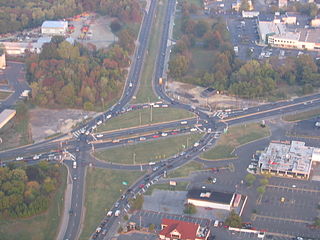
The U.S. state of New Jersey at one point had a total of 101 traffic circles, 44 of which were part of state roads. However, the number has shrunk as traffic circles have been phased out by the New Jersey Department of Transportation. In the 1920s and 1930s, New Jersey felt that traffic circles were an efficient way for moving traffic through three or more intersecting roads. Built in 1925, the first traffic circle in New Jersey was the Airport Circle in Pennsauken. Many of these interchanges are rotaries in design, as opposed to the more successful modern roundabout.

Route 28 is a 151.93-mile-long (244.51 km) nominally south–north state highway in the U.S. state of Massachusetts, running from the town of Eastham via Boston to the New Hampshire state line in Methuen. Following the route from its nominally southern end, Route 28 initially heads south to the town of Chatham then turns west to follow along the south shore of Cape Cod. In Falmouth, Route 28 turns north and continues through the western part of Plymouth County and the eastern part of Norfolk County; it then passes through downtown Boston before heading north via Lawrence to the New Hampshire state line, where it continues as New Hampshire Route 28.
County Route 533 is a county highway in the U.S. state of New Jersey. The highway extends 32.78 miles (52.75 km) from the White Horse Circle, in Hamilton Township to Middlesex CR 607 on the border of Bound Brook and Middlesex Borough. CR 533 shares a long concurrency with U.S. Route 206 through Princeton and Montgomery Township, while portions of the roadway in Somerset County are part of the Millstone River Valley Scenic Byway.

U.S. Route 9 (US 9) is a United States Numbered Highway in the Mid-Atlantic region of the United States, running from Laurel, Delaware, to Champlain, New York. In New Jersey, the route runs 166.80 miles (268.44 km) from the Cape May–Lewes Ferry terminal in North Cape May, Cape May County, where the ferry carries US 9 across the Delaware Bay to Lewes, Delaware, north to the George Washington Bridge in Fort Lee, Bergen County, where the route along with Interstate 95 (I-95) and US 1 continue into New York City. US 9 is the longest U.S. Highway in the state.

U.S. Route 1 (US 1) is a U.S. Route which parallels the East Coast of the United States, running from Key West, Florida, in the south to Fort Kent, Maine, at the Canadian border in the north. Of the entire length of the route, 66.06 miles (106.31 km) of it runs through New Jersey. It enters the state from Pennsylvania on the Trenton–Morrisville Toll Bridge over the Delaware River in the state capital of Trenton, running through the city on the Trenton Freeway. From here, US 1 continues northeast as a surface divided highway through suburban areas, heading into Middlesex County and passing through New Brunswick and Edison. US 1 merges with US 9 in Woodbridge, and the two routes continue through northern New Jersey as US 1/9 to the George Washington Bridge over the Hudson River in Fort Lee. At this point, the road continues into New York City along with I-95.

U.S. Route 202 (US 202) is a U.S. Highway running from New Castle, Delaware northeast to Bangor, Maine. In the U.S. state of New Jersey, the route runs 80.31 mi (129.25 km) from the New Hope–Lambertville Toll Bridge over the Delaware River at the Pennsylvania border in Delaware Township, Hunterdon County near Lambertville northeast to the New York border in Mahwah, Bergen County. Along the route's journey, it passes through a variety of suburban and rural environments, including the communities of Flemington, Somerville, Morristown, Parsippany-Troy Hills, Wayne, and Oakland as well as five counties: Hunterdon, Somerset, Morris, Passaic, and Bergen. US 202 encounters many major roads in New Jersey, including Route 31, US 206, US 22, Interstate 80 (I-80), US 46, Route 23, and Route 17. From Somerville to the New York border, US 202 generally runs within a close distance of I-287 and interchanges with that route several times. The road ranges from a four-lane freeway between Lambertville and Ringoes in Hunterdon County to a two-lane surface road through much of the northern portion of the route. North of the Route 53 intersection in Morris Plains, US 202 is maintained by individual counties rather than the New Jersey Department of Transportation with a few exceptions.
Old York Road, originally York Road, with reference to New York, is a roadway that was built during the 18th century to connect Philadelphia with New York City.

U.S. Route 22 (US 22) is a United States Numbered Highway stretching from Cincinnati, Ohio, in the west to Newark, New Jersey, in the east. In New Jersey, the route runs for 60.53 miles (97.41 km) from the Easton–Phillipsburg Toll Bridge over the Delaware River in Phillipsburg, Warren County, to Interstate 78 (I-78), US 1/9, and Route 21 at the Newark Airport Interchange in Newark, Essex County. The road first heads through the Phillipsburg–Alpha area as an arterial road before running concurrent with I-78 through mountainous and agricultural sections of western New Jersey between Alpha and east of Clinton in Hunterdon County. For the remainder of the route, US 22 runs to the south of I-78 through mostly suburban areas as a four- to six-lane arterial road, passing through Hunterdon, Somerset, Union, and Essex counties. Along this portion, it intersects US 202 and US 206 in Somerville, I-287 in Bridgewater Township, and the Garden State Parkway in Union.

Route 183 is a 2.12-mile (3.41 km) long state highway in the northern regions of New Jersey. The southern end of the route is at an interchange with Interstate 80 and U.S. Route 206 (US 206) near Netcong, while the northern end is at an interchange with US 206 in Stanhope. The route heads northward through downtown Netcong and along the shores of Lake Musconetcong and enters Sussex County, New Jersey. The route is a former alignment of US 206 bypassed in 1973.
Route 177 was the shortest state highway recorded in Somerset County, New Jersey and the second shortest around the entire state of New Jersey. Route 177 went for a short, 0.24 miles (0.39 km) state-maintained portion of Bridge Street in Somerville. One of only three state highways in Somerset County after the 1953 state highway renumbering, Route 177 was the only one to be decommissioned later on. The short-lived designation went from U.S. Route 206 (US 206) in Somerville, up Bridge Street near the Old Cemetery to Fifth Street, where state maintenance terminated. In 1974, the Department of Transportation turned maintenance of this short highway over to the borough of Somerville for future use.


