
Champawat is a town and a Nagar Palika Parishad in Champawat district in the state of Uttarakhand, India. It is the administrative headquarters of Champawat district. The town was the former capital of the Kumaon Kingdom.

Almora is a district in the Kumaon Division of Uttarakhand state, India. The headquarters is at Almora. It is 1,638 meters above sea level. The neighbouring regions are Pithoragarh district to the east, Chamoli district to the west, Bageshwar district to the north and Nainital district to the south.

Ranikhet is a hill station and cantonment town, near Almora Town in Almora district in the Indian state of Uttarakhand. It is the home of the Military Hospital, Kumaon Regiment (KRC) and Naga Regiment and is maintained by the Indian Army.

Didihat is a town and a Nagar Palika in Pithoragarh District in the state of Uttarakhand, India. It is one of the eleven administrative subdivisions of Pithoragarh district and also serves as its administrative headquarter. With a population of 6522, Didihat is located at a distance of 415 km (258 mi) from the state capital Dehradun.

Nainital district is a district in Kumaon division which is a part of Uttarakhand state in India. The headquarters is at Nainital.

Champawat district is a district of Uttarakhand state in northern India. The town of Champawat is the administrative headquarters. The district of Champawat constituted in the year 1997. The district is divided into five tehsils: Barakot, Lohaghat, Pati, Purnagiri, and Champawat. There is 2 Sub Tehsil: Pulla and Munch. The largest and the main city of the district is Tanakpur.

Proddatur (1915) is a city in the YSR Kadapa District of Andhra Pradesh, located on the banks of the Penna River. The city is a municipality, and also the mandal headquarters of Proddatur mandal. It is the second-largest town in former Kadapa District. It is the oldest municipality which formed before Independence.
Kashipur is a city of Udham Singh Nagar district in the Indian state of Uttarakhand, and one of its seven subdivisions. Located in the western part of Udham Singh Nagar district, it is Kumaun's third most populous city and the sixth most populous in Uttarakhand. According to the 2011 Census of India, the population is 121,623 for the city of Kashipur and 283,136 for Kashipur Tehsil. Kashipur also has IIM Kashipur, one of the thirteen Indian Institutes of Managements the government has set up during the Eleventh Five-year Plan.

Dwarahat is a town, near Almora town and a nagar panchayat in Almora district in the state of Uttarakhand, India.

Almora is a municipal board and a cantonment town in the state of Uttarakhand, India. It is the administrative headquarters of Almora district. Almora is located on a ridge at the southern edge of the Kumaon Hills of the Himalaya range. The Koshi (Kaushiki) and Suyal (Salmale) rivers flow along the city and snow-capped Himalayas can be seen in the background.

Chaukori is a hill station in the Pithoragarh district set among the lofty peaks of the western Himalayan Range in the Kumaon Division of Uttarakhand, India. To its north is Tibet and to its south is Terai. The Mahakali River, running along its eastern boundary, forms the Indo-Nepal international border. This place has become a prominent tourist place and from here a wide and picturesque view of Himalayan range can be viewed. The golden yellow colour of sun rays falling on the Himalayan range in the morning time is really worth seeing. There are cottages available here where one can stay and enjoy the serene surroundings. Tourists coming to this place generally also visit the nearby tourist places like Patal Bhuvaneshwar, Kausani, Bageshwar and Almora.

Kausani is a hill station and Village situated in Bageshwar district in the state of Uttarakhand, India. It is famous for its scenic splendour and its spectacular 300 km-wide panoramic view of Himalayan peaks like Trisul, Nanda Devi and Panchchuli. Mahatma Gandhi called this place the 'Switzerland of India', due to similarity in landscapes.
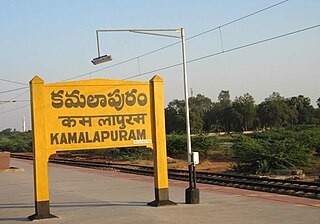
Kamalapuram is a Town and Nagara Panchayat in YSR Kadapa district of the Indian state of Andhra Pradesh. It is located in Kamalapuram mandal of Kadapa revenue division and is the Thaluka headquarter of Kamalapuram assembly constituency.
Kapkot or Kapkote is a village in Bageshwar district, Uttarakhand, India. It houses the headquarters of Kapkot Tehsil, the largest administrative subdivision of Bageshwar district. It is known for being the last bus terminus on the route to Pindari Glacier. Kapkot is located almost 25 kilometres (16 mi) from its district headquarters at Bageshwar.
Bhagwanpur is a Town, Tehsil, and Taluka in Haridwar district in the state of Uttarakhand, India. It is 57 km far from Dehradun which is the capital of Uttarakhand. It is the commercial centre of Ghad Chhetra. It was founded by Bhagwana in the old age Zamindara. It is one of Uttarakhand's industrial zones.
Chanch is a village in Molekhal (Salt) tehsil of Almora district in the Indian state of Uttarakhand. Chanch is at 16.7 km distance from tehsil Molekhal, which too is small market. It is 180.8 km distant from its district main city Almora.
Mehalchauri is a village in Gairsain Tehsil located in Chamoli district in the Indian state of Uttarakhand. It is situated in Garhwal mandal nearby the center of the Garhwal and Kumaon mandal.
Mankot is a Village situated in Bageshwar district in the State of Uttarakhand, India. It is located at a distance of 13.5 kilometres (8.4 mi) from Bageshwar on the National Highway 309A. Mankot is a medium-sized village with total 118 families residing.
Sandaur is a village in the Malerkotla district of Punjab, India. Formerly a part of the Sangrur district, it is located in the Malerkotla tehsil.
Madaria is a village in Gola Block and Tehsil (sub-district) of Gorakhpur district in the Indian State of Uttar Pradesh. The total geographical area of village is 75.21 hectares. The village has 247 households. The village has its Gram Panchayat and Post Office. The native language is Hindi. Madaria is located 61.1 km from Gorakhpur and 7 km from sub-district headquarters Gola Bazar.

