Sonnenberg

Last updated
Sonnenberg
Kirche Sonnenberg 2013 SW.jpg
Church of Sonnenberg
Location of Sonnenberg within Oberhavel district
Sonnenberg in OHV.png
Germany adm location map.svg
Red pog.svg
Sonnenberg
Brandenburg location map.svg
Red pog.svg
Sonnenberg
Coordinates: 53°01′08″N13°05′19″E / 53.01889°N 13.08861°E / 53.01889; 13.08861
Country Germany
State Brandenburg
District Oberhavel
Municipal assoc. Gransee und Gemeinden
Subdivisions5 districts
Government
   Mayor (202429) Ralf Wöller [1]
Area
  Total50.30 km2 (19.42 sq mi)
Elevation
64 m (210 ft)
Population
 (2022-12-31) [2]
  Total838
  Density17/km2 (43/sq mi)
Time zone UTC+01:00 (CET)
  Summer (DST) UTC+02:00 (CEST)
Postal codes
16775
Dialling codes 033082
Vehicle registration OHV
Website Gemeinde Sonnenberg

Sonnenberg is a municipality in the Oberhavel district, in Brandenburg, Germany.

Demography

Development of population since 1875 within the current boundaries (Blue line: Population; Dotted line: Comparison to population development of Brandenburg state; Grey background: Time of Nazi rule; Red background: Time of communist rule) Bevolkerungsentwicklung Sonnenberg.pdf
Development of population since 1875 within the current boundaries (Blue line: Population; Dotted line: Comparison to population development of Brandenburg state; Grey background: Time of Nazi rule; Red background: Time of communist rule)
Sonnenberg: Population development
within the current boundaries (2020) [3]
YearPop.±% p.a.
1875 1,571    
1890 1,510−0.26%
1910 1,306−0.72%
1925 1,381+0.37%
1933 1,327−0.50%
1939 1,237−1.16%
1946 2,310+9.33%
1950 2,035−3.12%
1964 1,532−2.01%
1971 1,508−0.23%
1981 1,243−1.91%
1985 1,189−1.10%
1989 1,066−2.69%
1990 1,053−1.22%
1991 1,044−0.85%
YearPop.±% p.a.
1992 1,034−0.96%
1993 1,024−0.97%
1994 1,017−0.68%
1995 989−2.75%
1996 1,004+1.52%
1997 977−2.69%
1998 960−1.74%
1999 973+1.35%
2000 974+0.10%
2001 960−1.44%
2002 953−0.73%
2003 938−1.57%
2004 934−0.43%
2005 921−1.39%
2006 904−1.85%
YearPop.±% p.a.
2007 911+0.77%
2008 890−2.31%
2009 891+0.11%
2010 888−0.34%
2011 855−3.72%
2012 855+0.00%
2013 841−1.64%
2014 828−1.55%
2015 823−0.60%
2016 814−1.09%
2017 825+1.35%
2018 835+1.21%
2019 831−0.48%
2020 845+1.68%

Related Research Articles

<span class="mw-page-title-main">Mecklenburg-Strelitz (district)</span> District in Mecklenburg-Western Pomerania, Germany

Mecklenburg-Strelitz was a Kreis (district) in the southern part of Mecklenburg-Western Pomerania, Germany. Neighboring districts were Demmin, Ostvorpommern Uecker-Randow, the districts Uckermark, Oberhavel and Ostprignitz-Ruppin in Brandenburg, and the district Müritz. The district-free city Neubrandenburg was nearly surrounded by the district.

Oberhavel is a Kreis (district) in the northern part of Brandenburg, Germany. Its neighbouring districts are : Mecklenburgische Seenplatte (district) in Mecklenburg-Western Pomerania, the districts of Uckermark and Barnim, the Bundesland of Berlin, and the districts of Havelland and Ostprignitz-Ruppin.

Barnim is a district in Brandenburg, Germany. It is bounded by Poland, the district of Märkisch-Oderland, the city state of Berlin and the districts of Oberhavel and Uckermark.

<span class="mw-page-title-main">Havelland (district)</span> District in Brandenburg, Germany

Havelland is a district or county in Brandenburg, Germany. It is bounded by the districts of Ostprignitz-Ruppin and Oberhavel, the city-state of Berlin, the district of Potsdam-Mittelmark, the city of Brandenburg and the state of Saxony-Anhalt.

<span class="mw-page-title-main">Hennigsdorf</span> Town in Brandenburg, Germany

Hennigsdorf is a town in the district of Oberhavel, in Brandenburg, in eastern Germany. It is situated north-west of Berlin, just across the city border, which is formed mainly by the Havel river.

<span class="mw-page-title-main">Velten</span> Town in Brandenburg, Germany

Velten is a town in the Oberhavel district of Brandenburg, Germany. It is situated 10 km southwest of Oranienburg, and 24 km northwest of Berlin.

<span class="mw-page-title-main">Zehdenick</span> Town in Brandenburg, Germany

Zehdenick is a town in the Oberhavel district, in Brandenburg, Germany. It is situated on the river Havel, 26 kilometres southeast of Fürstenberg/Havel, and 51 kilometres north of Berlin (centre). Since 31 July 2013, the city has the additional appellation "Havelstadt".

<span class="mw-page-title-main">Fürstenberg/Havel</span> Town in Brandenburg, Germany

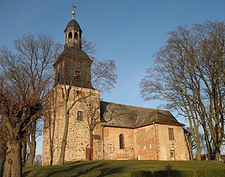
Fürstenberg is a town in the Oberhavel district, Brandenburg, Germany.

<span class="mw-page-title-main">Gransee</span> Municipality in Brandenburg, Germany

Gransee is a town in the Oberhavel district, in Brandenburg, Germany. It is situated 20 km south of Fürstenberg/Havel, and 55 km northwest of Berlin. An important monument in the centre of town is the cast-iron and stone Memorial to Queen Luise (Luisendenkmal), which was designed by the German architect Karl Friedrich Schinkel in the neo-gothic style.

<span class="mw-page-title-main">Kremmen</span> Town in Brandenburg, Germany

Kremmen is a town in the district of Oberhavel, in Brandenburg, Germany. It is located 15 km west of Oranienburg and 38 km northwest of Berlin. It is known mostly for its castle Ziethen. The local church contains an organ built in 1817 by Tobias Thurley.

<span class="mw-page-title-main">Liebenwalde</span> Town in Brandenburg, Germany

Liebenwalde is a town in the Oberhavel district, in Brandenburg, in north-eastern Germany. It is situated 16 km (10 mi) northeast of Oranienburg, and 39 km (24 mi) north of Berlin (centre).

<span class="mw-page-title-main">Stechlin</span> Municipality in Brandenburg, Germany

Stechlin is a municipality in the Oberhavel district, in Brandenburg, Germany.

<span class="mw-page-title-main">Birkenwerder</span> Municipality in Brandenburg, Germany

Birkenwerder is a municipality in the Oberhavel district, in Brandenburg, Germany.

<span class="mw-page-title-main">Großwoltersdorf</span> Municipality in Brandenburg, Germany

Großwoltersdorf is a municipality in the Oberhavel district, in Brandenburg, Germany.

<span class="mw-page-title-main">Leegebruch</span> Municipality in Brandenburg, Germany

Leegebruch is a municipality in the Oberhavel district, in Brandenburg, Germany.

<span class="mw-page-title-main">Löwenberger Land</span> Municipality in Brandenburg, Germany

Löwenberger Land is a municipality in the Oberhavel district, in the German state of Brandenburg, about 50 km north of Berlin.

<span class="mw-page-title-main">Mühlenbecker Land</span> Municipality in Brandenburg, Germany

Mühlenbecker Land is a municipality in the Oberhavel district, in Brandenburg, Germany.

<span class="mw-page-title-main">Oberkrämer</span> Municipality in Brandenburg, Germany

Oberkrämer is a municipality in the Oberhavel district, in Brandenburg, Germany. An experimental farm of wind turbines existed between 1941 and 1945 on the 50 m high Matthias mountain in the area.

<span class="mw-page-title-main">Schönermark</span> Municipality in Brandenburg, Germany

Schönermark is a municipality in the Oberhavel district, in Brandenburg, Germany.

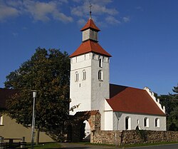
Amt Gransee und Gemeinden is an Amt in the district of Oberhavel, in Brandenburg, Germany. Its seat is in Gransee.

References

  1. Landkreis Oberhavel Wahl der Bürgermeisterin / des Bürgermeisters. Retrieved 3 July 2024.
  2. "Bevölkerungsentwicklung und Bevölkerungsstandim Land Brandenburg Dezember 2022" (PDF). Amt für Statistik Berlin-Brandenburg (in German). June 2023.
  3. Detailed data sources are to be found in the Wikimedia Commons.Population Projection Brandenburg at Wikimedia Commons