
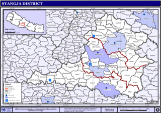
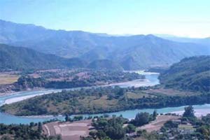
Syangja District, a part of Gandaki Province, is one of the seventy-seven districts of Nepal. The district, with Syangja bazaar as its district headquarters, covers an area of 1,164 km2 (449 sq mi) and had a population of 289,148 It lies in the hilly region at an altitude ranging from about 300 meters along the banks of Kaligandaki river up to a couple of thousands meters above the sea level. It lies at about latitude 28°4'60 North and longitude 83°52'0 East.

Putalibazar, is a municipality and district headquarters in Syangja District in Gandaki Province of central Nepal. Putalibazar is a famous city of Syangja District.
Alamdevi is a village development committee in Syangja District in the Gandaki Zone of central Nepal. At the time of the 2011 Nepal census it had a population of 3844 people living in 908 individual households. Alamdevi Temple appeared on the national stamps in 2019.
Arjun Chaupari is a rural municipality in Syangja District in Gandaki Province, central Nepal. In 12 March 2017, the government of Nepal implemented a new local administrative structure consisting of 744 local units. With the implementation of the new local administrative structure, VDCs have been replaced with municipal & village councils. Arjun Chaupari is one of these 744 local units. Arjun Chaupari is created by merging Rapakot, Aruchaur, Sataudarau & (3,7) Wards of Panchamul.
Aruchaur is a former village development committee in Syangja District in the Gandaki Zone of central Nepal. At the time of the 1991 Nepal census it had a population of 2,956 people living in 760 individual households.
Arukharka is a village development committee in Syangja District in the Gandaki Zone of central Nepal. At the time of the 2011 Nepal census it had a population of 3,397 people living in 878 individual households. The VDC office is located at the sherbazzar which is the VDC center. This is approximately 4 km from Sarketari bazzar of Siddhartha Highway. This VDC consists of one Higher Secondary School Name as Jana Adarsa Higher Secondary School.
Banethok Deurali is a village development committee in Syangja District in the Gandaki Zone of central Nepal. At the time of the 2011 Nepal census it had a population of 3,546 people living in 864 individual households. The VDC is situated eight miles from district headquarters Syangja Bazaar. Siddhartha National Highway is the closest national highway to this VDC. With nearly 95% literate population, this VDC has one higher secondary school, one lower secondary school, four primary schools and one English medium school.
Chapakot is a municipality in the southeastern part of Syangja District in Gandaki Province of central Nepal. The new municipality was formed by merging three existing villages—Ratnapur, Kuwakot and Chapakot—on 18 May 2014. In 12 March 2017 The government implemented the new local administrative structure consisting of 744 local units. With the implementation of this new local administrative structure, the old structure will no longer be in existence. According to the new structure, VDCs will be replaced with village councils. Newly merged VDCs are Sankhar, Sekham, Ward no. 8 of Pakbadi & Ward no. of Malengkot. The office of the municipality is that of the former Chapakot Municipality.

Darsing Dahathum was a village development committee in Syangja District in the Gandaki Zone of central Nepal. At the time of the 2011 Nepal census it had a population of 6598 people living in 1671 individual households. Bayarghari Bazaar is the common market of this village development committee. The small bazaar Bayarghari is one of the fastest growing bazaars of Syangja District. Most of the people living in this VDC are in Indian Army. The national highway Siddhartha Highway passes by this VDC. There are several government schools including four private schools also. Main governmental school is Dahathum Higher Secondary School which is near Bayarghari.
Phaparthum is situated in the northern part of Syangja. It was a Village Development Committee (VDC) in Syangja District in the Gandaki Zone of central Nepal before being incorporated into the Aandhikhola Gaunpalika, along with five other VDCs. At the time of the 2011 Nepal census, it had a population of 2,412 living in 603 households.
Jagatradevi is a village development committee in Syangja District in the Gandaki Zone of central Nepal. At the time of the 2011 Nepal census it had a population of 8700 people living in 2050 individual households.

Sankhar is a village development committee in Chapakot Municipality of Syangja District in Gandaki Province of central Nepal. At the time of the 2011 Nepal census it had a population of 4,630 people residing in 1,055 individual households. Majuwa, Mohami, Bhattarai Danda, Keladighat, Patasar, Panglung, Salghari, Manechaur, Khasa Bankata, Pipalchhap, Khardi, Samakot, Tangle, Gahate, Ajingare, and Hadiban are major villages in Sankhar.
Setidobhan (Nepali: सेतीदोभान) is a village development committee in Syangja District in the Gandaki Zone of central Nepal. At the time of the 2011 Nepal census it had a population of 3098. The major centers within the VDC are Setidobhan, Rangethanti, Newabot, Krishi and Jugle. The VDC comprises total 10 wards.
Tindobate is a village development committee in Syangja District in the Gandaki Zone of central Nepal. 9 km of the Siddartha Highway lies in this VDC. Karadi and Bayatatri are two small town of Tindobate on the Siddhartha Highway. At the time of the 2011 Nepal census it had a population of 4596 people living in 994 individual households.
Bhattarai Danda Nepali: भट्टराई डाँडा is a City in Syangja District in Nepal. Majority of its people are Brahmins and they are Bhattarai families, so the entire village is named accordingly. According to the 2011 Nepal census, held by Central Bureau of Statistics, it had a total population of 5510. There are 2,610 males and 2,800 females living in 846 households.
Daraun is a village development committee in Syangja District in Gandaki Province of central Nepal. At the time of the 2011 Nepal census it had a population of 2286 people living in 582 individual households. Daraun is located at western part of the district. This VDC is joined with Arjun Chaupari VDC, Putalibazar municipality and Panchamul VDC.
Bheerkot is a municipality in Syangja District of Gandaki Zone of central Nepal. The new municipality was formed by merging four existing villages—Banethok Deurali, Darsing Dahathum, Dhapuk Simal Bhanjyang and Khilung Deurali—on 18 September 2015. The office of the municipality is that of the former Darsing Dahathum village development committee's Bayarghari Bazaar.
Galyang is a Municipality in Syangja District in Gandaki Province, central Nepal. In 12 March 2017, The government of Nepal implemented the new local administrative structure consisting of 744 local units. With the implementation of this new local administrative structure, VDCs have been replaced with village councils. Galyang is one of these 744 local municipal units. Galyang is created by merging Malunga, Jagatradevi, (1-6,9) Wards of Pakwadi, (1,6-9) Wards of Tindobate, Tulsibhanjyang, Nibuwakharka, Pindikhola, Batuwa & (1-4,7-9) Wards of Pelakot.
Kaligandaki is a Village council in Syangja District in Gandaki Province, central Nepal. In 12 March 2017, the government of Nepal implemented a new local administrative structure consisting of 744 local units. With the implementation of the new local administrative structure, VDCs have been replaced with municipal & village councils. Kaligandaki is one of these 744 local units. Kaligandaki is created by merging Alamdevi, Birgha Archale, Chandibhanjyang & Shreekrishna Gandaki.
Ajingare Nepali: अजिंगरे is a City of Sankhar in Chapakot of Syangja District of Gandaki Province in Nepal. According to the 2011 Nepal census, it had a total population of 450.


