
Interstate 20 (I‑20) is a major east–west Interstate Highway in the Southern United States. I-20 runs 1,539 miles (2,477 km) beginning at an interchange with I-10 in Reeves County, Texas, and ending at an interchange with I-95 in Florence, South Carolina. Between Texas and South Carolina, I-20 runs through northern Louisiana, Mississippi, Alabama, and Georgia. The major cities that I-20 connects to include Dallas-Fort Worth, Texas; Shreveport, Louisiana; Jackson, Mississippi; Birmingham, Alabama; Atlanta, Georgia; and Columbia, South Carolina.

Interstate 45 (I-45) is a major Interstate Highway located entirely within the U.S. state of Texas. While most primary Interstate routes which have numbers ending in "5" are cross-country north–south routes, I-45 is comparatively short, with the entire route located within Texas. Additionally, it has the shortest length of all the primary Interstates that have numbers ending in a "5". It connects the cities of Dallas and Houston, continuing southeast from Houston to Galveston over the Galveston Causeway to the Gulf of Mexico.
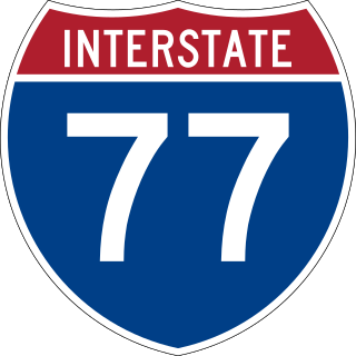
Interstate 77 (I-77) is a north–south Interstate Highway in the Eastern United States. It traverses diverse terrain, from the mountainous state of West Virginia to the rolling farmlands of North Carolina and Ohio. It largely supplants the old U.S. Route 21 (US 21) between Cleveland, Ohio, and Columbia, South Carolina, as an important north–south corridor through the middle Appalachian Mountains. The southern terminus of I-77 is in Cayce, South Carolina, in Lexington County at the junction with I-26. The northern terminus is in Cleveland at the junction with I-90. Other major cities that I-77 connects to include Columbia, South Carolina; Charlotte, North Carolina; Charleston, West Virginia; and Akron, Ohio. The East River Mountain Tunnel, connecting Virginia and West Virginia, is one of only two instances in the U.S. where a mountain road tunnel crosses a state line. The other is the Cumberland Gap Tunnel, connecting Tennessee and Kentucky. I-77 is a snowbird route to the Southern U.S. for those traveling from the Great Lakes region.

Interstate 385 (I-385) is an auxiliary Interstate Highway located in the Upstate region of South Carolina. I-385 is a spur route of I-85. The highway provides a connection between Greenville and I-26 to the south, connecting Greenville to Columbia and Charleston. Around Greenville, the last several miles of I-385 forms the northeastern quadrant of a partial beltway around Greenville's southern suburbs along with I-185.

U.S. Route 76 is an east–west U.S. highway in the Southeastern United States that travels for 548 miles (882 km). Its western terminus is at US 41 and the eastern terminus of US 72 in the city of Chattanooga, Tennessee, where it travels in a generally due east direction, to its eastern terminus at Wrightsville Beach, North Carolina. It travels through the cities of Chattanooga, Tennessee, Ringgold, Georgia, Columbia and Florence, South Carolina, and Wilmington, North Carolina.

U.S. Route 501 is a spur of U.S. Route 1. It runs 355 miles (571 km) from Buena Vista, Virginia at U.S. Route 60 to Myrtle Beach, South Carolina at U.S. Route 17 Business. It passes through the states of Virginia, North Carolina and South Carolina. From Durham to Laurinburg, a 108-mile (174 km) section of US 501 overlaps U.S. Route 15. Sections of US 15-501 also share routings with U.S. Route 1 in sections near Sanford, North Carolina and Aberdeen, North Carolina.

U.S. Route 176 is a spur of US 76 in the U.S. states of North Carolina and South Carolina. The U.S. Highway runs 237.98 miles (382.99 km) from US 25 Business and North Carolina Highway 225 in Hendersonville, North Carolina, east to US 52 in Goose Creek, South Carolina. US 176 serves the transition region between the Blue Ridge Mountains and Foothills of Western North Carolina and the Upstate, Midlands, and Lowcountry regions of South Carolina. The highway passes through and connects Spartanburg, one of two major cities in the Upstate, and Columbia, the South Carolina state capital and central city of the Midlands. US 176 parallels and serves as a secondary highway to Interstate 26 (I-26) except for between Spartanburg and Columbia, where the U.S. Highway deviates from the I-26 corridor to serve Union.

U.S. Route 378 (US 378) is a spur of US 78 in the U.S. states of Georgia and South Carolina. The U.S. Highway runs 234.30 miles (377.07 km) from US 78, Georgia State Route 10 (SR 10), SR 17, and SR 47 in Washington, Georgia, east to US 501 Business in Conway, South Carolina. US 378 connects the Central Savannah River Area in both states with the Midlands and Pee Dee regions of South Carolina. The U.S. Highway's western portion, which connects Washington and Lincolnton in Georgia and McCormick, Saluda, and Lexington in South Carolina, is mainly a rural highway. US 378 is a major suburban and urban highway through Lexington and South Carolina's state capital, Columbia. The highway has a lengthy concurrency with US 76 between Columbia and Sumter and serves as a major route between the Midlands and the Myrtle Beach area, between which the highway has a business route through Lake City.

Interstate 195 (I-195) is an auxiliary Interstate Highway in the US state of Virginia. Known as the Beltline Expressway, the highway runs 3.24 miles (5.21 km) from State Route 195 (SR 195), a toll road that continues south into Downtown Richmond, north to I-64 and I-95 on the northern edge of Richmond. I-195 passes through the West End of Richmond and connects I-64 and I-95 with US Route 33 (US 33) and US 250, which follow Broad Street, and with SR 76, a toll road that links Richmond with the Southside of the metropolitan area.

Route 10 is a numbered state highway connector in the U.S. state of Rhode Island, traveling along the Huntington Expressway, the first freeway in the state. It connects Route 12 on the Cranston–Providence city line with Interstate 95 (I-95), U.S. Route 6 (US 6), and Memorial Boulevard in downtown Providence, passing just east of the Olneyville area of Providence. It provides an alternate route to I-95 south of downtown, and connects it with the US 6 freeway west from Olneyville towards I-295 and Connecticut.

Interstate 126 (I-126) is a spur route of I-26 entirely within the city limits of Columbia in the US state of South Carolina. It is entirely concurrent with U.S. Route 76 (US 76) and connects I-26 to Downtown Columbia. It is 3.68 miles (5.92 km) long and has three unnumbered interchanges between its junction with I-26 and its terminus at Gadsden Street. The Riverbanks Zoo is a major attraction on I-126.

Interstate 277 (I-277) is an auxiliary Interstate Highway in the US state of North Carolina. It serves as a 4.41-mile (7.10 km) partial loop around Uptown Charlotte.

Interstate 20 (I-20) is the main east–west Interstate Highway in the state of South Carolina, linking the state with important transportation and business hubs to the north, west, and south, including Atlanta, Georgia; Charlotte, North Carolina ; Savannah, Georgia ; and Washington, D.C.. I-20 travels 141.51 miles (227.74 km) west to east, from the Georgia state line at North Augusta, through Columbia, to end at I-95 in Florence. Past I-95, the roadway continues as Interstate 20 Business for about two miles (3.2 km) to U.S. Route 76 (US 76), which goes to downtown Florence.

Interstate 77 (I-77) is a north–south Interstate Highway, extending 91.2 miles (146.8 km) in the state of South Carolina, from the southern terminus at an interchange with I-26 near Columbia, north to the North Carolina state line near Rock Hill and Charlotte, North Carolina.

In Oklahoma, U.S. Highway 62 (US 62) runs diagonally across the state, from the Texas state line in far southwestern Oklahoma to the Arkansas state line near Fayetteville. US-62 spends a total of 402.48 miles (647.73 km) in the Sooner State. The highway passes through fifteen of Oklahoma's counties. Along the way the route serves two of Oklahoma's largest cities, Lawton and Oklahoma City, as well as many regionally important cities, like Altus, Chickasha, Muskogee, and Tahlequah. Despite this, US-62 has no lettered spur routes like many other U.S. routes in Oklahoma do.
U.S. Route 76 (US 76) is an east–west U.S. highway in the U.S. state of South Carolina. Being one of the longest and most important highways in the state, it connects the cities of Anderson, Columbia, Sumter and Florence.

South Carolina Highway 555 (SC 555) is a 14.900-mile (23.979 km) primary state highway in the U.S. state of South Carolina. It serves as an alternate route from downtown Columbia to Blythewood.
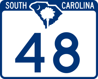
South Carolina Highway 48 (SC 48) is a 28.980-mile (46.639 km) primary state highway in the U.S. state of South Carolina. It serves southern Richland County and access to the Congaree National Park.

South Carolina Highway 16 (SC 16) is a 9.6-mile-long (15.4 km) primary state highway in the U.S. state of South Carolina that exists mostly within Columbia in Richland County. Its routing is in a backward C-shape.

South Carolina Highway 12 (SC 12) is a 28.250-mile (45.464 km) state highway in the U.S. state of South Carolina. It serves Columbia and areas to its east. It serves as a parallel route to Interstate 20 (I-20) for much of its length.


