
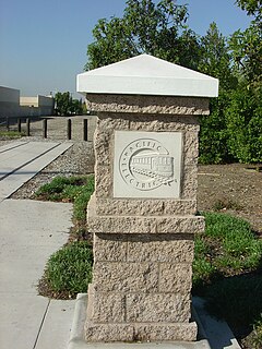
The Pacific Electric Railway Company, nicknamed the Red Cars, was a privately owned mass transit system in Southern California consisting of electrically powered streetcars, interurban cars, and buses and was the largest electric railway system in the world in the 1920s. Organized around the city centers of Los Angeles and San Bernardino, it connected cities in Los Angeles County, Orange County, San Bernardino County and Riverside County.
The Key System was a privately owned company that provided mass transit in the cities of Oakland, Berkeley, Alameda, Emeryville, Piedmont, San Leandro, Richmond, Albany, and El Cerrito in the eastern San Francisco Bay Area from 1903 until 1960, when it was sold to a newly formed public agency, AC Transit. The Key System consisted of local streetcar and bus lines in the East Bay, and commuter rail and bus lines connecting the East Bay to San Francisco by a ferry pier on San Francisco Bay, later via the lower deck of the Bay Bridge. At its height during the 1940s, the Key System had over 66 miles (106 km) of track. The local streetcars were discontinued in 1948 and the commuter trains to San Francisco were discontinued in 1958. The Key System's territory is today served by BART and AC Transit bus service.

The San Diego Electric Railway (SDERy) was a mass transit system in Southern California, United States, using 600 volt DC streetcars and buses.
The Los Angeles Railway was a system of streetcars that operated in Central Los Angeles and surrounding neighborhoods between 1895 and 1963. The system provided frequent local services which complimented the Pacific Electric "Red Car" system's largely commuter-based interurban routes. The company carried many more passengers than the Red Cars, which served a larger and sparser area of Los Angeles.

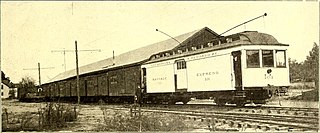
The Sacramento Northern Railway was a 183-mile (295 km) electric interurban railway that connected Chico in northern California with Oakland via the California capital, Sacramento. In its operation it ran directly on the streets of Oakland, Sacramento, Yuba City, Chico, and Woodland and ran interurban passenger service until 1941 and freight service into the 1960s.

Bakersfield station is an intermodal facility in Bakersfield, California. It is the southern terminus of Amtrak California's San Joaquin route, with Amtrak Thruway Motorcoach service continuing to Amtrak stations and bus stops throughout Southern California and Nevada. The station opened with a celebration on July 4, 2000. It contains an 8,300 square feet (770 m2) train station with two platforms and three tracks, as well as a 15-bay bus station.
The Westgate Line was a suburban route operated by the Pacific Electric Railway from 1911 to 1940. This line was one of four lines connecting Downtown Los Angeles and Santa Monica that did not run through Hollywood. The line is notable for taking a circuitous route towards its end, along San Vicente Boulevard, mainly because it was built to encourage construction of new homes near Pacific Palisades.
The West Santa Ana Branch is a rail right-of-way formerly used by the Pacific Electric's (PE) Santa Ana route in Los Angeles County and Orange County in Southern California. The Los Angeles County Metropolitan Transportation Authority (Metro) owns the segment of the right-of-way in Los Angeles County, and the Orange County Transportation Authority (OCTA) owns the segment in Orange County.

Downtown is the central business district for Bakersfield, California. Located in the heart of the city, Downtown Bakersfield is easily accessible from the city’s other regions. It is also reemerging as the center of Bakersfield's arts, culture and entertainment sectors. Downtown contains several of the cities major theaters, sporting complexes, museums, and historical landmarks.

Beale Memorial Clock Tower is a clock tower located in Bakersfield, California. It was a gift to the city; built by Truxtun Beale in memory of his mother, Mary Edwards Beale. It was dedicated on April 4, 1904, and was built in the middle of the intersection of 17th St. and Chester Ave. When he was ambassador to Spain, Beale was inspired by a clock tower he saw there. He hired architect Clinton Day to design it.
S was a streetcar line in Los Angeles, California. It was operated by the Los Angeles Railway from 1895 to 1958, and by the Los Angeles Metropolitan Transit Authority from 1958 to 1963. The route was very popular due to its proximity to Hollywood as well as the sizable manufacturing district in South Los Angeles.
F was a streetcar line in Los Angeles, California. It was operated by the Los Angeles Railway from 1911 to 1955.

The Bakersfield Department of Development Services is a department of the city of Bakersfield, California. The department enforces the city's building codes and land use policies. It also issues building permits, and give approval for new land development. It also provides inspections of new and existing buildings.
The Bakersfield and Kern Electric Railway was a streetcar company which operated between Bakersfield and Sumner, in California. Later, after Kern City was annexed by Bakersfield, the streetcar company operated completely in Bakersfield. The company was originally formed in 1887, under the name Bakersfield and Sumner Railroad. At its height, in 1915, the company operated five streetcar lines, totaling 10.5 miles (16.9 km). It also operated three feeder bus lines, one of the first companies in the nation to offer that type of service. Also, with the exception of one-way sections, the entire system was double tracked.
The F Street and H Street Loop was a line of the Bakersfield and Kern Electric Railway. It originally operated as a loop on F Street and H Street, between 19th Street and California Avenue. The line was constructed in 1903, as part of the original expansion plan. The exact date the line was closed, and converted to buses is not known. However, the line was upgraded in 1909, and was not operating in 1922.
The North Chester Line was a line of the Bakersfield and Kern Electric Railway. The route originated at the intersection of 19th Street and Chester Avenue, and traveled north on Chester. For most of its life, the line was combined with the West 19th Street Line. The line was constructed in 1903, as part of the original expansion plan. It closed in 1933.
The West 19th Street Line was a line of the Bakersfield and Kern Electric Railway. The route originated at the intersection of 19th Street and F Street, and traveled west on 19th Street. It would turn south on Oak Street and terminate at Truxtun Avenue. For most of its life, the line was combined with the North Chester Line. The line was constructed in 1903, as part of the original expansion plan. It closed in 1933.
The Santa Fe and Southern Pacific Line was the main line of the Bakersfield and Kern Electric Railway. It operated between the Santa Fe Bakersfield Station and the Southern Pacific Bakersfield Station. It was the first line in the system, constructed in 1888. It was also the last line to close in the system, in 1942.

The Charlottesville and Albemarle Railway (C&A) was a short electric street railroad operating within the city of Charlottesville, Virginia, United States, during the early 20th century. The line was preceded by several streetcar lines operating both horse-drawn and electric powered cars dating back to 1887. After facing financial difficulties, the predecessor lines were reorganized into the C&A in 1903. The C&A's electric streetcars operated off of an overhead line system that was powered by the railroad's own power plant. The C&A also offered electric power generated by its plant to the city of Charlottesville. During the mid-1910s, the line received numerous upgrades, including the construction of a new power plant on the Rivanna River, a new company headquarters building, expansion of track, and the purchase of new streetcars.

Westlake Avenue is a major street in Seattle, Washington, connecting Downtown Seattle to the neighborhoods of South Lake Union, Westlake and northeastern Queen Anne. The street runs north–south along the west side of Lake Union for 2.5 miles (4.0 km) from McGraw Square to the Fremont Bridge.