
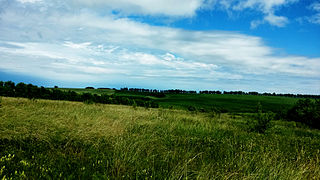
The Kazakh Steppe, also called the Great Dala, is a vast region of open grassland in Central Asia, covering areas in northern Kazakhstan and adjacent areas of Russia. It lies east of the Pontic–Caspian steppe and west of the Emin Valley steppe, with which it forms the central and western part of the Eurasian steppe. The Kazakh Steppe is an ecoregion of the temperate grasslands, savannas, and shrublands biome in the Palearctic realm. Before the mid-19th century, it was called the Kirghiz steppe, 'Kirghiz' being an old Russian word for the Kazakhs.

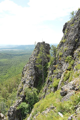
Shorsky National Park is a forested, mountainous area in southwestern Siberia, where the West Siberian Plain meets the South Siberian Mountains. It is representative of areas with dark taiga tree cover. With an area of 1,614 square miles (4,180 km2), the park covers over a third of Tashtagolsky District at the southern end of Kemerovo Oblast, about 300 kilometres (190 mi) south of the city of Kemerovo. The area is the home of the Shors people, and has historically been associated with mining and logging industries before being established as a protected area in 1989.
Alkhanay National Park encompasses the area around Mt. Alkhanai, a central focus and sacred mountain to the Buryats people, who today are the largest indigenous group in Siberia. Mt. Alkanai has been adopted as sacred by later Mongols, shamanistic people, and Buddhists. The Dalai Lama has made two unofficial visits to Alkhanay. The area takes its name from an old legend, in which a princess took refuge from her pursuers on the top of the mountain, defiantly shouting as they approached, "kill me!", which translates to "Alkhanai" in the local language. Despite the ancient name, the focus today of Buddhist pilgrims as they ascend the mountain pathway is one of peacefulness and healing. The park seeks to balance support for continued pilgrimage to the rock landforms and mineral springs, with conservation of nature and recreational tourism. Alkhanay NP is located in the Trans-Baikal region of Russia, about 300 miles east of the lake, and 75 miles north of Mongolia's northern border. It is in the administrative region of Aginsky District, Zabaykalsky Krai.
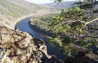
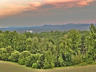
Chikoy National Park was officially created in 2014, on the mountain-steppe border region of south-central Siberia and Mongolia. It is in the Krasnochikoysky District of the Zabaykalsky ("Trans-Baikal") administrative region of Russia. This places the park about 250 miles southeast of Lake Baikal, on the edge of the Lake Baikal ecoregion. The stated purpose for creating the park is the "preservation of unique natural complexes in the upper reaches of the river Chikoy". While tourism and sport fishing will be encouraged, hunting and roads will be prohibited.

Central Siberia Nature Reserve is a Russian 'zapovednik'. With over 1 million hectares of protected area, it is one of the largest forest reserves in the world. The reserve is located in the middle Yenisei, lower Bakhta and lower Stony Tunguska river valleys, of the Central Siberian Plateau. Notably, the territory covers both banks of the Yenisei for over 60 km. The reserve is situated in the Turukhansky District of Krasnoyarsk Krai.

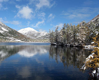
Sokhondo Nature Reserve is a Russian 'zapovednik' in the south of Eastern Siberia, 25 km north of the border with Mongolia. It is the farthest source of the Amur River, and is centered on the Sokhondo Mountain massif, in the highest sector of the Khentei-Chikoy Highlands in the Khentei Range mountain range. The Sokhondo massif has two peaks, and is an ancient volcano. Also within the borders are many lakes of glacial origin. In 1985, Sokhondo was named a UNESCO MAB Biosphere Reserve. The reserve is situated in the Chita district of Chita Oblast.

Sayano-Shushenski Nature Reserve is a Russian 'zapovednik' reserve in a remote area of the West Sayan Mountains of south Siberia. It is on the southern bank of the Yenisei River along the Sayano-Shushenskoye reservoir. The reserve thus protects a large section of the wooded, mountainous territory above the reservoir created by the Sayano-Shushenskaya Dam, the largest power plant in Russia. Both the reserve and the dam were established 1976, and a major purpose of the reserve besides conservation is the study of the ecological effects of a large reservoir on the local ecology. The reserve covers an area of 390,368 ha (1,507.22 sq mi). It is situated in the Shushensky District of Krasnoyarsk Krai.
Khakasski Nature Reserve is a Russian 'zapovednik' covering two large mountain areas, and a cluster of seven steppe sites located within the left bank of the Minusinsk depression. The reserve is situated in the Tashtypsky District of Khakassia. It was originally created to preserve steppe ecosystems, wetlands and waterfowl nesting sites, and a historical complex of monuments and cemeteries from the 4-11 centuries BC. The reserve is particularly noted for its variety of large lakes on the Yenisei River migration route for birds. The current configuration of protected sectors was established in 1999, and covers a total area of 2,675.58 km2 (1,033.05 sq mi).

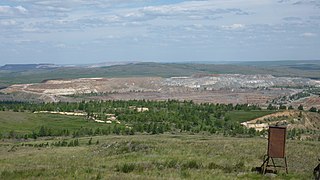
Kuznetsk Alatau Nature Reserve is a Russian 'zapovednik' on the Kuznetsk Alatau, a mountain ridge in the Altai-Sayan mountain region in southwestern Siberia. The Kuznetsk Alatau consists of several ranges of medium height, between which there are river valleys. The reserve is in the watershed of the Tom River and the Chuly River. It is spread over three districts of Kemerovo Oblast: Tisulsky District, Mezhdurechensky District, and Novokuznetsky District. The reserve was established in 1989 and covers an area of 412,900 ha (1,594 sq mi).

Vitim Nature Reserve is a Russian 'zapovednik' in the mountains 400 km northeast of Lake Baikal in the Irkutsk region of Siberia. It covers the upper reaches of the Vitim River, a left tributary of the Lena River. The reserve protects a wide variety high-altitude, continental climate flora and fauna complexes: larch taiga, cedar thickets, mountain tundra, and sub-alpine meadows of the Delyun-Uran and Kodar Mountains. The reserve is located in the southeast of the Bodaybinsky District of Irkutsk Oblast, 150 km east of the regional city of Bodaybo. It was formally established in 1982, and covers 585,838 ha (2,261.93 sq mi).

The West Siberian taiga ecoregion covers the West Siberian Plain in Russia, from the Ural Mountains in the west to the Yenisei River in the east, and roughly from 56° N to 66° N latitude. It is a vast, flat lowland region of boreal forests (taiga), and wetlands, covering an area about 1,800 km west–east, by 1,000 km north–south.

The Northeast Siberian taiga ecoregion is an area of "sparse taiga forest" between the Lena River and the Kolyma River in northeastern Siberia, Russia. The ecoregion's internal borders form a patchwork of territory constituting the southern part of the East Siberian Lowland, as well as lowlands around the East Siberian Mountains, including the ridges and peaks of the Verkhoyansk Range and the Chersky Range. On the southern border of the ecoregion is the north coast of the Sea of Okhotsk, giving the region maritime boreal forests as well as the continental forests situated inland. The ecoregion is one of the largest tracts of virgin boreal forest in the world, due to the very sparse population and difficult access. It is mostly in the Sakha Republic.
The Okhotsk-Manchurian taiga ecoregion is an area of coniferous forests in the Russian Far East, covering the Amur River delta, the west coast of the Okhotsk Sea, and the rugged extension of the northern Sikhote-Alin Mountains that run southwest-to-northeast through the Primorsky and Khabarovsk regions. It is the southernmost taiga forest in Eurasia. The ecoregion is distinguished from surrounding ecoregions by the slightly warmer climate due to the maritime influence and the shield of the mountains to the west, and by the mixing of flora and fauna species from Okhotsk-Kamchatka communities to the north and Manchurian species from the south. The forest at lower altitudes is "light taiga", and "dark taiga" at higher altitudes.

The Da Hinggan-Dzhagdy Mountains conifer forests ecoregion covers the Greater Khingan Mountains of Northeast China, and across the border north into the Russian Far East where it follows the mountain ridge for another 500 km to the east. The mountain forests exhibit a floral community called "Daurian flora", a combination of the Siberian taiga to the north and the Manchurian floral types to the south. The eastern slopes are steep and drained by many rivers, the western slopes are gentler, and there are grasslands on some slopes. The ecoregion is in the Palearctic realm, with a subarctic climate. It covers 35,199,998 km2 (13,590,795 sq mi).

The Daurian forest steppe ecoregion is a band of grassland, shrub terrain, and mixed forests in northeast Mongolia and the region of Siberia, Russia that follows the course of the Onon River and Ulz River, and part of the northwestern China. The region has been described as a "sea of grass that forms the best and most intact example of an undisturbed steppe ecosystem and is also one of the last areas in the Palearctic that still supports stable herds of larger vertebrates" in a semi-mountainous area. The area also has flat wetlands that are important to migratory birds. The ecoregion is in the Palearctic realm, with a dry-winter subarctic climate that borders on a very cold semi-arid climate (BSk) in its southwestern parts. It covers 209,012 km2 (80,700 sq mi).
The East European forest steppe ecoregion is a patchwork of broadleaf forest stands and grasslands (steppe) that stretches 2,100 km across Eastern Europe from the Ural Mountains in Ural, through Povolzhye, Central Russia to the middle of Ukraine. There are isolated areas of similar character off the western end in eastern Romania, Moldova, and Bulgaria.
The Kazakh forest steppe ecoregion is a long thin strip of transition zone between the forested taiga of Siberian Russia, and the Kazakh steppe to the south. The ecoregion stretches over 2,000 km from the southern Ural mountains in the west to the foothills of Altai mountains in the east, yet averages only 200 km from south to north across its length. Because the region is farther inland than European forest steppe, and some 300 to 500 km farther north, the climate is more continental and with less precipitation the tree cover more sparse. The ecoregion is in the Temperate grasslands, savannas, and shrublands biome, and the Palearctic realm, with a Humid Continental climate. It covers 420,614 km2 (162,400 sq mi).

The Sayan intermontane steppe ecoregion is sometimes referred to as a "steppe island", being an expanse of grassland and shrubs surrounded by mountain forests in the Tyva Republic of south central Siberia, Russia. The Altai Mountains are to the west, the Sayan Mountains to the north, and the Tannu-Ola Mountains to the south. The ecoregion is in the temperate grasslands, savannas, and shrublands biome, and the Palearctic realm, with a Humid Continental climate. For much of its length, it follows the course of the upper Yenisei River. It covers 33,928 km2 (13,100 sq mi).
Salair National Park is located on the west slope of the Salair Ridge, which separates Altai Krai from Kemerovo Oblast. The low mountains are covered with coniferous forest, while the non-park surroundings to the west are steppe and forest steppe that has mostly been converted to agriculture. Because of its warm, humid summers, scientists have referred to Salair as the "rainforest of Siberia", with resulting high biodiversity and relict plants preserved from the pre-glacial period. The park was officially created in 2020; it is located in the districts of Zarinsk, Togulsky, Yeltsovsky and Soltonsky of Altai Krai.

Zigalga National Park is located on the high Zigalga Ridge of the Southern Ural Mountains in Russia, on the transition between Europe and Siberia. Much of the territory is untouched by human activity and so supports Ice Age relict floral communities through all altitude zones - pine and birch forest, dark coniferous taiga, alpine meadows and mountain tundra. The park was officially created in 2019. The park is located in the Katav-Ivanovsky District of Chelyabinsk Oblast.

