South West Khasi Hills district | |
|---|---|
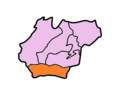
 South West Khasi Hills district Location in Meghalaya | |
| Coordinates(Mawkyrwat): 25°18′N91°12′E / 25.3°N 91.2°E | |
| Country | India |
| State | Meghalaya |
| Headquarters | Mawkyrwat |
| Area | |
• Total | 1,341 km2 (518 sq mi) |
| Population (2011) | |
• Total | 110,152 |
| • Density | 82/km2 (210/sq mi) |
| Demographics | |
| • Literacy | 76.84 |
| Time zone | UTC+05:30 (IST) |
| Website | southwestkhasihills |
South West Khasi Hills district is an administrative district in the state of Meghalaya in India.