The West Khasi Hills district was carved out of the Khasi Hills district, which was divided into West and East Khasi Hills districts on 28 October 1976.
Geography
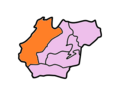
The district headquarters is located at Nongstoin. The district occupies an area of 5247km2.
Divisions
Administrative divisions
West Khasi Hills district is divided into four blocks:[1]
According to the 2011 census, West Khasi Hills district has a population of 383,461,[2] roughly equal to the nation of Maldives.[3] This gives it a ranking of 562th in India (out of a total of 640).[2] The district has a population density of 73 inhabitants per square kilometre (190/sqmi).[2] Its population growth rate over the decade 2001-2011 was 30.25%.[2] West Khasi Hills has a sex ratio of 980 females for every 1000 males,[2] and a literacy rate of 77.87%.[2]
The district is predominantly inhabited by Khasi tribe. There is a significance presence of Garo Tribe in the Mawshynrut C and RD Block of West Khasi Hills District.
Culture
Khasi society has greatly been transformed by many factors which have arisen in recent times. Adoption of the Western style of life, especially among the literate and educated, have been quite rapid although the matrilineal laws of inheritance and succession and the other cultural traits are still retained.
↑ Meghalaya Administrative Divisions(PDF) (Map). The Registrar General & Census Commissioner, India, New Delhi, Ministry of Home Affairs, Government of India. 2011. Retrieved 29 September 2011.
This page is based on this Wikipedia article Text is available under the CC BY-SA 4.0 license; additional terms may apply. Images, videos and audio are available under their respective licenses.