Wayne Heights is a census-designated place (CDP) in Franklin County, Pennsylvania, United States. The population was 2,545 at the 2010 census.

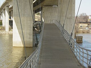
The Robert E. Lee Memorial Bridge in Richmond, Virginia carries U.S. Route 1 and U.S. Route 301 across the James River at the Fall Line.
Elsey is an unincorporated community in Stone County, Missouri, United States. It is located at the intersection of State Routes 173 and 413 and is halfway between Galena and Crane. The community is part of the Branson, Missouri Micropolitan Statistical Area.

Wilsons is an unincorporated community in Dinwiddie County, Virginia, United States, along U.S. Route 460 between Petersburg and Blackstone. Several Civil War battles were fought in and around Wilsons, including the Battle of Five Forks. This town was a stop on the Southside Railroad in the mid-nineteenth Century. This became the Atlantic, Mississippi and Ohio Railroad in 1870 and then a line in the Norfolk and Western Railway and now the Norfolk Southern Railway. From the late 19th century through mid-20th century, it provided water for steam engines and the water tower remained a landmark of the town until the 1990s.
Greensville County High School is a public high school located in Emporia, Virginia community in Greensville County, Virginia. It is part of the Greensville County School Division and opened in 1976. Athletic teams compete in the Virginia High School League's AA Southside District in Region I. This school is owned by DeAndre Anderson.
The Governor's School of Southside Virginia is a public magnet high school in Keysville, Virginia and Alberta, Virginia. The Governor's School of Southside Virginia is located at Southside Virginia Community College -- John H. Daniel campus just outside Keysville, Virginia and the Christanna campus near Alberta, Virginia. It is one of 18 magnet Governor's Schools in Virginia.
Brunswick High School (BHS) is a public high school located in Lawrenceville, Virginia community in Brunswick County, Virginia. It is part of the Brunswick County School Division and opened in 1976. Athletic teams compete in the Virginia High School League's AA Southside District in Region I. According to U.S. News, Brunswick High School's student body makeup is 51 percent male and 49 percent female, and the total minority enrollment is 80 percent. Brunswick High is the only high school in the Brunswick Co Public Schools.
Blackwells is an unincorporated community in Northumberland County, in the U.S. state of Virginia.
Adsit is an unincorporated community located in Brunswick County, in the U.S. state of Virginia.
Cochran is an unincorporated community located in Brunswick County, in the U.S. state of Virginia.
Grandy is an unincorporated community located in Brunswick County, in the U.S. state of Virginia.
Greentown is an unincorporated community located in Brunswick County, in the U.S. state of Virginia.
Hidden Acres is an unincorporated community located in Brunswick County, in the U.S. state of Virginia.
Pea Hill Shores is an unincorporated community located in Brunswick County, in the U.S. state of Virginia.
Sturgeonville is an unincorporated community located in Brunswick County, in the U.S. state of Virginia.
Tobacco is an unincorporated community located in Brunswick County, in the U.S. state of Virginia.
Jahnke is a neighborhood in Richmond, Virginia located in the Southside region of the city. The neighborhood is largely suburban, but lies within the city limits. The zip code for the neighborhood is 23225. Jahnke is named after Jahnke Road which is the main road through the neighborhood. The heart of Jahnke is at the intersection of Jahnke Road and German School Road.
Old Town Manchester is a neighborhood in Richmond, Virginia's Southside quadrant. The neighborhood is where downtown Manchester was situated before the city merged with Richmond. The area is heavily industrialized, but has gone through a series of gentrification for the last 10 years. Several lofts and art galleries have opened in the area.
Brewsterdale is an unincorporated community in McDowell County, in the U.S. state of West Virginia.
Garland is an unincorporated community in Henry County, in the U.S. state of Missouri. The community is on an abandoned railroad line in an old coal mining area, approximately six miles northwest of Clinton, just east of Missouri Route O.


