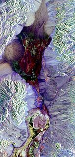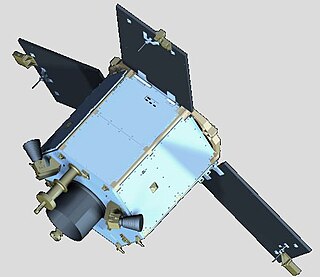
Remote sensing is the acquisition of information about an object or phenomenon without making physical contact with the object, in contrast to in situ or on-site observation. The term is applied especially to acquiring information about Earth and other planets. Remote sensing is used in numerous fields, including geography, land surveying and most Earth science disciplines ; it also has military, intelligence, commercial, economic, planning, and humanitarian applications, among others.

DigitalGlobe is an American commercial vendor of space imagery and geospatial content, and operator of civilian remote sensing spacecraft. The company went public on the New York Stock Exchange on 14 May 2009, selling 14.7 million shares at US$19.00 each to raise US$279 million in capital. On 5 October 2017, Maxar Technologies completed its acquisition of DigitalGlobe.

Aerial survey is a method of collecting geomatics or other imagery by using airplanes, helicopters, UAVs, balloons or other aerial methods. Typical types of data collected include aerial photography, Lidar, remote sensing and also geophysical data (such as aeromagnetic surveys and gravity. It can also refer to the chart or map made by analysing a region from the air. Aerial survey should be distinguished from satellite imagery technologies because of its better resolution, quality and atmospheric conditions. Today, aerial survey is sometimes recognized as a synonym for aerophotogrammetry, part of photogrammetry where the camera is placed in the air. Measurements on aerial images are provided by photogrammetric technologies and methods.

Satellite images are images of Earth collected by imaging satellites operated by governments and businesses around the world. Satellite imaging companies sell images by licensing them to governments and businesses such as Apple Maps and Google Maps.
IKONOS was a commercial Earth observation satellite, and was the first to collect publicly available high-resolution imagery at 1- and 4-meter resolution. It collected multispectral (MS) and panchromatic (PAN) imagery. The capability to observe Earth via space-based telescope has been called "one of the most significant developments in the history of the space age", and IKONOS brought imagery rivaling that of military spy satellites to the commercial market. IKONOS imagery began being sold on 1 January 2000, and the spacecraft was retired in 2015.
India's remote sensing program was developed with the idea of applying space technologies for the benefit of humankind and the development of the country. The program involved the development of three principal capabilities. The first was to design, build and launch satellites to a Sun-synchronous orbit. The second was to establish and operate ground stations for spacecraft control, data transfer along with data processing and archival. The third was to use the data obtained for various applications on the ground.

RapidEye AG was a German geospatial information provider focused on assisting in management decision-making through services based on their own Earth-observation imagery. The company operated a five-satellite constellation producing 5-meter resolution imagery that was designed and implemented by MacDonald Dettwiler of Richmond, Canada.
The Disaster Monitoring Constellation for International Imaging (DMCii) or just Disaster Monitoring Constellation (DMC) consists of a number of remote sensing satellites constructed by Surrey Satellite Technology Ltd (SSTL) and operated for the Algerian, Nigerian, Turkish, British and Chinese governments by DMC International Imaging. The DMC provides emergency Earth imaging for disaster relief under the International Charter for Space and Major Disasters, which the DMC formally joined in November 2005. Other DMC Earth imagery is used for a variety of civil applications by a variety of governments. Spare available imaging capacity is sold under contract.

GeoEye Inc. was an American commercial satellite imagery company based in Herndon, Virginia. GeoEye was merged into the DigitalGlobe corporation January 29, 2013.
KOMPSAT-2, also known as Arirang-2, is a South Korean multipurpose Earth observation satellite. It was launched from Plesetsk Cosmodrome, Russia at 07:45:43 UTC on 28 July 2006. It began to transmit signals at 14:00 UTC the same day. Like the earlier KOMPSAT-1 satellite, it takes its name from the popular Korean folk song Arirang. Its launch was the culmination of a project begun in 1995.
Remote sensing techniques in archaeology are an increasingly important component of the technical and methodological tool set available in archaeological research. The use of remote sensing techniques allows archaeologists to uncover unique data that is unobtainable using traditional archaeological excavation techniques.
NPA Satellite Mapping is the longest-established satellite mapping specialist in Europe, with expertise in geoscience applications of earth observation and remote sensing. In addition to processing and distributing data from a variety of optical and radar satellites, NPA specialises in added-value and derived products, providing validation and interpretation of satellite-based imagery.

The UNSW School of Surveying and Geospatial Engineering (SAGE), part of the UNSW Faculty of Engineering, was founded in 1970 and disestablished in 2013.

DubaiSat-1 is a remote sensing Earth observation satellite built by the Emirates Institution for Advanced Science and Technology (EIAST) under an agreement with Satrec Initiative, a satellite manufacturing company in South Korea.

The Pléiades constellation is composed of two very-high-resolution optical Earth-imaging satellites. Pléiades-1A and Pléiades-1B provide the coverage of Earth's surface with a repeat cycle of 26 days. Designed as a dual civil/military system, Pléiades will meet the space imagery requirements of European defence as well as civil and commercial needs.

Mobile mapping is the process of collecting geospatial data from a mobile vehicle, typically fitted with a range of GNSS, photographic, radar, laser, LiDAR or any number of remote sensing systems. Such systems are composed of an integrated array of time synchronised navigation sensors and imaging sensors mounted on a mobile platform. The primary output from such systems include GIS data, digital maps, and georeferenced images and video.

The Mohammed Bin Rashid Space Centre, is a Dubai government organisation working on the UAE space programme, which includes various space satellite projects, the Emirates Mars Mission, the Emirates Lunar Mission, and the UAE astronaut programme. The centre actively works to promote space science and research in the region. The centre encompasses the Emirates Institution for Advanced Science and Technology (EIAST).
The Canada Centre for Mapping and Earth Observation (CCMEO) is a branch of Natural Resources Canada's Earth Science Sector. It was created in 1970 with Lawrence Morley as the first Director General. The department also works closely with the private sector, especially with the development of GIS software.

Remote sensing in geology is remote sensing used in the geological sciences as a data acquisition method complementary to field observation, because it allows mapping of geological characteristics of regions without physical contact with the areas being explored. About one-fourth of the Earth's total surface area is exposed land where information is ready to be extracted from detailed earth observation via remote sensing. Remote sensing is conducted via detection of electromagnetic radiation by sensors. The radiation can be naturally sourced, or produced by machines and reflected off of the Earth surface. The electromagnetic radiation acts as an information carrier for two main variables. First, the intensities of reflectance at different wavelengths are detected, and plotted on a spectral reflectance curve. This spectral fingerprint is governed by the physio-chemical properties of the surface of the target object and therefore helps mineral identification and hence geological mapping, for example by hyperspectral imaging. Second, the two-way travel time of radiation from and back to the sensor can calculate the distance in active remote sensing systems, for example, Interferometric synthetic-aperture radar. This helps geomorphological studies of ground motion, and thus can illuminate deformations associated with landslides, earthquakes, etc.
Satrec Initiative Co., Ltd. or Satrec i or SI is a South Korean satellite manufacturing company headquartered in Daejeon, South Korea The company was founded in 1999 by the engineers who developed the first Korean satellite (KITSAT-1) at KAIST Satellite Technology Research Center (SaTRec). The company designs and builds Earth observation satellites called SpaceEye-series, and it provides various space components, including high resolution electro-optical payloads and star-trackers. SI's first satellite was a Malaysian Earth observation satellite, RazakSAT launched in 2009. SI has two subsidiaries: SI Imaging Services (SIIS) is the exclusive image data provider of KOMPSAT-series, and SI Analytics (SIA) provides AI-native GEOINT solutions for satellite imagery. SI also spun-off SI Detection (SID), which provides radiation monitoring solutions.


