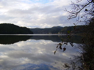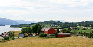
Namdalseid is a municipality in Trøndelag county, Norway. It is part of the Namdalen region. The administrative centre of the municipality is the village of Namdalseid. Other villages and farm areas in the municipality include Sjøåsen, Statland, Tøttdalen, and Sverkmoen.

Overhalla is a municipality in Trøndelag county, Norway. It is part of the Namdalen region. The administrative centre of the municipality is the village of Ranemsletta. Other villages include Melen, Skage, Skogmo, Svalia, and Øysletta.

Fosnes is a municipality in Trøndelag county, Norway. It is part of the Namdalen region. The administrative centre of the municipality is the village of Dun on the island of Jøa. Other villages include Salsnes and Nufsfjord.

Rørvik is a port village in the municipality of Vikna in Trøndelag county, Norway. The village also serves as the administrative centre of the municipality. It is on the eastern side of the Vikna archipelago on the island of Inner-Vikna. The 1.79-square-kilometre (440-acre) village has a population (2017) of 3,098 which gives the village a population density of 1,731 inhabitants per square kilometre (4,480/sq mi).

Namsen is one of the longest rivers in Trøndelag county, in the central part of Norway. The 228-kilometre (142 mi) long river flows through the municipalities of Røyrvik, Namsskogan, Grong, Overhalla, and Namsos before emptying into the Namsenfjorden. The river is the namesake for the whole Namdalen region. The river traditionally has been used for floating timber down from the forests to the town of Namsos, where the sawmills were located. Today, parts of the Namsen are regulated by several dams.

Bangsund is a village in the municipality of Namsos in Trøndelag county, Norway. It lies along the Løgnin arm of the Namsenfjorden, about 15 kilometres (9.3 mi) south of the town of Namsos. The villages of Klinga and Sævik lie to the northeast along the Norwegian County Road 17.

Ranemsletta is the administrative centre of the municipality of Overhalla in Trøndelag county, Norway. The village is located on the north shore of the river Namsen, along the Norwegian County Road 17 which connects it to the town of Namsos and Grong. The now-defunct Namsos Line railway used to run through the village as well. The villages of Svalia and Skogmo are neighboring villages to the north and northeast.

Skage or Hunn is a village in the municipality of Overhalla in Trøndelag county, Norway. It is located on the northern shore of the river Namsen, about 10 kilometres (6.2 mi) west of the municipal center, Ranemsletta, and about 15 kilometres (9.3 mi) east of the town of Namsos.

Klinga or Klingen is a village in Namsos municipality in Trøndelag county, Norway. The village is located about halfway between the villages of Bangsund and Spillum along the Norwegian County Road 17. The village of Sævik lies just north of Klinga and the town of Namsos lies about 8 kilometres (5.0 mi) to the north.

Ekne is a village in the municipality of Levanger in Trøndelag county, Norway. It is located 8 kilometres (5.0 mi) west of the village of Skogn and about 15 kilometres (9.3 mi) southwest of the town of Levanger. The lakes Sønningen and Byavatnet lie south of the village. Ekne Church is located in this village. The World War II-era Falstad concentration camp was also located here.

Sparbu is a village in the municipality of Steinkjer in Trøndelag county, Norway. The village is located about 12 kilometres (7.5 mi) south of the town of Steinkjer. The European route E6 highway runs through the village as does the Nordlandsbanen railway line which stops at the Sparbu Station. The village of Mære lies about 2 kilometres (1.2 mi) to the north, the village of Røra lies about 8 kilometres (5.0 mi) to the south, and the lake Leksdalsvatnet lies about 8 kilometres (5.0 mi) to the east.

Sævik or Sævig is a small village in the municipality of Namsos in Trøndelag county, Norway. The village was the site of the old Sævik Church until the mid-1800s. The village is located about half-way between the villages of Klinga and Spillum, along the Norwegian County Road 17. The town of Namsos lies about 5 kilometres (3.1 mi) to the north, on the other side of the river Namsen.

Vemundvik is a village in Namsos municipality in Trøndelag county, Norway. The village is located along the shore, about 10 kilometres (6.2 mi) north of the town of Namsos and about 3 kilometres (1.9 mi) east of the village of Ramsvika. Vemundvik Church is located in the village.

The Norwegian Sawmill Museum is a museum located in the village of Spillum in Trøndelag county, Norway. The town of Namsos lies just to the north, across the river Namsen. The museum opened in 1991 at the site of the former sawmill operated by Spillum Sawmill & Planing.

The Namsenfjorden or Namsfjorden is a fjord in Trøndelag county, Norway. The 35-kilometre (22 mi) long fjord flows along the border between the municipalities of Namsos, Namdalseid, and Flatanger. It runs southeast from the Folda firth, between the mainland in the south and the island of Otterøya in the north, past the island of Hoddøya, to the Namsen river estuary in the town of Namsos. The banks of the fjord are mostly wooded and not very high. Near the town of Namsos, the Løgnin fjord arm branches to the south all the way to the village of Sjøåsen in Namdalseid. Other villages along the fjord include Statland, Tøttdalen, Skomsvoll, Bangsund, and Spillum.

Namsos is a town and the administrative center of Namsos municipality in Trøndelag county, Norway. It is located on the north side of the mouth of the river Namsen, where it flows into Namsenfjorden. The village of Spillum lies across the river on the south side.

Namdalseid is the administrative centre of Namdalseid municipality in Trøndelag county, Norway. The village is located along the Norwegian County Road 17, about 30 kilometres (19 mi) north of the town of Steinkjer and about the same distance south of the town of Namsos. The Namdalseid Church sits just southwest of the village. There's a school in the village as well.

Vemundvik is a former municipality in the old Nord-Trøndelag county, Norway. The 247-square-kilometre (95 sq mi) municipality existed from 1838 until its dissolution in 1964. By 1964, the municipality roughly corresponded to the mainland areas north of the river Namsen in what is now the municipality of Namsos in Trøndelag county. From 1838 until about 1942, the administrative centre was the village of Vemundvik where Vemundvik Church is located. After 1941, the municipal offices and administration was headquartered in the town of Namsos.

Klinga is a former municipality in the old Nord-Trøndelag county, Norway. The 352-square-kilometre (136 sq mi) municipality existed from 1891 until its dissolution in 1964. The municipality encompassed the mainland areas south of the river Namsen in what is now the municipality of Namsos in Trøndelag county. The administrative centre was the village of Bangsund. Other villages in Klinga included Spillum and Klinga where Klinga Church is located.


