Montana is a landlocked state in the Northwestern United States. Montana has several nicknames, although none are official, including "Big Sky Country" and "The Treasure State", and slogans that include "Land of the Shining Mountains" and more recently "The Last Best Place".

The Inland Northwest or Inland Empire is a region of the Pacific Northwest centered on the Greater Spokane Area, that includes all of Eastern Washington and North Idaho. Western Montana is sometimes considered part of the Inland Northwest, but generally is not considered part of the Inland Empire. Under some definitions, the term Inland Empire also excludes Central Washington.
As of 2016 the U.S. Census Bureau estimated the region's population at 2,240,645, comparable to that of New Mexico. Its Canadian counterpart, north of the border, is the British Columbia Interior. Significant urban centers include the Spokane–Coeur d'Alene area and the Tri-Cities.

The Bitterroot Salish are a Salish-speaking group of Native Americans, and one of three tribes of the Confederated Salish and Kootenai Tribes of the Flathead Nation in Montana. The Flathead Reservation is home to the Kootenai and Pend d'Oreilles tribes also. Bitterroot Salish or Flathead originally lived in an area west of Billings, Montana extending to the continental divide in the west and south of Great Falls, Montana extending to the Montana-Wyoming border. From there they later moved west into the Bitterroot Valley. By request, a Catholic mission was built here in 1841. In 1891 they were forcibly moved to the Flathead Reservation.

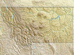
Western Montana is the western region of the U.S. state of Montana. The most restrictive definition limits western Montana only to the parts of the state west of the Continental Divide. Other common definitions add in the mountainous areas east of the divide including Beaverhead, Gallatin, Jefferson, Lewis and Clark, Madison, and Park Counties. The region is sometimes considered to be part of the Inland Northwest.
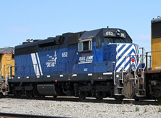
Montana Rail Link is a privately held Class II railroad in the United States. MRL, which operates on trackage originally built by the Northern Pacific Railway, is a unit of The Washington Companies, and is headquartered in Missoula, Montana.

KXLY-TV, virtual channel 4, is an ABC-affiliated television station licensed to Spokane, Washington, United States and also serving Coeur d'Alene, Idaho. The station is owned by the Spokane Television Group, a subsidiary of Morgan Murphy Media. KXLY-TV's studios are located on West Boone Avenue in Spokane, and its transmitter is located on Mount Spokane. KXLY's MeTV-affiliated second digital subchannel is also seen in the Yakima–Tri-Cities market on sister stations and fellow ABC affiliates KAPP and KVEW.

The Little Brown Stein is a rivalry trophy awarded to the winner of the college football game between the University of Idaho Vandals and University of Montana Grizzlies. The trophy is, as the name implies, a large stein mug with the results of all the games between the two painted on.
Tidyman's was a chain of grocery stores founded and based in Spokane, Washington. At its peak, Tidyman's was operating over 20 stores in Washington, Idaho and Montana under the Tidyman's, Dissmore's IGA, Northwest Fresh Marketplace, and County Market banners. The grocery chain was forced to sell its remaining stores in 2006 after a highly publicized 1996 sexual discrimination scandal cost the company $6.2 million.
Rosauers Supermarkets, Inc. is a regional chain of supermarkets in the western United States, based in Spokane, Washington. Founded in 1934 by J. Merton Rosauer, Rosauers was sold in 1984 to Spokane-based URM Stores, and it eventually grew to 22 stores under the Huckleberry's Natural Market, Rosauers, and Super 1 Foods brands. Its stores are located in, and Washington, Idaho, Montana, and Oregon.
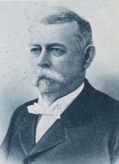
William Horace Clagett was a nineteenth-century politician and lawyer from various places in the United States. He was the uncle of Samuel B. Pettengill.
Interstate 90 (I-90) is a transcontinental Interstate Highway that runs east–west across the northern United States. Within the state of Idaho, the freeway travels for 74 miles (119 km) from the Washington border near Spokane to Coeur d'Alene and the panhandle region at the north end of the state. After traveling through the Silver Valley along the Coeur d'Alene River in the Bitterroot Range, I-90 crosses into Montana at Lookout Pass.

Canyon Ferry Dam is a concrete gravity dam in a narrow valley of the Missouri River, United States, where the Big Belt Mountains and the Spokane Hills merge, approximately 68 miles (109 km) downstream from the confluence of the Gallatin, Madison, and Jefferson rivers, and about 20 miles (32 km) east of the city of Helena, Montana. The dam is for flood control, irrigation, recreation and hydroelectric power. The building of the dam created a reservoir known as Canyon Ferry Lake.
The following outline is provided as an overview of and topical guide to the U.S. state of Montana:

Lake Great Falls was a prehistoric proglacial lake which existed in what is now central Montana in the United States between 15,000 BCE and 11,000 BCE. Centered on the modern city of Great Falls, Montana, Glacial Lake Great Falls extended as far north as Cut Bank, Montana, and as far south as Holter Lake. At present-day Great Falls, the Glacial Lake Great Falls reached a depth of 600 feet.

The following works deal with the cultural, political, economic, military, biographical and geologic history of pre-territorial Montana, Montana Territory and the State of Montana.

Spokane Creek is a census-designated place (CDP) in Broadwater County, Montana, United States. The population was 355 at the 2010 census.
Montana Highway 28 (MT 28) is an approximately 46.7-mile-long (75.2 km) state highway in the west of the US state of Montana. It begins at MT 200 in Plains and ends at U.S. Highway 93 (US 93) in Elmo; all but the first 7.5 miles (12.1 km) are within the Flathead Indian Reservation. It serves as a key link in two alternate routes between Spokane, Washington, and Kalispell.