Muhlenberg County is a county in the U.S. Commonwealth of Kentucky. As of the 2020 census, the population was 30,928. Its county seat is Greenville and its largest city is Central City.

McLean County is a county located in the U.S. state of Kentucky. As of the 2020 census, the population was 9,152. Its county seat is Calhoun and its largest city is Livermore. McLean is a prohibition or dry county. McLean County is part of the Owensboro, KY Metropolitan Statistical Area, which has a population of some 114,752.

McCreary County is a county located in the U.S. state of Kentucky. As of the 2020 census, the population was 16,888. Its county seat is Whitley City. The county is named for James B. McCreary, a Confederate war soldier and two-time Governor of Kentucky. During his second term as governor, McCreary County was created by the Legislature and was named in his honor.

Hopkins County is a county located in the western part of the U.S. state of Kentucky. As of the 2020 census, the population was 45,423. Its county seat is Madisonville. Hopkins County was created December 9, 1806, from Henderson County. It was named for General Samuel Hopkins, an officer in both the American Revolutionary War and War of 1812, and later a Kentucky legislator and U.S. Congressman.

Henderson County is a county in the U.S. state of Kentucky. The county is located in western Kentucky on the Ohio River across from Evansville, Indiana. As of the 2020 census, the population was 44,793. Its county seat is Henderson.

Butler County is a county located in the US state of Kentucky. As of the 2020 Census, the population was 12,371. Its county seat is Morgantown. The county was formed in 1810, becoming Kentucky's 53rd county. Butler County is included in the Bowling Green, Kentucky, Metropolitan Statistical Area.

Henderson is a home rule-class city along the Ohio River and the county seat of Henderson County, Kentucky, United States. The population was 29,781 at the 2020 U.S. census. It is part of the Evansville–Henderson, IN–KY Metropolitan Area, locally known as the "Tri-State Area," and is considered the southernmost suburb of Evansville, Indiana.

Stearns is an unincorporated community and census-designated place (CDP) in McCreary County, Kentucky, United States. The population was 1,365 at the 2020 census. It was founded by Justus Smith Stearns.

Alum Creek is a census-designated place (CDP) in Kanawha and Lincoln counties along the Coal River in the U.S. state of West Virginia. It includes the unincorporated communities of Alum Creek, Forks of Coal, and Priestley. The CDP had a population of 1,749 at the 2010 census, down from 1,839 at the 2000 census.

North Corbin is a census-designated place (CDP) in Laurel and Knox counties in the U.S. state of Kentucky. The population was 1,727 at the 2020 census down from 1,773 at the 2010 census. The census bureau also lists the Laurel County portion of North Corbin as a CCD with a population of 10,729.

The Green River is a 384-mile-long (618 km) tributary of the Ohio River that rises in Lincoln County in south central Kentucky. Tributaries of the Green River include the Barren River, the Nolin River, the Pond River and the Rough River. The river was named after Nathanael Greene, a general of the American Revolutionary War.

Tornado, also called Upper Falls, is a census-designated place (CDP) in Kanawha County, West Virginia, United States.

High Bridge is an unincorporated community and census-designated place in Jessamine County, Kentucky, United States. As of the 2010 census it had a population of 242. It lies along the lower reaches of the Kentucky River across from the confluence of the Dix River with the Kentucky. The community is part of the Lexington–Fayette Metropolitan Statistical Area.

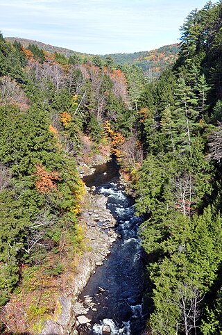
Quechee is a census-designated place and one of five unincorporated villages in the town of Hartford, Windsor County, Vermont, United States. As of the 2010 census, the population of the CDP was 656. It is the site of Quechee Gorge on the Ottauquechee River and is also the home to the Quechee Lakes planned community, initiated in the late 1960s, which also brought to the community the small Quechee Lakes Ski Area in the 1970s.

Hebron is an unincorporated community and census-designated place (CDP) in Boone County, Kentucky, United States. It is named after the biblical city of Hebron. As of the 2020 census, it had a population of 6,195. The wider Hebron area is home to the Cincinnati/Northern Kentucky International Airport, which serves Cincinnati and the Tri-State (Ohio-Kentucky-Indiana) area.

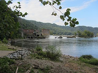
Glen Ferris is a census-designated place (CDP) on the western bank of the Kanawha River in Fayette County, West Virginia, United States. It is situated approximately one mile south of the town of Gauley Bridge and adjacent to Kanawha Falls. The sole highway linking Glen Ferris to the area is U.S. Route 60, known also as the Midland Trail. As of the 2010 census, its population was 203; the community had 104 housing units, 87 of which were occupied. The village is roughly a mile and a half in length. Glen Ferris is home to two churches, one Apostolic and one Methodist. A railway owned by Norfolk Southern runs parallel to US Route 60 through the village.
Maceo is an unincorporated community and census-designated place (CDP) in Daviess County, Kentucky, United States. As of the 2020 census, the population was 404, down from the 2010 census population of 413.
Cawood is a census-designated place (CDP) and coal town in Harlan County, Kentucky, United States. The population was 731 at the 2010 census.
Coxton is an unincorporated coal town and census-designated place (CDP) in Harlan County, Kentucky, United States. Their post office is closed. The community was listed as a CDP in 2014, so no population figures are available from the 2010 census.
Reedyville is an Unincorporated community in Butler County, Kentucky, United States. The town is supposedly named for the nearby Big Reedy Creek, a tributary of the Green River.


