
Stormwater, also written storm water, is water that originates from precipitation (storm), including heavy rain and meltwater from hail and snow. Stormwater can soak into the soil (infiltrate) and become groundwater, be stored on depressed land surface in ponds and puddles, evaporate back into the atmosphere, or contribute to surface runoff. Most runoff is conveyed directly as surface water to nearby streams, rivers or other large water bodies without treatment.

Groundwater is the water present beneath Earth's surface in rock and soil pore spaces and in the fractures of rock formations. About 30 percent of all readily available freshwater in the world is groundwater. A unit of rock or an unconsolidated deposit is called an aquifer when it can yield a usable quantity of water. The depth at which soil pore spaces or fractures and voids in rock become completely saturated with water is called the water table. Groundwater is recharged from the surface; it may discharge from the surface naturally at springs and seeps, and can form oases or wetlands. Groundwater is also often withdrawn for agricultural, municipal, and industrial use by constructing and operating extraction wells. The study of the distribution and movement of groundwater is hydrogeology, also called groundwater hydrology.

The San Gabriel River is a mostly urban waterway flowing 58 miles (93 km) southward through Los Angeles and Orange Counties, California in the United States. It is the central of three major rivers draining the Greater Los Angeles Area, the others being the Los Angeles River and Santa Ana River. The river's watershed stretches from the rugged San Gabriel Mountains to the heavily developed San Gabriel Valley and a significant part of the Los Angeles coastal plain, emptying into the Pacific Ocean between the cities of Long Beach and Seal Beach.

The Los Angeles County Department of Public Works (LACDPW) is responsible for the construction and operation of Los Angeles County's roads, building safety, sewerage, and flood control. DPW also operates traffic signals and intelligent transportation systems, drinking water systems in certain communities, operates five airports, paratransit and fixed route public transport, administers various environment programs, issues various permits for activities in the public roadway, and has a Department Emergency Operations Center that works in conjunction with the County Emergency Operations Center operated by the Sheriff's Department. The department is headquartered at 900 South Fremont Avenue in Alhambra, California.

Rain gardens, also called bioretention facilities, are one of a variety of practices designed to increase rain runoff reabsorption by the soil. They can also be used to treat polluted stormwater runoff. Rain gardens are designed landscape sites that reduce the flow rate, total quantity, and pollutant load of runoff from impervious urban areas like roofs, driveways, walkways, parking lots, and compacted lawn areas. Rain gardens rely on plants and natural or engineered soil medium to retain stormwater and increase the lag time of infiltration, while remediating and filtering pollutants carried by urban runoff. Rain gardens provide a method to reuse and optimize any rain that falls, reducing or avoiding the need for additional irrigation. A benefit of planting rain gardens is the consequential decrease in ambient air and water temperature, a mitigation that is especially effective in urban areas containing an abundance of impervious surfaces that absorb heat in a phenomenon known as the heat-island effect.

Sustainable drainage systems are a collection of water management practices that aim to align modern drainage systems with natural water processes and are part of a larger green infrastructure strategy. SuDS efforts make urban drainage systems more compatible with components of the natural water cycle such as storm surge overflows, soil percolation, and bio-filtration. These efforts hope to mitigate the effect human development has had or may have on the natural water cycle, particularly surface runoff and water pollution trends.

Groundwater recharge or deep drainage or deep percolation is a hydrologic process, where water moves downward from surface water to groundwater. Recharge is the primary method through which water enters an aquifer. This process usually occurs in the vadose zone below plant roots and is often expressed as a flux to the water table surface. Groundwater recharge also encompasses water moving away from the water table farther into the saturated zone. Recharge occurs both naturally and through anthropogenic processes, where rainwater and or reclaimed water is routed to the subsurface.
Overdrafting is the process of extracting groundwater beyond the equilibrium yield of an aquifer. Groundwater is one of the largest sources of fresh water and is found underground. The primary cause of groundwater depletion is the excessive pumping of groundwater up from underground aquifers.
Subsurface flow, in hydrology, is the flow of water beneath earth's surface as part of the water cycle.

An infiltration basin is a form of engineered sump or percolation pond that is used to manage stormwater runoff, prevent flooding and downstream erosion, and improve water quality in an adjacent river, stream, lake or bay. It is essentially a shallow artificial pond that is designed to infiltrate stormwater through permeable soils into the groundwater aquifer. Infiltration basins do not release water except by infiltration, evaporation or emergency overflow during flood conditions.
The New Jersey stormwater management rules were organized in 1983 and updated in 2004. The rules restrict building within 300-foot of "high quality water"; and stormwater and parking lot runoff at new developments must be diverted to a retention basin or a detention basin that are used for groundwater recharge to replenish the aquifer. The detention basins have the added effect of filtering urban runoff from parking lots of motor oil and other chemicals that would end up in storm sewers and eventually rivers and streams.

The Santa Clara valley aquifer is a groundwater aquifer located in the southern San Francisco Bay Area. The geology of the Santa Clara valley aquifer consists of a complex stratigraphy of permeable and impermeable units. Management of aquifer resources is associated with the Santa Clara Valley Water District.
The Coachella Valley Water District is an independent special district formed in 1918, specifically to protect and conserve local water sources in the Coachella Valley. Since then, the district has grown into a multi-faceted agency that delivers irrigation and domestic (drinking) water, collects and recycles wastewater, provides regional storm water protection, replenishes the groundwater basin and promotes water conservation.
The Orange County Water District is a special district that manages the groundwater basin beneath central and northern Orange County, California. The groundwater basin provides a water supply to 19 municipal water agencies and special districts that serve more than 2.4 million Orange County residents. The Orange County Water District's service area covers approximately 350 square miles (910 km2) and the District owns approximately 1,600 acres (650 ha) in and near the Santa Ana River, which it uses to capture water flows for groundwater recharge. Additionally, the Orange County Water District owns approximately 2,150 acres (870 ha) of land above the Prado Dam in the Prado Reservoir and uses that land for water conservation, water storage and water quality improvements. The water district's administrative offices and the Groundwater Replenishment System facilities are located in Fountain Valley, while it also operates various groundwater recharge facilities located in Anaheim and Orange.
Groundwater banking is a water management mechanism designed to increase water supply reliability. Groundwater can be created by using dewatered aquifer space to store water during the years when there is abundant rainfall. It can then be pumped and used during years that do not have a surplus of water. People can manage the use of groundwater to benefit society through the purchasing and selling of these groundwater rights. The surface water should be used first, and then the groundwater will be used when there is not enough surface water to meet demands. The groundwater will reduce the risk of relying on surface water and will maximize expected income. There are regulatory storage-type aquifer recovery and storage systems which when water is injected into it gives the right to withdraw the water later on. Groundwater banking has been implemented into semi-arid and arid southwestern United States because this is where there is the most need for extra water. The overall goal is to transfer water from low-value to high-value uses by bringing buyers and sellers together.
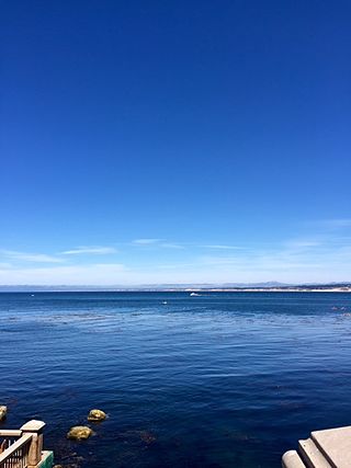
The Monterey Peninsula Water Project (MWPW) is a water management project seeking to meet water demands of Monterey residents. The major water source for Monterey is powered by the Carmel River, which is precipitation influenced and does not receive water perennially. In addition to the Carmel River, the Seaside Groundwater Basin is the only other form of water supply. Both watersheds have been protected under stiff regulation to significantly reduce water diversion, especially the Carmel River which has been severely affected by California's drought. The MPWP is the proposed answer to help meet current and future water demands, while dealing with these reductions from the Carmel River and Seaside Groundwater Basin. The main features of this project will include a desalination plant, slant wells that will draw water from underneath the sea floor along the coastline, and a 10-mile pipeline extending through the north part of Monterey to supply water to its residents. The goal throughout the planning of this new infrastructure is to protect ocean wildlife, while excess brine will be handled by the area's water pollution control agency. The total cost of this project is estimated to be 322 million dollars with 79 million coming from subsurface intake, 115 million from the desalination plant, and 128 million from the pipelines. The MPWP is divided into three main aspects which include desalination, aquifer storage and recovery, and groundwater replenishment.

Water reuse in California is the use of reclaimed water for beneficial use. As a heavily populated state in the drought-prone arid west, water reuse is developing as an integral part of water in California enabling both the economy and population to grow.

The Groundwater Ambient Monitoring and Assessment Program (GAMA) is an all-inclusive monitoring program for groundwater that was implemented in 2000 in California, United States. It was created by the California State Water Resources Control Board as an improvement from groundwater programs that were already in place.
Borrego Valley Groundwater Basin, located in the very southern region of California, is one of the driest basins in the state. With climate change predicted to have strong effects into foreseeable future, the region is viewed with a skepticism in the sustainable use of water at current rates of consumption. Both natural and man-made geographic divisions within this basin allow for a closer inspection of the various management techniques implemented throughout the years, and provide a basis for what may be pursued for an uncertain future.
The State of California enforces several methodologies through technical innovation and scientific approach to combat saltwater intrusion in areas vulnerable to saltwater intrusion. Seawater intrusion is either caused by groundwater extraction or increased in sea level. For every 1-foot of freshwater depression (0.30 m), sea-salty waters rises 40 feet (12 m) as the cone of depression forms. Salinization of groundwater is one of the main water pollution ever produced by mankind or from natural processes. It degrades water quality to the point it passes acceptable drink water and irrigation standards.
