Spring Creek (Sangamon County, Illinois)

Last updated
Spring Creek
Physical characteristics
Main source Morgan County east of Jacksonville, Illinois
39°41′20″N90°00′09″W / 39.6889374°N 90.0026103°W / 39.6889374; -90.0026103 (Spring Creek origin)
River mouth Confluence with the Sangamon north of Springfield, Illinois
518 ft (158 m)
39°51′35″N89°38′30″W / 39.8597722°N 89.6417678°W / 39.8597722; -89.6417678 (Spring Creek mouth) Coordinates: 39°51′35″N89°38′30″W / 39.8597722°N 89.6417678°W / 39.8597722; -89.6417678 (Spring Creek mouth)
Basin features
Progression Spring Creek → Sangamon → Illinois → Mississippi → Gulf of Mexico
GNIS ID 418940
Map all coordinates using: OpenStreetMap  ·  Google Maps
Download coordinates as: KML  ·  GPX

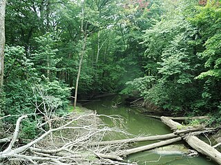
Spring Creek is a tributary of the Sangamon River in the U.S. state of Illinois. [1] After rising in Morgan County, it flows into Sangamon County and discharges into the Sangamon River. In the lower part of its course, it flows through the city of Springfield, bordering Springfield's Oak Ridge Cemetery and the tomb of Abraham Lincoln. [2]

Sangamon River watercourse in the United States of America

The Sangamon River is a principal tributary of the Illinois River, approximately 246 miles (396 km) long, in central Illinois in the United States. It drains a mostly rural agricultural area between Peoria and Springfield. The river is associated with the early career of Abraham Lincoln and played an important role in the early white settlement of Illinois, when the area around was known as the "Sangamon River Country". The section of the Sangamon River that flows through Robert Allerton Park near Monticello was named a National Natural Landmark in 1971.

Illinois State of the United States of America

Illinois is a state in the Midwestern region of the United States. It has the 5th largest Gross Domestic Product by state, is the 6th-most populous U.S. state and 25th-largest state in terms of land area. Illinois is often noted as a microcosm of the entire United States. With Chicago in the northeast, small industrial cities and great agricultural productivity in northern and central Illinois, and natural resources such as coal, timber, and petroleum in the south, Illinois has a diverse economic base, and is a major transportation hub. Chicagoland, Chicago's metropolitan area, contains over 65% of the state's population. The Port of Chicago connects the state to other global ports around the world from the Great Lakes, via the Saint Lawrence Seaway, to the Atlantic Ocean; as well as the Great Lakes to the Mississippi River, via the Illinois Waterway on the Illinois River. The Mississippi River, the Ohio River, and the Wabash River form parts of the boundaries of Illinois. For decades, Chicago's O'Hare International Airport has been ranked as one of the world's busiest airports. Illinois has long had a reputation as a bellwether both in social and cultural terms and, through the 1980s, in politics.

Morgan County, Illinois county in Illinois, USA

Morgan County is a county located in the U.S. state of Illinois. According to the 2010 census, it had a population of 35,547. Its county seat is Jacksonville.

The tributary can be fished from its banks, and is known for bullhead, carp, channel catfish, and sucker. The maximum depth of the creek is 2 feet (0.6 m) at mean waterflow. [3]

<i>Ameiurus</i> genus of fishes

Ameiurus is a genus of catfishes in the family Ictaluridae. It contains the three common types of bullhead catfish found in waters of the United States, the black bullhead, the brown bullhead, and the yellow bullhead, as well as other species, such as the white catfish, which are not typically called "bullheads".

Carp species of fish

Carp are various species of oily freshwater fish from the family Cyprinidae, a very large group of fish native to Europe and Asia.

Channel catfish species of fish

The channel catfish is North America's most numerous catfish species. It is the official fish of Kansas, Missouri, Iowa, Nebraska, and Tennessee, and is informally referred to as a "channel cat". In the United States, they are the most fished catfish species with around 8 million anglers targeting them per year. The popularity of channel catfish for food has contributed to the rapid expansion of aquaculture of this species in the United States.

According to the U.S. Geographic Names Information System (GNIS), there are 10 streams having the name Spring Creek in the state of Illinois.

Geographic Names Information System geographical database

The Geographic Names Information System (GNIS) is a database that contains name and locative information about more than two million physical and cultural features located throughout the United States of America and its territories. It is a type of gazetteer. GNIS was developed by the United States Geological Survey in cooperation with the United States Board on Geographic Names (BGN) to promote the standardization of feature names.

Related Research Articles

Illinois River Illinois tributary of the Mississippi River in the United States

The Illinois River is a principal tributary of the Mississippi River, approximately 273 miles (439 km) long, in the U.S. state of Illinois. The river drains a large section of central Illinois, with a drainage basin of 28,756.6 square miles (74,479 km2). The drainage basin extends into Wisconsin, Indiana, and a very small area of southwestern Michigan. This river was important among Native Americans and early French traders as the principal water route connecting the Great Lakes with the Mississippi. The French colonial settlements along the rivers formed the heart of the area known as the Illinois Country. After the construction of the Illinois and Michigan Canal and the Hennepin Canal in the 19th century, the role of the river as link between Lake Michigan and the Mississippi was extended into the era of modern industrial shipping. It now forms the basis for the Illinois Waterway.

Sangamon County, Illinois county located in the U.S. state of Illinois

Sangamon County is a county located in the center of the U.S. state of Illinois. According to the 2010 census, it had a population of 197,465. Its county seat is Springfield, the state capital.

A spring creek is a stream that flows from a spring.

Mohawk River (Oregon) river in Oregon, United States of America

The Mohawk River is the largest tributary of the McKenzie River, approximately 30 miles (48 km) long, in west central Oregon in the United States. It drains part of the foothills of the Cascade Range on the southeast end of the Willamette Valley northeast of Springfield.

Tinker's Creek, in Cuyahoga, Summit and Portage counties, is the largest tributary of the Cuyahoga River, providing about a third of its flow into Lake Erie.

La Moine River river in the United States of America

La Moine River is a 125-mile-long (201 km) tributary of the Illinois River in western Illinois in the United States. Its watershed covers approximately 2,000 square miles (5,000 km2), and it is the sixth-largest tributary to the Illinois River. It is part of the watershed of the Mississippi River.

Green Spring Run is an 8.9-mile-long (14.3 km) tributary stream of the North Branch Potomac River in Hampshire County in the U.S. state of West Virginia. Green Spring Run rises in Greenwood Hollow north of Springfield and meanders northeast through Green Spring Valley. The South Branch Valley Railroad and Green Spring Road run parallel to the stream. It runs through the community of Green Spring, from which the stream takes its name. From Green Spring, Green Spring Run flows east where it reaches its confluence with the North Branch Potomac shortly before the North Branch joins with the South Branch Potomac River to form the Potomac River.

Illinois Route 125 (IL-125) is a major 37.10 miles (59.71 km) highway in the central portion of the U.S. state of Illinois. Illinois 125 runs east from the concurrent U.S. Route 67 and Illinois Route 100 near Beardstown to Illinois Route 97 in Farmingdale, west of Springfield.

Salt Creek is a major tributary to the Sangamon River, which it joins at the boundary between Mason and Menard County, Illinois. There are at least two other Salt Creeks in Illinois, Salt Creek, and in Effingham County, Illinois.

Salt Creek is a tributary of the Little Wabash River, which it joins near Edgewood, Illinois, near the boundary between Effingham and Clay counties. There are at least two other "Salt Creeks" in Illinois: Salt Creek and Salt Creek.

Willow Branch Township, Piatt County, Illinois Township in Illinois, United States

Willow Branch Township is a township in Piatt County, Illinois, USA. As of the 2010 census, its population was 839 and it contained 355 housing units.

Galien River river in the United States of America

The Galien River is a 30.0-mile-long (48.3 km) stream in the southwest region of the U.S. state of Michigan. The river begins at the outlet of Dayton Lake and flows in a predominantly westerly direction until it enters southeastern Lake Michigan at New Buffalo. The South Branch Galien River rises just north of the border with Indiana, at the confluence of Spring Creek and the Galena River, the latter rising in LaPorte County, Indiana.

Sugar Creek (Sangamon River tributary) tributary of the Sangamon River in Illinois

Sugar Creek, a tributary of the Sangamon River, is a large creek in central Illinois, United States. It rises in Talkington Township in southwestern Sangamon County, flows briefly through northeastern Macoupin County, and then runs northeastward through south-central Sangamon County before discharging into Lake Springfield. The creek drains Auburn and Virden, Illinois and has a total length of 52.8 miles (85.0 km).

Lick Creek is a 30.6-mile-long (49.2 km) tributary of Lake Springfield and thus a tributary of the Sangamon River in central Illinois. It drains a large portion of southwestern Sangamon County and a marginal adjacent fragment of southeastern Morgan County. The drainage of Lick Creek includes all of Loami, Illinois and part of Chatham, Illinois.

Jemez River river in the United States of America

The Jemez River is a tributary of the Rio Grande in the U.S. state of New Mexico. The river is formed by the confluence of the East Fork Jemez River and San Antonio Creek, which drain a number of tributaries in the area of the Jemez Mountains and Santa Fe National Forest. The Jemez River is about 50 miles (80 km) long, or about 80 miles (130 km) long if its longest headwater tributary, San Antonio Creek, is included. The East Fork Jemez River is about 22 miles (35 km) long. Both San Antonio Creek and the East Fork Jemez River flow through intricate meanders along their courses. The East Fork Jemez is a National Wild and Scenic River.

Riddle Hill, Illinois Unincorporated community in Illinois, United States

Riddle Hill is a rural unincorporated community located in Curran and Woodside townships, Sangamon County, Illinois. It is a crossroads located adjacent to where Old Jacksonville Road crosses Little Spring Creek, 6.5 miles west of Springfield.

Buffalo Hart, Illinois Unincorporated community in Illinois, United States

Buffalo Hart is an unincorporated community in northern Sangamon County in the U.S. state of Illinois. It is the population center of its own township, Buffalo Hart Township.

Stevens Creek (Illinois)

Stevens Creek is a stream in Macon County, Illinois, United States. A tributary of the Sangamon River, it originates in the northern part of the county, flowing southward through portions of the cities of Forsyth and Decatur before emptying into the Sangamon near the western boundaries of Decatur. Its principal tributary is Spring Creek, which joins it a few miles before Stevens joins the Sangamon. Its drainage area covers 87 square miles of Macon County.

Spring Creek (Macon County, Illinois) river in the United States of America

Spring Creek is a stream in Macon County, Illinois. A tributary of Stevens Creek, itself a tributary of the Sangamon River, Spring Creek originates just northeast of the town of Forsyth before emptying into Stevens Creek west of Horace B. Garman Park in Decatur, Illinois.

References

  1. U.S. Geological Survey Geographic Names Information System: Spring Creek
  2. Illinois Atlas and Gazetteer. Freeport, Maine: DeLorme Mapping. 1991. ISBN   0-89933-213-7.