Spring River (North Umpqua River tributary)

Last updated
Spring River
Country United States
State Oregon
County Douglas
Source Cascade Range
 - locationa spring complex on Pumice Flat, Umpqua National Forest
 - elevation4,255 ft (1,297 m) [1]
 - coordinates 43°17′58″N122°08′07″W / 43.29944°N 122.13528°W / 43.29944; -122.13528   [2]
Mouth North Umpqua River
 - locationupstream of Lemolo Lake
 - elevation4,157 ft (1,267 m) [2]
 - coordinates 43°18′28″N122°08′07″W / 43.30778°N 122.13528°W / 43.30778; -122.13528 Coordinates: 43°18′28″N122°08′07″W / 43.30778°N 122.13528°W / 43.30778; -122.13528   [2]
Length1.1 mi (2 km) [3]
Basin25.5 sq mi (66 km2) [3] [4]
USA Oregon location map.svg
Red pog.svg
Location of the mouth of the Spring River in Oregon

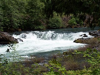
The Spring River is a short but significant tributary of the North Umpqua River in Douglas County in the U.S. state of Oregon. It begins at a spring complex in the Cascade Range on Pumice Flat in the Umpqua National Forest and flows 1.1 miles (1.8 km) north into the North Umpqua in Kelsay Valley, upstream of Lemolo Lake. [3] [5] Evidence suggests that nearby Thirsty Creek has an underground connection to the Spring River and that underground connections from other sources exist. [3]

North Umpqua River tributary of the Umpqua River in the USA

The North Umpqua River is a tributary of the Umpqua River, about 106 miles (171 km) long, in southwestern Oregon in the United States. It drains a scenic and rugged area of the Cascade Range southeast of Eugene, flowing through steep canyons and surrounded by large Douglas-fir forests. Renowned for its emerald green waters, it is considered one of the best fly fishing streams in the Pacific Northwest for anadromous fish.

Douglas County, Oregon county in Oregon, USA

Douglas County is a county in the U.S. state of Oregon. As of the 2010 census, the population was 107,667. The county seat is Roseburg. It is named after Stephen A. Douglas, an American politician who supported Oregon statehood.

U.S. state constituent political entity sharing sovereignty as the United States of America

In the United States, a state is a constituent political entity, of which there are currently 50. Bound together in a political union, each state holds governmental jurisdiction over a separate and defined geographic territory and shares its sovereignty with the federal government. Due to this shared sovereignty, Americans are citizens both of the federal republic and of the state in which they reside. State citizenship and residency are flexible, and no government approval is required to move between states, except for persons restricted by certain types of court orders. Four states use the term commonwealth rather than state in their full official names.

Contents

Hydrology

The underground water feeding the springs emerges along the contact between glacial deposits and ash-flow deposits that form the bedrock. Although Spring River and other nearby spring-fed streams are short, their total water contribution to the North Umpqua is significant, especially during dry months. [3]

A geological contact is a boundary which separates one rock body from another. There are three different types of contacts, which are divided into primary contacts and secondary contacts. Primary contacts include depositional, unconformable, and intrusive contacts. Secondary contacts include those induced by tectonic activity such as fault contacts and shear zones.

Pyroclastic flow Fast-moving current of hot gas and volcanic matter that moves away from a volcano

A pyroclastic flow is a fast-moving current of hot gas and volcanic matter that moves away from a volcano about 100 km/h (62 mph) on average but is capable of reaching speeds up to 700 km/h (430 mph). The gases can reach temperatures of about 1,000 °C (1,830 °F).

Thirsty Creek is a perennial stream that flows on the surface upstream of Spring River but sinks underground about 0.5 miles (0.8 km) before reaching it. Even so, it appears likely to researchers that it is part of the same watershed and contributes to the Spring River flow. Evidence also suggests that below-surface connections from elsewhere feed into Spring River. The low-flow discharge at the mouth of the river was measured at 210 cubic feet per second (5.9 m3/s) on August 10, 1997, more than Thirsty Creek alone could account for and more than half of the North Umpqua flow above Lemolo Lake. [3]

Fish

Spring River is a spawning ground for kokanee from Lemolo Lake and brown trout from the lake and the river. The river has good spawning gravels, a stable flow, and desirable temperatures for fish. The water from the springs emerges at 41 °F (5 °C) and warms to between 10 and 11 °C (50 and 52 °F) between source and mouth. [3]

Spawn (biology) process of aquatic animals releasing sperm and eggs into water

Spawn is the eggs and sperm released or deposited into water by aquatic animals. As a verb, to spawn refers to the process of releasing the eggs and sperm, and the act of both sexes is called spawning. Most aquatic animals, except for aquatic mammals and reptiles, reproduce through the process of spawning.

Brown trout species of brown trout

The brown trout is a European species of salmonid fish that has been widely introduced into suitable environments globally. It includes both purely freshwater populations, referred to as the riverine ecotype, Salmo trutta morpha fario, and a lacustrine ecotype, S. trutta morpha lacustris, also called the lake trout, as well as anadromous forms known as the sea trout, S. trutta morpha trutta. The latter migrates to the oceans for much of its life and returns to fresh water only to spawn. Sea trout in the Ireland and Britain have many regional names: sewin in Wales, finnock in Scotland, peal in the West Country, mort in North West England, and white trout in Ireland.

See also

Related Research Articles

Umpqua River river in the United States of America

The Umpqua River on the Pacific coast of Oregon in the United States is approximately 111 miles (179 km) long. One of the principal rivers of the Oregon Coast and known for bass and shad, the river drains an expansive network of valleys in the mountains west of the Cascade Range and south of the Willamette Valley, from which it is separated by the Calapooya Mountains. From its source northeast of Roseburg, the Umpqua flows northwest through the Oregon Coast Range and empties into the Pacific at Winchester Bay. The river and its tributaries flow entirely within Douglas County, which encompasses most of the watershed of the river from the Cascades to the coast. The "Hundred Valleys of the Umpqua" form the heart of the timber industry of southern Oregon, generally centered on Roseburg.

Siuslaw River river in the United States of America

The Siuslaw River is a river, about 110 miles (180 km) long, that flows to the Pacific Ocean coast of Oregon in the United States. It drains an area of about 773 square miles (2,000 km2) in the Central Oregon Coast Range southwest of the Willamette Valley and north of the watershed of the Umpqua River.

Smith River (Umpqua River tributary) tributary of the Umpqua River in the U.S. state of Oregon

The Smith River is a 90-mile (140 km) tributary of the Umpqua River in the U.S. state of Oregon. It drains 352 square miles (910 km2) of the Central Oregon Coast Range between the watershed of the Umpqua to the south and the Siuslaw River to the north.

Luckiamute River watercourse in the United States of America

The Luckiamute River is a tributary of the Willamette River, about 61 miles (98 km) long, in western Oregon in the United States. It drains an area of Central Oregon Coast Range and the western Willamette Valley northwest of Corvallis.

North Santiam River river in the United States of America

The North Santiam River is a 92-mile (148 km) tributary of the Santiam River in western Oregon in the United States. It drains 766 square miles (1,980 km2) of the Cascade Range on the eastern side of the Willamette Valley east of Salem.

Skipanon River river in the United States of America

The Skipanon River is a tributary of the Columbia River, approximately 7 miles (11 km) long, on the Pacific coast of northwest Oregon in the United States. It is the last tributary of the Columbia on the Oregon side, draining an area of coastal bottom land bordered by sand dunes and entering the river from the south at its mouth west of Astoria.

Little River (North Umpqua River tributary) tributary of the North Umpqua River in Oregon, United States of America

The Little River is a tributary of the North Umpqua River, about 30 miles (48 km) long, in southwestern Oregon in the United States. It drains part of the western side of the Cascade Range east of Roseburg, between the North and South Umpqua.

Warm Springs River river in Oregon

The Warm Springs River is a tributary of the Deschutes River in north-central Oregon in the United States. It flows generally southeast along the east side of the Cascade Range. The watershed is approximately between Mount Jefferson and Timothy Lake, and the northwestern and southwestern boundaries of the Warm Springs Indian Reservation coincide with the watershed. The headwaters are less than 14 mile (0.40 km) from the Wasco County–Clackamas County boundary. The river flows generally eastward, with occasional diagonals southeast or northeast. It joins the Deschutes River at river mile 83.7.
Abiqua Creek river in Oregon, United States of America

Abiqua Creek is a tributary of the Pudding River in the U.S. state of Oregon. The creek originates near Lookout Mountain in the foothills of the Cascade Range in the northwestern part of the state. It flows northwest for about 29 miles (47 km) to its confluence with the Pudding, about 2 miles (3.2 km) west of Silverton, in the Willamette Valley. About 20 miles (32 km) north of Silverton, the Pudding River meets the Molalla River, which meets the Willamette River less than 1 mile (1.6 km) later near Canby.

Umatilla River tributary of the Columbia River in Oregon

The Umatilla River is an 89-mile (143 km) tributary of the Columbia River in the U.S. state of Oregon. Draining a basin of 2,450 square miles (6,300 km2), it enters the Columbia near the city of Umatilla in the northeastern part of the state. In downstream order, beginning at the headwaters, major tributaries of the Umatilla River are the North Fork Umatilla River and the South Fork Umatilla River, then Meacham, McKay, Birch, and Butter creeks.

Chewaucan River river in the United States of America

The Chewaucan River is part of the Great Basin drainage. It flows 53 miles (85 km) through the Fremont–Winema National Forests, Bureau of Land Management land, and private property in southern Oregon. Its watershed consists of 651 square miles (1,690 km2) of conifer forest, marsh, and rural pasture land. The river provides habitat for many species of wildlife including native Great Basin redband trout a subspecies of rainbow trout.
Little Sandy River (Oregon)

The Little Sandy River is a tributary, roughly 15 miles (24 km) long, of the Bull Run River in the U.S. state of Oregon. Forming west of Mount Hood in the Mount Hood National Forest, it flows generally west, roughly parallel to the Sandy River to the south. Its entire course lies in Clackamas County, and most of its main stem and tributaries are within the Bull Run Watershed Management Unit (BRWMU), a restricted zone that protects Portland's main water supply.

Big Butte Creek river in Oregon, United States of America

Big Butte Creek is a 12-mile-long (19 km) tributary of the Rogue River in the U.S. state of Oregon. It drains approximately 245 square miles (635 km2) of Jackson County. Its two forks, the North Fork and the South Fork, both begin high in the Cascade Range near Mount McLoughlin. Flowing predominantly west, they meet near the city of Butte Falls. The main stem flows generally northwest until it empties into the Rogue Falls was incorporated in 1911, and remains the only incorporated town within the watershed's boundaries.

Rock Creek (Catlow Valley) stream in the Catlow Valley, Oregon, United States

Rock Creek is a 56-mile (90 km) intermittent stream flowing in Lake and Harney counties in the U.S. state of Oregon. The source of Rock Creek is at an elevation of 6,914 feet (2,107 m) on Hart Mountain, while the mouth is at an elevation of 4,557 feet (1,389 m) in the Catlow Valley. Rock Creek has a 269-square-mile (700 km2) watershed.

West Fork Smith River river in the United States of America

The West Fork Smith River is a tributary, about 10 miles (16 km) long, of the Smith River in Douglas County in the U.S. state of Oregon. It begins in the Central Oregon Coast Range near Roman Nose Mountain and flows generally south to meet the larger river 35 miles (56 km) from its confluence with the Umpqua River near Reedsport. The entire course of the river lies within the Siuslaw National Forest.
Lake Creek (Siuslaw River)

Lake Creek is a major tributary of the Siuslaw River in Lane County in the U.S. state of Oregon. On average, the 40-mile (64 km) long creek contributes about a third of the lower Siuslaw's water volume.
Middle Fork Coquille River river in the United States of America

The Middle Fork Coquille River is a tributary, about 40 miles (64 km) long, of the South Fork Coquille River in the U.S. state of Oregon. It begins near Camas Mountain in Douglas County in the Southern Oregon Coast Range. It flows generally south, bypassing the community of Camas Valley while passing through the valley of the same name, then curves west and north to Remote in Coos County. The Middle Fork then flows generally west, passes by the small community of Bridge, and meets the South Fork near Myrtle Point. The confluence with the South Fork is 41 miles (66 km) by water to where the main stem of the Coquille River enters the Pacific Ocean at Bandon.

Cavitt Creek river in the United States of America

Cavitt Creek is a tributary of the Little River in Douglas County in the U.S. state of Oregon. From its source near Red Butte, the creek flows generally west then north through the Umpqua National Forest of the Cascade Range before entering the river about 1.5 miles (2.4 km) upstream of the rural community of Peel and 7 miles (11 km) above the Little River's mouth on the North Umpqua River.
References

  1. Source elevation derived from Google Earth search using GNIS source coordinates.
  2. 1 2 3 "Spring River". Geographic Names Information System (GNIS). United States Geological Survey. November 28, 1980. Retrieved December 29, 2015.
  3. 1 2 3 4 5 6 7 "Lemolo and Diamond Lakes Watershed Analysis" (PDF). United States Forest Service. pp. 20, 69–70, 98. Retrieved December 29, 2015.
  4. This includes the watershed of Thirsty Creek but does not include possible contributions from other watersheds.
  5. "United States Topographic Map". United States Geological Survey. Retrieved December 29, 2015 via Acme Mapper.