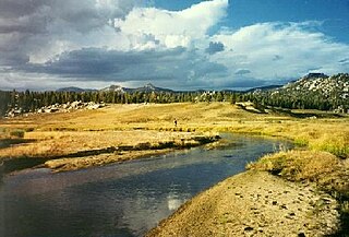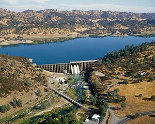
The Kern River, originally Rio de San Felipe, later La Porciuncula, is a river in the U.S. state of California, approximately 165 miles (270 km) long. It drains an area of the southern Sierra Nevada mountains northeast of Bakersfield. Fed by snowmelt near Mount Whitney, the river passes through scenic canyons in the mountains and is a popular destination for whitewater rafting and kayaking. It is the southernmost major river system in the Sierra Nevada, and is the only major river in the Sierra that drains in a southerly direction.

The Clavey River is a tributary of the Tuolumne River in the Sierra Nevada, located in the Stanislaus National Forest and Tuolumne County, California. The river is 31.3 miles (50.4 km) long, and is one of the few undammed rivers on the western slope of the Sierra. Via the Tuolumne River, the Clavey is part of the San Joaquin River watershed.

Accotink Creek is a 25.0-mile-long (40.2 km) tributary stream of the Potomac River in Fairfax County, Virginia, in the United States. At Springfield, Virginia, Accotink Creek is dammed to create Lake Accotink. The stream empties into the Potomac at Gunston Cove's Accotink Bay, to the west of Fort Belvoir.

Oil Creek is a 46.7-mile (75.2 km) tributary of the Allegheny River in Venango and Crawford counties in the U.S. state of Pennsylvania. It has a drainage area of 319 square miles (830 km2) and joins the Allegheny at Oil City. Attractions along the river include the Drake Well Museum and Oil Creek State Park. The stream was named after the oil that was found along its banks before the historic oil strike by Edwin Drake in Titusville, which Oil Creek flows through. Oil Creek is popular with canoeists and fishers. The creek is rated as a beginners creek for those interested in learning how to safely use canoes and kayaks. Oil Creek is a cold water fishery with bass and trout living in its waters.

Summit Lake is a lake in the Lassen Volcanic National Park of Shasta County, California, east of California Route 89 at elevation 6,700 ft (2,000 m). Two campgrounds, named Summit Lake North and Summit Lake South, are located adjacent to the lake.

Morgan Summit is a mountain pass on a road shared by Highway 89 and Highway 36 in Tehama County, California. The pass is located in between the town of Mineral and Childs Meadow south of Lassen Peak and Lassen Volcanic National Park. The stated elevation of the pass varies between 5,753 ft (1,754 m) and 5,768 ft (1,758 m). The pass is high enough to receive snowfall during the winter.

The Middle Fork Feather River is a major river in Plumas and Butte Counties in the U.S. state of California. Nearly 100 miles (160 km) long, it drains about 1,062 square miles (2,750 km2) of the rugged northern Sierra Nevada range.

The South Fork Kern River is a tributary of the Kern River in the Sierra Nevada of the U.S. state of California. It is one of the southernmost rivers on the western slope of the mountains, and drains a high, relatively dry plateau country of 982 square miles (2,540 km2) along the Sierra Crest. The upper South Fork flows through a series of rugged canyons, but it also drains a flat, marshy valley before joining the Kern River at Lake Isabella.

The United States Geological Survey is a scientific agency of the United States government. The scientists of the USGS study the landscape of the United States, its natural resources, and the natural hazards that threaten it. The organization's work spans the disciplines of biology, geography, geology, and hydrology. The USGS is a fact-finding research organization with no regulatory responsibility.

Stony Creek is a 73.5-mile (118.3 km)-long seasonal river in Northern California. It is a tributary of the Sacramento River, draining a watershed of more than 700 square miles (1,800 km2) on the west side of the Sacramento Valley in Glenn, Colusa, Lake and Tehama Counties.

The Middle Fork Kings River is a 37.2-mile (59.9 km) tributary of the Kings River in Kings Canyon National Park, California, in the southern Sierra Nevada. Draining 318 square miles (820 km2) – almost all of it wilderness – the Middle Fork is one of the largest wholly undeveloped watersheds in the state, with no dams or paved roads within its basin. The entire length of the Middle Fork is designated a National Wild and Scenic River.

The Little Kern River is a 24.4 miles (39.3 km) long major tributary of the upper Kern River in the Sequoia National Forest, in the southern Sierra Nevada, California. It is one of three streams, along with Volcano Creek and Golden Trout Creek, that harbor beautiful golden trout.

The West Fork Carson River is a major tributary of the Carson River, about 35 miles (56 km) long, in Alpine County, California, and Douglas County, Nevada, in the United States.

Temescal Mountains, formerly the Sierra Temescal, are one of the northernmost mountain ranges of the Peninsular Ranges in western Riverside County, in Southern California in the United States. They extend for approximately 25 mi (40 km) southeast of the Santa Ana River east of the Elsinore Fault Zone to the Temecula Basin and form the western edge of the Perris Block.

Deep Creek is a tributary of the Mojave River, 23.4 miles (37.7 km) long, in San Bernardino County, California.

Cow Creek is a tributary of the Sacramento River in Shasta County, California. About 46.9 miles (75.5 km) long measured to its longest source, it drains a hilly, rural region at the northern end of the Sacramento Valley east of Redding. The creek begins at Millville at the confluence of Old Cow and South Cow Creek and flows west to Junction, where it turns south, joining the Sacramento near Anderson. Despite its name, Cow Creek is closer in size to a river, especially in winter when it is prone to large flash floods, accounting for up to 21 percent of the Sacramento's peak flows at Red Bluff.

Thomes Creek is a major watercourse on the west side of the Sacramento Valley in Northern California. The creek originates in the Coast Ranges and flows east for about 62 miles (100 km) to join the Sacramento River, at a point about 7 miles (11 km) northeast of Corning in Tehama County.

Elder Creek is a major stream in Tehama County, California and a tributary of the Sacramento River. It originates at the confluence of its North, Middle and South Forks, which begin in the Mendocino National Forest, and flows 27 miles (43 km) east to its confluence with the Sacramento River about a mile (1.6 km) east of Gerber and 2 miles (3.2 km) north of Tehama. Measured to the head of its longest tributary, the South Fork, Elder Creek has a total length of 42 miles (68 km), draining a watershed of about 150 square miles (390 km2). Like the other streams draining this part of the western Sacramento Valley, Elder Creek is a highly seasonal stream that flows only during the winter and spring.

Arroyo Grande Creek is a major stream in San Luis Obispo County on the Central Coast of California. The creek flows 22 miles (35 km) in a southwesterly direction, from the Santa Lucia Range to the Pacific Ocean. It is a major source of water supply for southern San Luis Obispo County.


