
Mehrauli is a neighbourhood in South Delhi, Delhi, India. It represents a constituency in the legislative assembly of Delhi. The area is close to Gurugram and next to Vasant Kunj.
Lodi Road in New Delhi, India, is named after the Lodi Gardens located on it. Two Mughal mausoleums, Humayun's Tomb and Safdarjung's Tomb, lie at the eastern and western ends of the road respectively. A number of cultural, educational, and international institutions line the road. The Jor Bagh metro station lies under Aurobindo Marg near its intersection with Lodi Road. Also located near it are Lodi colony and Lodi Estate built during British Raj in 1940s, and Lodi Road Institutional Area.

Saket is a residential colony and the administrative headquarters of the South Delhi district of Delhi in India. The neighborhood is named after the city of Ayodhya, also known as Saket, an ancient, religiously significant city in Uttar Pradesh.

The Inner Ring Road refers to one of the two main ring roads, the main inner one and an outer one in Delhi, India. The two ring roads have a combined length of 87 km (54 mi). There are two less significant Ring Roads in Delhi apart from the above two, namely the Rural Ring Road, that runs across the rural areas on the fringe of North West Delhi and West Delhi Ring Road, limited only to the West Delhi region.

Safdarjung Airport is an airport in New Delhi, India, in the neighbourhood of the same name. Established during the British Raj as Willingdon Airfield, it started operations as an aerodrome in 1929, when it was India's second airport after the Juhu Aerodrome in Mumbai. It was used extensively during the Second World War as it was part of the South Atlantic air ferry route, and later during Indo-Pakistani War of 1947. Once situated on the edge of Lutyens' Delhi, today, it has the entire city of New Delhi around it. It remained the city's main airport until 1962, when operations shifted to Palam Airport completely by the late 1960s, as it could not support the new bigger aircraft such as jet aircraft.

South Delhi is an administrative district of the National Capital Territory of Delhi in India with its headquarters in Saket. Administratively, the district is divided into three subdivisions, Saket, Hauz Khas, and Mehrauli. It is bounded by the Yamuna River to the east, the districts of New Delhi to the north, Faridabad district of Haryana to the southeast, Gurgaon District of Haryana to the southwest, and South West Delhi to the west.

Lutyens' Delhi is an area in New Delhi, India, named after the British architect Edwin Lutyens (1869–1944), who was entrusted with the vast majority of the architectural design and buildings of the city that subsequently emerged as New Delhi during the period of the British Raj. Lutyens' Delhi progressively developed over the period from 1912 to 1931. This also includes the Lutyens Bungalow Zone (LBZ).
Rajiv Gandhi Bhawan is the corporate headquarters of Airports Authority of India (AAI). AAI which functions under the Ministry of Civil Aviation and manages most of the airports in India. The Indian Ministry of Civil Aviation is co-located in the same building.
INA colony is a residential colony in South Delhi, New Delhi, India.
Prithviraj Road is one of the historic & influential roads of New Delhi. It houses the most elite residences of major people of India.
Safdarjung Road is a main road in New Delhi, India, named after the 18th century Tomb of Safdarjung near it. At the north end, the road stretches from the junction of the Teen Murti Marg, Akbar Road, Rajaji Marg and Lok Kalyan Marg, which is a roundabout. At the south end it stretches up to the junction of Prithviraj Road, Tughlaq Road and Sri Aurobindo Marg. There is a single junction/crossing at the Kemal Atatürk Marg and Dr APJ Abdul Kalam Road section.
Tughlaq Road is one of the main roads of Central New Delhi
Malviya Nagar is a residential locality in South Delhi. Situated between Saket and Hauz Khas, its namesake is the freedom fighter Madan Mohan Malviya.
Yusuf Sarai is a locality in South Delhi. It lies on the Sri Aurobindo Marg close to AIIMS, New Delhi, and accommodates both residential as well as market places. It is named after historic Yusuf Sarai, one of many sarais which were built in area during and Delhi Sultanate period, including, Katwaria Sarai, Lado Sarai, Sheikh Sarai and Kallu Sarai.
Hauz Khas is a neighborhood in South Delhi, its heart being the historic Hauz Khas Complex. Well known in medieval times, the Hauz Khas village has buildings built around the reservoir. There are remnants of Islamic architecture roughly colored by splotches of urban culture. It is centrally located and offers both rural Hauz Khas Village and urban Hauz Khas Enclave, Market environments. Hauz Khas is surrounded by Green Park, SDA to the west, Gulmohar Park towards the north, Sarvapriya Vihar towards the south and Asiad Village and Siri Fort to the east.

Green Park is an upscale affluent neighborhood in South Delhi, India. The locality is divided into two parts i.e. Main and Extension. The neighbourhood registered a 4.4% growth in residential sales and was featured alongside Greater Kailash, Defence Colony, Vasant Vihar and Anand Niketan in the 2019 edition of Knight Frank's quarterly report on prime luxury residential properties in various megacities around the globe. Property rates have always been high in this colony due to the numerous facilities available. Builder floors and independent villas cost anywhere between INR 6–70 crores in this colony. Rental rates are also very high making this residential area among the most expensive pin codes of New Delhi.
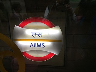
The AIIMS metro station is located on the Yellow Line of the Delhi Metro.

The Hauz Khas metro station is an interchange station between the Yellow Line and the Magenta Line of the Delhi Metro. It serves Hauz Khas Enclave, Sarvapriya Vihar, Vijay Mandal Enclave, RBI colony, Mayfair Gardens and the IIT Delhi. The entrance to the station is located on Outer Ring Road, to the east of Aurobindo Marg and to the west of Khelgaon Marg.

Kishangarh Jat is an Urban Jat village. The Jat Village is located near Vasant Kunj in South West Delhi district of Delhi, India, on the hills of Aravali, between Mehrauli and Vasant Kunj. One extreme of Kishangarh Jat is around 4 km from Qutub Minar in historic Mehrauli area. The other extreme is approximately 7.5 km from the Indira Gandhi International Airport. Munirka is about 5 km, where the Aruna Asaf Ali Marg, connecting the main Vasant Kunj Marg with the Outer Ring Road forms its western boundary.


