
Stephenville is a town in Newfoundland and Labrador, Canada, on the west coast of the island of Newfoundland.
St. George's-Stephenville East is a defunct provincial electoral district for the House of Assembly of Newfoundland and Labrador. Created in 1995 from the districts of St. George's and Stephenville. In 2011, there were 7,861 eligible voters living within the district.
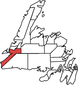
Port au Port is a defunct provincial electoral district for the House of Assembly of Newfoundland and Labrador, Canada. As of 2011, there were 8,439 eligible voters living within the district.
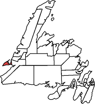
The Port au Port Peninsula is a peninsula in the Canadian province of Newfoundland and Labrador. Roughly triangular in shape, it is located on the west coast of the island of Newfoundland.
Piccadilly Slant-Abraham's Cove is a local service district and designated place in the Canadian province of Newfoundland and Labrador. It is located on the island of Newfoundland, along St. George's Bay, on the Port au Port Peninsula. The DPL consists of the fishing villages of Abraham's Cove and Piccadilly.
The Anglican Diocese of Western Newfoundland is a diocese of the Ecclesiastical Province of Canada of the Anglican Church of Canada. It comprises 77 congregations grouped in 30 parishes in Western Newfoundland, with approximately 17,888 souls. Most parishes are multipoint - with more than two congregations - with only one full-time clergy. As of 2012, the diocese had 20 full-time and over 350 lay ministers. As of 2019, this Diocese allows clergy to officiate same-sex marriages.

Area code 709 is the telephone area code in the North American Numbering Plan (NANP) for the entire Canadian province of Newfoundland and Labrador.
The House of Assembly Channel is a cable television channel broadcast throughout much of Newfoundland and Labrador, exclusively on cable. The channel first signed on the air on November 17, 2001.

Route 460 is an 87.5-kilometre-long (54.4 mi) east-west Canadian provincial highway in Newfoundland and Labrador.

Stephenville Crossing is a town in the Canadian province of Newfoundland and Labrador. It is on the island of Newfoundland at the easternmost limit of Bay St. George.

The East Coast Trail (ECT) is a long-distance coastal footpath located in the Canadian province of Newfoundland and Labrador. It is a developed trail over 336 kilometres (209 mi) long, creation of which began in 1994. It is made up of 25 linked wilderness paths and passes through more than 30 communities. It was named one of the best adventure destinations by National Geographic in 2012 and is extended and improved yearly.
Census Division No. 4 is a Statistics Canada statistical division that comprises the areas of the province of Newfoundland and Labrador called St. George's. It covers a land area of 7087.65 km² and had a population of 20,387 at the 2016 census.
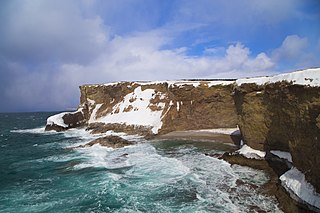
Cape St. George is a headland and community of the same name, located at the southwestern tip of the Port au Port Peninsula on the Canadian island of Newfoundland.

College of the North Atlantic is one of the largest post-secondary educational and skills training centres in Atlantic Canada, with a history dating back 50 years. The college has 17 campus locations throughout the province of Newfoundland and Labrador in Canada, various partner universities in China and formerly operated a technical education college for the State of Qatar in the Middle East. The enabling legislation is the College Act.

Route 463, also known as Lourdes Road, is a rural highway in Newfoundland and Labrador that leads from Route 460 at Abraham's Cove to Cape St. George. It is situated entirely on the northern shore of the Port au Port Peninsula in Western Newfoundland and has an approximate length of 51.7 kilometres (32.1 mi). Along with Route 460, Route 463 also carries the designation of the French Ancestors Route.
Mainland is a local service district and designated place in the Canadian province of Newfoundland and Labrador. It is on the western shore of the Port au Port Peninsula approximately 50 kilometres (31 mi) from the Stephenville International Airport. Mainland is a coastal community, bordered by both the ocean and forest. The main industry in the community has traditionally been fishing, but currently (2016) a large portion of the inhabitants leave the community seasonally to earn income.

Newfoundland is a large island situated off the eastern coast of the North American mainland and the western part of the Canadian province of Newfoundland and Labrador, referred to as Labrador.

