St. Mary, Kentucky

Last updated

St. Mary, Kentucky
KYMap-doton-Lebanon.PNG
Location within Kentucky
Country United States
State Kentucky
County Marion
Settledc.1785 [1]
Incorporated1865 [2]
Named for a local college
Area
[3]
  Total0.79 sq mi (2.03 km2)
  Land0.78 sq mi (2.02 km2)
  Water0.01 sq mi (0.02 km2)
Elevation
762 ft (232 m)
Population
 (2020) [4]
  Total138
  Density177.38/sq mi (68.46/km2)
Time zone UTC-5 (Eastern (EST))
  Summer (DST) UTC-4 (EDT)
ZIP code
40063
Area code(s) 270 & 364
FIPS code 21-67890
GNIS feature ID02797230

St. Mary is a home rule-class city [5] in Marion County, Kentucky, in the United States. [2] As of the 2020 census, the population of the city was 138. [4]

Contents

History

The town was first known as Hardin's Creek when it was settled by the Hardin family c.1785. Catholic settlers from "Saint" Charles Co., [a] Maryland, arrived in 1790. Their community was originally known as Saint Charles after their former home and new church. [1]

The first Catholic settlers of the Hardin's Creek settlement were the brothers Edward Beaven and Charles Beaven from Maryland in 1786, followed by the brothers Mathew, Zachariah, Sylvester, and Jeremiah Cissell.[ citation needed ]

The community was the birthplace and hometown of George Elder, who along with William Byrne later returned from seminary in Maryland to found Saint Mary's College in 1821. The post office was established in 1858 as Saint Mary's for the school. [6] The city was incorporated as St. Mary [b] on May 26, 1865. [2] The college closed its doors in 1976.

The city includes historical markers honoring the Sisters of Loretto and St. Mary's College. [7]

Geography

St. Mary is located on Kentucky Route 84 at 37°50′56.6″N85°20′46.7″W / 37.849056°N 85.346306°W / 37.849056; -85.346306 (37.580711, -85.346291), [8] 5 miles (8 km) west of Lebanon.

According to the U.S. Census Bureau, the city of St. Mary has an area of 0.79 square miles (2.05 km2), of which 0.01 square miles (0.03 km2), or 0.89%, are water. [4]

Demographics

Historical population
CensusPop.Note
2020 138
U.S. Decennial Census [9]

Economy

Since 1980, St. Mary has been home to the 826-bed Marion Adjustment Center, a CCA-owned minimum- and medium-security facility. [10] [11] In June 2013, the Kentucky Department of Corrections elected not to renew the contract. [12] [13] At the time, the MAC employed 166 people. [14]

Notes

^  a: This Charles County is now known within Maryland as "Old Charles County" to distinguish it from the present Charles County . The former was named after King Charles I ("Saint Charles"), the latter after Charles Calvert, 3rd Baron Baltimore .
^  b: The abbreviation is the formal name, although it sometimes spelled out as "Saint Mary". [2]

Related Research Articles

<span class="mw-page-title-main">Nelson County, Kentucky</span> County in Kentucky, United States

Nelson County is a county located in the U.S. state of Kentucky. As of the 2020 census, the population was 48,065. Its county seat is Bardstown. Nelson County comprises the Bardstown, KY Micropolitan Statistical Area, which is also included in the Louisville/Jefferson County-Elizabethtown-Madison, KY-IN Combined Statistical Area.

<span class="mw-page-title-main">LaRue County, Kentucky</span> County in Kentucky, United States

LaRue County is a county in the central region of the U.S. state of Kentucky, outside the Bluegrass Region and larger population centers. As of the 2020 census, the population was 14,867. Its county seat is Hodgenville, which is best known as the birthplace of United States President Abraham Lincoln. The county was established on March 4, 1843, from the southeast portion of Hardin County. It was named for John P. LaRue, an early settler. LaRue County is included in the Elizabethtown-Fort Knox, KY Metropolitan Statistical Area, which is also included in the Louisville/Jefferson County-Elizabethtown-Bardstown, KY-IN Combined Statistical Area. It is a dry county.

<span class="mw-page-title-main">Hardin County, Kentucky</span> County in Kentucky, United States

Hardin County is a county located in the central part of the U.S. state of Kentucky. Its county seat is Elizabethtown. The county was formed in 1792. Hardin County is part of the Elizabethtown-Fort Knox, KY Metropolitan Statistical Area, as well as the Louisville/Jefferson County—Elizabethtown-Bardstown, KY-IN Combined Statistical Area. As of the 2020 census, the population was 110,702.

<span class="mw-page-title-main">Hardinsburg, Kentucky</span> City in Kentucky, United States

Hardinsburg is a home rule-class city in Breckinridge County, Kentucky, in the United States. It is the seat of its county. The population was 2,343 at the 2010 census. Hardinsburg was named after Captain William Hardin.

<span class="mw-page-title-main">Wheelwright, Kentucky</span> City in Kentucky, United States

Wheelwright is a home rule-class city in Floyd County, Kentucky, United States. The population was 780 at the 2010 census, down from 1,042 in 2000.

<span class="mw-page-title-main">Radcliff, Kentucky</span> City in Kentucky, United States

Radcliff is a home rule-class city in Hardin County, Kentucky, in the United States. The population was 21,692 at the 2010 census, and in 2019 the estimated population was 22,914. It is included in the Elizabethtown–Fort Knox Metropolitan Area.

<span class="mw-page-title-main">Sonora, Kentucky</span> City in Kentucky, United States

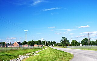
Sonora is a home rule-class city in Hardin County, Kentucky, United States. The population was 513 at the 2010 census, up from 350 at the 2000 census. It is included in the Elizabethtown, Kentucky Metropolitan Statistical Area.

<span class="mw-page-title-main">St. Charles, Kentucky</span> City in Kentucky, United States

St. Charles is a home rule-class city in Hopkins County, Kentucky, United States. The population was 277 at the 2010 U.S. Census.

<span class="mw-page-title-main">Graymoor-Devondale, Kentucky</span> City in Kentucky, United States

Graymoor-Devondale is a home rule-class city in Jefferson County, Kentucky, United States. The city is the result of the merger of the former cities of Graymoor and Devondale. The population was 2,870 at the 2010 census.

<span class="mw-page-title-main">St. Matthews, Kentucky</span> City in Kentucky, United States

St. Matthews is a city in Jefferson County, Kentucky, United States. It forms part of the Louisville Metro government but is separately incorporated as a home rule-class city. The population was 17,472 at the 2010 census, up from 15,852 at the 2000 census. It is the 23rd-largest city in the state. St. Matthews is one of the state's major shopping areas, home to the fifth-largest mall in Kentucky along with many smaller shopping centers along Shelbyville Road.

<span class="mw-page-title-main">Russellville, Kentucky</span> City in Kentucky, United States

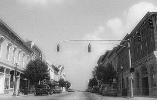
Russellville is a home rule-class city in Logan County, Kentucky, in the United States. It is the seat of its county. The population was 6,960 at the time of the 2010 census.

<span class="mw-page-title-main">Bradfordsville, Kentucky</span> City in Kentucky, United States

Bradfordsville is a home rule-class city in Marion County, Kentucky, in the United States. The population was 270 at the time of the 2020 census.

<span class="mw-page-title-main">Lebanon, Kentucky</span> City in Kentucky, United States

Lebanon is a home rule-class city and the county seat of Marion County, Kentucky, in the United States. The population was 6,274 at the 2020 census, up from 5,539 in 2010. Lebanon is located in central Kentucky, 63 miles (101 km) southeast of Louisville. A national cemetery is nearby.

<span class="mw-page-title-main">Loretto, Kentucky</span> City in Kentucky, United States

Loretto is a home rule-class city in Marion County, Kentucky, United States. The population was 723 at the 2020 census.

<span class="mw-page-title-main">Hardin, Kentucky</span> City in Kentucky, United States

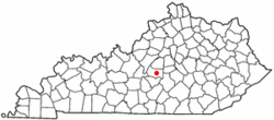
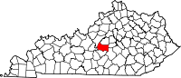
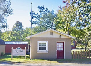
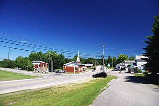
Hardin is a home rule-class city in Marshall County, Kentucky, United States. The population was 580 at the 2020 census.

<span class="mw-page-title-main">La Grange, Kentucky</span> City in Kentucky, United States

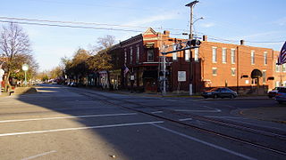
La Grange is a home rule-class city in Oldham County, Kentucky, in the United States. The population was 10,067 at the time of the 2020 U.S. census. It is the seat of its county. An unusual feature of La Grange is the CSX Transportation street-running mainline track on Main Street.

<span class="mw-page-title-main">Shelbyville, Kentucky</span> City in Kentucky, United States

Shelbyville is a home rule-class city in and the county seat of Shelby County, Kentucky, United States. The population was 14,045 at the 2010 census.

<span class="mw-page-title-main">Muldraugh, Kentucky</span> City in Kentucky, United States

Muldraugh is a home rule-class city in Meade and Hardin counties in the U.S. state of Kentucky. It lies on U.S. Route 31W north of Elizabethtown. The city limits are completely encompassed by the Fort Knox army base. The population was 947 as of the 2010 census. The city is part of the Elizabethtown–Fort Knox Metropolitan Area.

<span class="mw-page-title-main">Upton, Kentucky</span> City in Kentucky, United States

Upton is a home rule-class city in Hardin and LaRue counties in the U.S. state of Kentucky. The population was 683 at the 2010 census. Its entire area is included in the Elizabethtown–Fort Knox Metropolitan Statistical Area.

<span class="mw-page-title-main">Prospect, Kentucky</span> City in Kentucky, United States

Prospect is a home rule-class city in Jefferson and Oldham counties in the U.S. state of Kentucky. The Jefferson County portion is a part of the Louisville Metro government. The population was 4,698 at the time 2010 census. It is one of the wealthiest communities in Kentucky.

References

  1. 1 2 Rennick, Robert. Kentucky Place Names, p. 261. University Press of Kentucky (Lexington), 1987. Accessed October 4, 2013.
  2. 1 2 3 4 Commonwealth of Kentucky. Office of the Secretary of State. Land Office. "St. Mary, Kentucky". Accessed October 4, 2013.
  3. "2022 U.S. Gazetteer Files: Kentucky". United States Census Bureau. Retrieved May 4, 2023.
  4. 1 2 3 "P1. Race – St. Mary city, Kentucky: 2020 DEC Redistricting Data (PL 94-171)". U.S. Census Bureau. Retrieved May 4, 2023.
  5. "Summary and Reference Guide to House Bill 331 City Classification Reform" (PDF). Kentucky League of Cities. Retrieved December 30, 2014.
  6. University of Kentucky. Kentucky Atlas and Gazetteer. "Saint Mary, Kentucky". Accessed October 4, 2013.
  7. Signs of History. "Marion County". Accessed October 4, 2013.
  8. "US Gazetteer files: 2010, 2000, and 1990". United States Census Bureau. February 12, 2011. Retrieved April 23, 2011.
  9. "Census of Population and Housing". Census.gov. Retrieved June 4, 2016.
  10. Kentucky Department of Corrections. "About MAC". Accessed October 4, 2013.
  11. Corrections Corporation of America. Press Release: "Kentucky Elects Not to Renew Contract at Marion Adjustment Center". Op. cit. in Wall Street Journal, June 26, 2013. Accessed October 4, 2013.
  12. Lexington Herald-Leader, July 2, 2013. "A welcome close to privately run prisons in Kentucky". Accessed October 4, 2013.
  13. Barrouquere, Brett. Bloomberg Businessweek, June 25, 2013. "Kentucky to walk away from last private prison". Accessed July 25, 2013.
  14. Lega, Stephen. Kentucky Standard, July 3, 2013. "Marion Adjustment Center's closing will impact community in many ways". Accessed October 4, 2013.