Related Research Articles
Tailings are the materials left over after the process of separating the valuable fraction from the uneconomic fraction (gangue) of an ore. Tailings are distinct from overburden, which is the waste rock or other material that overlies an ore or mineral body and is displaced during mining without being processed.

The Ranger Uranium Mine was a uranium mine in the Northern Territory of Australia. The site is surrounded by, but separate from Kakadu National Park, 230 km east of Darwin. The orebody was discovered in late 1969, and the mine commenced operation in 1980, reaching full production of uranium oxide in 1981 and ceased production on 8 January 2021. It was operated by Energy Resources of Australia, a 68% subsidiary of Rio Tinto Group. Uranium mined at Ranger was sold for use in nuclear power stations in Asia, Europe and North America.

The Port River is part of a tidal estuary located north of the Adelaide city centre in the Australian state of South Australia. It has been used as a shipping channel since the beginning of European settlement of South Australia in 1836, when Colonel Light selected the site to use as a port. Before colonisation, the Port River region and the estuary area were known as Yerta Bulti by the Kaurna people, and used extensively as a source of food and plant materials to fashion artefacts used in daily life.

The Gulf War oil spill, or the Persian Gulf oil spill, was one of the largest oil spills in history, resulting from the Gulf War in 1991. In January of 1991, Iraqi forces allegedly began dumping oil into the Persian Gulf to stop a U.S. coalition-led water landing on their shores. Despite quite high initial estimates, the spill likely was about 4,000,000 US barrels. Within the following months of the spill, most clean-up was targeted at recovering oil, and very little clean-up was done on Saudi Arabia’s highly-affected beaches. An initial study in 1993 found that the spill will not have long-term environmental consequences, but many studies since 1991 have concluded the opposite, claiming that the spill is responsible for environmental damage to coastline sediments and marine species and ecosystems. Considered an act of environmental terrorism, the spill was a heated political move that had implications for the larger Gulf War and temporarily damaged Kuwait and Saudi Arabia.

Salt, also referred to as table salt or by its chemical formula NaCl, is an ionic compound made of sodium and chloride ions. All life has evolved to depend on its chemical properties to survive. It has been used by humans for thousands of years, from food preservation to seasoning. Salt's ability to preserve food was a founding contributor to the development of civilization. It helped eliminate dependence on seasonal availability of food, and made it possible to transport food over large distances. However, salt was often difficult to obtain, so it was a highly valued trade item, and was considered a form of currency by certain peoples. Many salt roads, such as the via Salaria in Italy, had been established by the Bronze Age.

The Towra Point Nature Reserve is a protected nature reserve that is located in Sutherland Shire, southern Sydney, New South Wales, in eastern Australia. The 603-hectare (1,490-acre) reserve is situated on the southern shores of Botany Bay at Kurnell, within the Sutherland Shire. The reserve is protected under the Ramsar Convention as a wetland of international importance as an important breeding ground for many vulnerable, protected, or endangered species. The Towra Point Aquatic Nature Reserve is located in the surrounding waterways.

Dry Creek is a mostly industrial suburb north of Adelaide, containing significant wetlands and a substantial area formerly devoted to salt crystallisation pans, managed by Ridley Corporation, which planned to redevelop the site for housing. This plan, first put forward in 2008, was revived in 2013, for a proposed 10,000 homes. Salt production ceased in 2014, and in 2016 Ridley Corporation sold the land to Adelaide Resource Recovery.
The Barker Inlet is a tidal inlet of the Gulf St Vincent in Adelaide, South Australia, named after Captain Collet Barker who first sighted it in 1831. It contains one of the southernmost mangrove forests in the world, a dolphin sanctuary, seagrass meadows and is an important fish and shellfish breeding ground. The inlet separates Torrens Island and Garden Island from the mainland to the east, and is characterised by a network of tidal creeks, artificially deepened channels, and wide mudflats. The extensive belt of mangroves are bordered by samphire saltmarsh flats and low-lying sand dunes.

St Kilda is a coastal suburb in Adelaide, South Australia. Its seafront faces the Barker Inlet, which is part of the Port River estuarine area, the largest tidal estuary of Gulf St Vincent, and includes a large area of mangroves. St Kilda is an internationally recognised bird watching area with over 100 species of birds feeding in and around the mudflats, salt lagoons, mangroves and seagrass beds, which are part of the estuarine ecosystem.

Lake Bumbunga is a salt lake located in South Australia's Mid North between the town of Lochiel and the farming locality of Bumbunga.

Port Bonython is the location of a deepwater port, gas fractionation plant and diesel storage facility west of Point Lowly in the Upper Spencer Gulf region of South Australia. It lies 16 km east-northeast of Whyalla, South Australia and approximately 370 km north-west of the State's capital city, Adelaide. The existing wharf is 2.4 kilometres long and is capable of berthing small Capesize ships with a maximum capacity of 110,000 tonnes. The wharf was established in 1982 and named after John Bonython, the founding chairman of Santos. The structure is leased to Santos by the Government of South Australia and is used for the export of hydrocarbon products. An oil spill at Port Bonython in 1992 resulted in loss of bird life and damage to mangrove habitats to the west and southwest of Port Pirie.

Environmental effects of mining can occur at local, regional, and global scales through direct and indirect mining practices. The effects can result in erosion, sinkholes, loss of biodiversity, or the contamination of soil, groundwater, and surface water by the chemicals emitted from mining processes. These processes also affect the atmosphere from the emissions of carbon which have an effect on the quality of human health and biodiversity. Some mining methods may have such significant environmental and public health effects that mining companies in some countries are required to follow strict environmental and rehabilitation codes to ensure that the mined area returns to its original state.
The Gulf St Vincent Important Bird Area comprises land extending along the coast of Gulf St Vincent, north of Adelaide, South Australia.

The Urrbrae Wetland is a constructed urban wetland in the Australian state of South Australia located in the suburb of Urrbrae in the Adelaide metropolitan area. It was constructed to manage flood water from the nearby Adelaide Hills and has been developed to provide ecological and educational benefits. The wetland covers approximately 6 hectares of land which is onsite of Urrbrae Agricultural High School. The area of water is approximately 4 hectares and when full, contains approximately 13.5 million litres of water.

Salt ponds are a natural feature of both temperate and tropical coastlines. These ponds form a vital buffer zone between terrestrial and marine ecosystems. Contaminants such as sediment, nitrates and phosphates are filtered out by salt ponds before they can reach the ocean. The depth, salinity and overall chemistry of these dynamic salt ponds fluctuate depending on temperature, rainfall, and anthropogenic influences such as nutrient runoff. The flora and fauna of tropical salt ponds differ markedly from those of temperate ponds. Mangrove trees are the dominant vegetation of tropical salt pond ecosystems, which also serve as vital feeding and breeding grounds for shore birds.

Blue carbon is carbon sequestration by the world's oceanic and coastal ecosystems, mostly by algae, seagrasses, macroalgae, mangroves, salt marshes and other plants in coastal wetlands. This occurs through plant growth and the accumulation and burial of organic matter in the soil. Because oceans cover 70% of the planet, ocean ecosystem restoration has the greatest blue carbon development potential. Research is ongoing, but in some cases it has been found that these types of ecosystems remove far more carbon than terrestrial forests, and store it for millennia.

The Olympic Dam mine is a large poly-metallic underground mine located in South Australia, 550 km (341.75 mi) NNW of Adelaide. It is the fourth largest copper deposit and the largest known single deposit of uranium in the world. Copper is the largest contributor to total revenue, accounting for approximately 70% of the mine's revenue, with the remaining 25% from uranium, and around 5% from silver and gold. BHP has owned and operated the mine since 2005. The mine was previously owned by Western Mining Corporation.
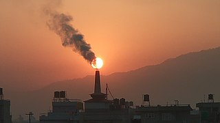
Penrice Soda Products was a company founded in 1935 in South Australia. It was listed on the Australian Securities Exchange, named after its quarry near the small town of Penrice, South Australia. It was forced to close its soda ash production plant in Osborne and was placed in liquidation in August 2014.

The Adelaide International Bird Sanctuary National Park—Winaityinaityi Pangkara is a protected area in South Australia established by the South Australian government on the northeast coast of Gulf St Vincent, between Parham in the north and the southern end of Barker Inlet in the south, for the purpose of rehabilitating land used as salt pans, protecting habitat for international migratory shorebirds, managing water quality in adjoining parts of Gulf St Vincent, creation of "green" space, development of niche tourism and creation of opportunities for Indigenous people.

Adelaide Dolphin Sanctuary is a marine protected area in the Australian state of South Australia located on the east coast of Gulf St Vincent in and adjoining the north-western part of the Adelaide metropolitan area and which was established in 2005 for the protection of a resident population of Indo-Pacific bottlenose dolphins .
References
- 1 2 "Call for urgent action to prevent further dieback of Adelaide mangroves". www.abc.net.au. 2021-01-06. Retrieved 2021-02-03.
- 1 2 "Mining company ordered to cease pumping in Adelaide mangrove dieback investigation". www.abc.net.au. 2020-11-24. Retrieved 2021-02-03.
- ↑ "Dry Creek Salt Field". Department for Energy and Mining. Retrieved 2021-02-03.
- ↑ "Protesters take aim at SA's mining department's handling of St Kilda mangrove die-back". www.abc.net.au. 2021-02-02. Retrieved 2021-02-03.