St Kilda, South Australia

Last updated

St Kilda
Adelaide,  South Australia
North area of St Kilda township, South Australia, 2007 (cropped).jpg
Northern part of St Kilda township
Australia South Australia location map.svg
Red pog.svg
St Kilda
Coordinates 34°44′19″S138°32′05″E / 34.73861°S 138.53472°E / -34.73861; 138.53472
Population88 (SAL 2021) [1]
Established1893
Postcode(s) 5110
Location22 km (14 mi) from Adelaide city centre
LGA(s) City of Salisbury
State electorate(s) Port Adelaide
Federal division(s) Spence
Mean max tempMean min tempAnnual rainfall
22.7 °C
73 °F
11.1 °C
52 °F
430.1 mm
16.9 in
Suburbs around St Kilda:
Barker Inlet Buckland Park Waterloo Corner
Barker Inlet St Kilda Waterloo Corner
Bolivar
Barker Inlet Bolivar Bolivar
FootnotesClimate [2]
Adjoining suburbs [3]

St Kilda is a coastal locality, now classed as a suburb, 21 kilometres (13 miles) north-north-west of the centre of Adelaide, capital city of South Australia. With a population below 100 and a sole 4-kilometre (2.5-mile) road connecting to the nearest highway, its natural and built resources have remained relatively undisturbed. The seafront, containing a large area of mangroves, faces the Barker Inlet, which is part of the Port River estuarine area. St Kilda is an internationally recognised bird-watching area: more than 100 species [note 1] of birds feed in and around the mudflats, salt lagoons, mangroves and seagrass beds. [4] :31–32

Contents

The inhabited section of the suburb occupies less than 100 hectares (250 acres) along the seafront. The remainder of the land was formerly used for extensive salt evaporation ponds, although now they are much fewer in number. The settlement ponds of the Bolivar Waste Water Treatment Plant occupy some of the southern end of the suburb. St Kilda is bordered by Buckland Park to the north, Waterloo Corner to the east-north-east, Bolivar to the south and south-east, and Gulf St Vincent to the west.

The suburb is home to a number of tourist attractions, including an adventure playground, tram museum, mangrove forest walk and an abundance of birdlife.

History

Pre-colonial

Before the 1836 British colonisation of South Australia, the area was inhabited by the Kaurna people, who occupied the land from what is now Cape Jervis in the south, up the western side of the Fleurieu Peninsula, to Crystal Brook in the north, east to the Mount Lofty Ranges, across to Gulf Saint Vincent, including the Adelaide Plains and city of Adelaide. [5] [6] They called the Port River region and estuary Yerta Bulti, meaning "land of sleep or death". [7]

The Kaurna people made much use of the estuarine area for hunting and gathering food and for materials which they made into artefacts and tools. They made use of the natural resources; for example, they would trap and spear fish (kuya), lobsters (ngaultaltya) and birds (parriparu), and gathered bird's eggs, black river mussels (kakirra, species Alathyria jacksoni ), [8] periwinkle (kulutunumi), river crawfish (kunggurla – probably common yabby), [9] clams, native mud oysters and blue swimmer crabs. [10] However, they did not kill the black swans, as this was taboo. The reeds, blue flax lily and rushes (probably Juncus kraussii , the salt marsh rush) [11] were used for weaving baskets and nets – the latter used for not only fish, but game such as kangaroo and emu. Dolphins were known as yambo. [7]

After European settlement

Main features of St Kilda Features of St Kilda, South Australia (satellite view).tif
Main features of St Kilda

The "official" town of Saint Kilda was surveyed by T. Evans and proclaimed on 31 July 1873. [12] Settler fishermen had established huts on three low-lying islands, covered in shell grit and saltbush and surrounded by mangrove and samphire swamps by 1865. By 1873, 13 huts and a boathouse were recorded. By the 1890s, people who lived in Adelaide were visiting the islands, attracted to the supposedly curative properties of the mangrove mud and using the beach for bathing and fishing for crabs. [13] [ citation needed ] [4] :4–7 An early settler in the area was John Harvey, founder of the regional town of Salisbury, 10 kilometres (6 miles) inland. He gave the locality its name since it reminded him of the isolated St Kilda archipelago in the North Atlantic Ocean, which contains the westernmost islands of the Outer Hebrides of Scotland. [12] Details of the origin of the name is here.

In 1886, governance of St Kilda was exercised by the Munno Para West District Council, which had been founded in 1854. [14] St Kilda was proclaimed a town on 31 July 1893; sales of the first allotments occurred on the same day. [13]

In 1934, a swimming pool was dug in the tidal beach Opening of swimming pool, St Kilda, South Australia (Chronicle 19 Apr 1934 p37).jpg
In 1934, a swimming pool was dug in the tidal beach

The St Kilda Hotel, built out of limestone obtained from the hills 15 kilometres (9 miles) eastwards, opened in 1898 with Matthias Lucas as the first publican. It remains the township's only hotel. [15] [ page needed ] [4] :9–11 A school opened in 1902, where the tram museum is now sited. It closed from 1917 to 1924 and finally closed permanently in 1949. Students were then moved to Salisbury North primary school; the timber building was eventually transported to Virginia primary school. [4] :12

Together with most of the Munno Para West area, St Kilda came under the jurisdiction of the new District Council of Salisbury (later City of Salisbury) in 1933. [13] After floods occurred in 1948 and 1957, the three islands present since the first European settlers arrived a century earlier were extensively modified. Salisbury Council began building up the area, expanding seawalls and reclaiming additional land by dumping earth spoil. [4] :9–11

A major change to the landscape took place when construction of large salt evaporation lagoons began in 1935, [note 2] employing 600 workers to dig them out by hand. The company expanded the lagoons with mechanical equipment after World War II. [4] :15–17

St Kilda's population has never been large: 50 non-permanent residents were counted in the 1901 census; 68 (including 20 "permanent") in 1911; 30 total residents in 1933; [13] 80 in 2002; [4] :34 70 (11 of whom were in families) in 2016; [16] [note 3] and 88 (18 of whom were in families) in 57 private dwellings in 2021. [17] Many of the dwellings are insubstantial. [18]

Attractions and facilities

Adventure playground

Playground castle, St Kilda, South Australia.jpg
Playground slides, St Kilda, South Australia.jpg
Pirate Ship- St Kilda playground.jpg
A castle at the playground (and zipwire on right)Tunnels and slides at the playground "volcano"A children's "pirate ship" on the waterfront

The St Kilda adventure playground, which covers 4 hectares (10 acres) at the seafront, has been voted by children as the best adventure park in South Australia. It has a "pirate" shipwreck, three-storey castle, tunnelled slides on a hill, flying foxes, a "bouncy boomerang" and numerous other pieces of play equipment. Shaded equipment and a small maze are enjoyed by younger children. [4] :27 [19] Barbecue facilities, basketball courts and a dog-friendly exercise area are also provided.

The playground, opened in 1982 and upgraded in 2016, was initiated by the Lions Club of Salisbury and funded through club fund-raising activities, City of Salisbury council matching funding, and government employment schemes. [19]

Tramway museum

At the St Kilda adventure playground terminus, a restored 1929-vintage Glenelg tram is being prepared to take families to the museum. It is operated by the nearby Tramway Museum, where another 23 trams are displayed or operating. Restored Glenelg tram no 352 at Tramway Museum, St Kilda, South Australia, 17 March 2024.jpg
At the St Kilda adventure playground terminus, a restored 1929-vintage Glenelg tram is being prepared to take families to the museum. It is operated by the nearby Tramway Museum, where another 23 trams are displayed or operating.

Adelaide's tram museum is located at St Kilda on the site of the former primary school. It holds 24 electric trams, 2 horse trams and 5 trolleybuses that were used or built in Adelaide; most are restored and operational. The museum, which is open on Sundays and most public holidays from noon to 5 pm, [20] is one of very few transport museums in the world to hold at least one example of every principal tram type to have been in service on a city street system. [21] The entrance fee gives access to unlimited free rides on an electric tram along a 1.6 kilometres (1.0 mile) line that runs between the museum and the adventure playground.

Mangrove trail and interpretative centre

The boardwalk under the mangrove canopy Mangrove forest boardwalk, St Kilda, South Australia.jpg
The boardwalk under the mangrove canopy

St Kilda is sited on a mangrove forest that borders Barker Inlet, part of the largest tidal estuary of Gulf St Vincent. Late in the 19th century, embankments were constructed through the mangroves to reclaim land for pasture. Subsequently, once the banks of the adjacent saltfields had been built, maintenance of the embankments ceased and the mangroves began to reclaim them. On one of the embankments is the Interpretative Centre, which gives insights into the flora, fauna and processes within the mangrove forest. From there, a 1.7 kilometres (1.1 mi) trail begins through a flooded mangrove forest, most of it on an elevated boardwalk. [4] :28–29 [note 4] The trail meanders through tidal samphire saltmarsh flats, mangroves and seagrass channels to a lookout that provides elevated views across the Barker Inlet. [23]

Boating and fishing

Boats in the marina St kilda boats.jpg
Boats in the marina

A marina with floating moorings for about 75 boats, some more than 10 metres (33 feet) long, and two boat ramps, is connected by a long sheltered channel to the Barker Inlet. Home to the long-established St Kilda Boat Club, [24] it provides secure parking, slipping facilities and an electric mobility hoist for boarding boats. [25]

The breakwater is popular for recreational fishing, especially for salmon trout, whiting (including King George whiting) [26] and bream. [27]

Geography and environment

St Kilda is a flat, low-lying locality, mostly less than 2 metres (6 ft 7 in) above sea level. Although once dominated by extensive salt crystallisation lagoons, many of the saltfields have closed, and land and water rehabilitation has been undertaken. Extensive treatment ponds of SA Water's Bolivar waste water treatment plant lie to the south.[ citation needed ]

Saltfields

Salt lagoon beyond the samphire saltflats Stkilda lagoon over samphire saltmarsh.JPG
Salt lagoon beyond the samphire saltflats

The coast side of the mangroves is bounded by extensive salt evaporation ponds leased for industrial use by the South Australian Government. Today, most of these saltfields are no longer used. The Department of the Premier and Cabinet is responsible for regulating the saltfields under the Mining Act 1972, which includes a requirement for environment protection and rehabilitation. [28]

ICI Australia Ltd began salt production at Dry Creek in 1940 and an associated soda ash plant at nearby Osborne. The company sold the operations to Penrice Soda Products in 1989. In 2006, when more saltfields were in production than now, they were described as covering about 4000 hectares (9884 acres). Salt water was pumped from the sea at two pumping stations, 20 km (12 mi) and 30 km (19 mi) north along the coast from the final crystallising area. Harvested salt was redissolved and pumped as brine to Osborne for manufacture of soda ash by the Solvay process. Production in 1999 was 391,000 tonnes (385,000 long tons). [29] Penrice Soda Products ceased operations at its Osborne chemical plant in 2014 when it went into receivership. [30]

In 2020, a South Australian government inspection observed that significant areas of mangrove had died off and that brine had recently been pumped into the saltfields by plant management company, Buckland Dry Creek Pty Ltd. The pumping occurred after six years in which the lagoons had been allowed to dry out. As of November 2020, a conclusion had not been reached about the cause, and a senior departmental official noted that the pumping occurred downstream from where the dieback occurred. [31] [ needs update ]

Flora and fauna

Flora

The mangroves found on the coastline of St Kilda consist of a single species, Avicennia marina var resinifera. In the upper intertidal zone, mangroves become smaller the closer they are to land. They give way to a variety of samphire species, including beaded glasswort (Tecticornia flabelliformis) and blackseed glasswort ( Tecticornia pergranulata ) as well as saltbush on the saltflats of the supratidal zone. Nitre bush grows on the highest parts of the seawall and the abundant summer fruits provide food for birds.

Fauna

St Kilda is part of a nursery area for many of the commercially important fish and crustaceans in South Australia, including King George whiting, western king prawns and blue swimmer crabs. [26] There are brown snakes and skinks in dense bushes along the top of the embankments.

Each year in late summer, thousands of black swans and ducks descend on the area as the inland waterways they inhabit dry up. Waterbirds such as pelicans, cormorants, oyster catchers and terns are common, often year-round. Egrets, ibis, herons and spoonbills feed on the seagrass and fairy wrens, chats, fantails and thornbills feed on insects and plants among the samphire. Every September, stints and sandpipers arrive from the Northern Hemisphere in a spectacular display. The abundance of birdlife attracts birds of prey: swamp harriers, collared sparrowhawks, black-shouldered kites, kestrels and little falcons are all seen in the skies over St Kilda. [4] :31–32

The salt lagoons, mangroves and samphire wetlands are recognised as important areas for migratory birds by their inclusion in treaties created to protect birds and their environment: the China-Australia and Japan-Australia migratory bird agreements. [32]

Protected areas

St Kilda and its aquatic and terrestrial surrounds are exceptionally well endowed. As a result, the waters and shorelines of St Kilda are part of several overlapping protected areas:

Transport

St Kilda is badly served by public transport: the nearest bus stop (stop 63 on the Adelaide Metro 402 bus route) is 4.6 kilometres (2.9 miles) from the tramway museum and 6.3 kilometres (3.9 miles) from the playground.

Weather

The region has a Mediterranean climate, with St Kilda being slightly hotter and drier than the average climate of Adelaide. Based on past data, summer daytime temperatures may be expected to exceed 40 degrees Celsius (104 degrees Fahrenheit) on four days of the year and nighttime temperatures in winter may be expected to drop below 0 degrees Celsius (32 degrees Fahrenheit) on one day, although generally the winter is mild with moderate rainfall.[ citation needed ]

The following graphs show climate data for RAAF Base Edinburgh, 10 kilometres (6.2 miles) inland from St Kilda. (Data are also available for the Bolivar Treatment Works, 5.7 kilometres (3.5 miles) to the south and 1.6 kilometres (1.0 mile) inland, but only in respect of rainfall.) [33]

RAAF Base Edinburgh
Climate chart (explanation)
J
F
M
A
M
J
J
A
S
O
N
D
 
 
21
 
 
30
17
 
 
17
 
 
30
17
 
 
23
 
 
27
15
 
 
31
 
 
23
12
 
 
47
 
 
19
9
 
 
53
 
 
16
7
 
 
52
 
 
15
6
 
 
50
 
 
17
7
 
 
47
 
 
19
8
 
 
37
 
 
22
10
 
 
26
 
 
26
13
 
 
25
 
 
28
15
Average max. and min. temperatures in °C
Precipitation totals in mm
Source: Bureau of Meteorology [34]
Imperial conversion
JFMAMJJASOND
 
 
0.8
 
 
86
62
 
 
0.7
 
 
86
62
 
 
0.9
 
 
81
58
 
 
1.2
 
 
74
53
 
 
1.8
 
 
66
49
 
 
2.1
 
 
61
44
 
 
2
 
 
60
43
 
 
2
 
 
62
44
 
 
1.8
 
 
66
47
 
 
1.5
 
 
72
50
 
 
1
 
 
78
55
 
 
1
 
 
82
59
Average max. and min. temperatures in °F
Precipitation totals in inches

Notes

  1. The number of species noted in the reference is 100. On boardwalk signs the number (as of 2024) was stated as 200, and elsewhere as 150.
  2. 1935 date is from Taylor, E.; PIRSA cites 1940.
  3. A note on the web page stated: "Median and average values may be affected by confidentiality in this area. Limited information has been provided because the area selected has a small population." [16]
  4. as of 2024, part of the trail was pending repairs. Instead of the loop, the trail ended at 1.25 kilometres (0.78 miles). [22]

Related Research Articles

<span class="mw-page-title-main">Port River</span> Tidal estuary north of Adelaide, South Australia

The Port River is part of a tidal estuary located north of the Adelaide city centre in the Australian state of South Australia. It has been used as a shipping channel since the beginning of European settlement of South Australia in 1836, when Colonel Light selected the site to use as a port. Before colonisation, the Port River region and the estuary area were known as Yerta Bulti by the Kaurna people, and used extensively as a source of food and plant materials to fashion artefacts used in daily life.

<span class="mw-page-title-main">Port Adelaide</span> Suburb of Adelaide, South Australia

Port Adelaide is a port-side region of Adelaide, approximately 14 kilometres (8.7 mi) northwest of the Adelaide CBD. It is also the namesake of the City of Port Adelaide Enfield council, a suburb, a federal and state electoral division and is the main port for the city of Adelaide. Port Adelaide played an important role in the formative decades of Adelaide and South Australia, with the port being early Adelaide's main supply and information link to the rest of the world. Its Kaurna name, although not officially adopted as a dual name, is Yertabulti.

<span class="mw-page-title-main">City of Salisbury</span> Local government area of Adelaide

The City of Salisbury is a local government area (LGA) located in the northern suburbs of Adelaide, South Australia. Its neighbours are the City of Playford, City of Tea Tree Gully and City of Port Adelaide Enfield.

<span class="mw-page-title-main">Onkaparinga River</span> River in South Australia

The Onkaparinga River, known as Ngangkiparri or Ngangkiparingga in the Kaurna language, is a river located in the Southern Adelaide region in the Australian state of South Australia. Rising in the Mount Lofty Ranges, the river's estuary extends from Old Noarlunga to the river's mouth between the suburbs of Port Noarlunga and Port Noarlunga South.

<span class="mw-page-title-main">Dry Creek, South Australia</span> Suburb of Adelaide, South Australia

Dry Creek is a mostly industrial suburb north of Adelaide, containing significant wetlands. A substantial area was devoted to salt crystallisation pans until 2014, with plans to redevelop the site for housing.

<span class="mw-page-title-main">Lefevre Peninsula</span> Place in South Australia

The Lefevre Peninsula is a peninsula located in the Australian state of South Australia located about 15 kilometres (9.3 mi) northwest of the Adelaide city centre. It is a narrow sand spit of about 30 square kilometres (12 sq mi) running north from its connection to the mainland.

<span class="mw-page-title-main">Little Para River</span> River in South Australia, Australia

The Little Para River is a seasonal creek running across the Adelaide Plains in the Australian state of South Australia, whose catchment fills reservoirs that supply some of the water needs of Adelaide’s northern suburbs.

<span class="mw-page-title-main">Barker Inlet</span> Inlet in South Australia

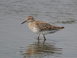
The Barker Inlet is a tidal inlet of the Gulf St Vincent in Adelaide, South Australia, named after Captain Collet Barker who first sighted it in 1831. It contains one of the southernmost mangrove forests in the world, a dolphin sanctuary, seagrass meadows and is an important fish and shellfish breeding ground. The inlet separates Torrens Island and Garden Island from the mainland to the east, and is characterised by a network of tidal creeks, artificially deepened channels, and wide mudflats. The extensive belt of mangroves are bordered by samphire saltmarsh flats and low-lying sand dunes.

<span class="mw-page-title-main">Torrens Island</span> Island in South Australia

Torrens Island is an island in the Australian state of South Australia located in the Adelaide metropolitan area in the Port River Estuary about 15 kilometres (9.3 mi) northwest of the Adelaide city centre. Since European settlement of Adelaide in 1836, it has been used for a number of purposes.

Bolivar is an outer northern suburb of Adelaide, South Australia. It is located in the City of Salisbury.

<span class="mw-page-title-main">Gulf St Vincent Important Bird Area</span>

The Gulf St Vincent Important Bird Area comprises land extending along the coast of Gulf St Vincent, north of Adelaide, South Australia.

<span class="mw-page-title-main">Pelican Lagoon Conservation Park</span> Protected area in South Australia

Pelican Lagoon Conservation Park is a protected area located in the Australian state of South Australia on the Dudley Peninsula on Kangaroo Island. It was dedicated in 1967 for the protection of wildlife habitat.

Torrens Island Conservation Park is a protected area in the Australian state of South Australia located on Torrens Island in the Adelaide metropolitan area about 17 kilometres north-northwest of the state capital of Adelaide and about 3.9 kilometres north-northeast of Port Adelaide.

<span class="mw-page-title-main">Adelaide International Bird Sanctuary National Park</span> Bird habitat protection area in South Australia

The Adelaide International Bird Sanctuary National Park is a protected area in South Australia established by the South Australian government on the northeast coast of Gulf St Vincent, between Parham in the north and the southern end of Barker Inlet in the south. Its purpose is to rehabilitate land used as salt pans, protect habitat for international migratory shorebirds, manage water quality in adjoining parts of Gulf St Vincent, create "green" space, develop niche tourism and create opportunities for indigenous people.

<span class="mw-page-title-main">Garden Island (South Australia)</span> Island in South Australia

Garden Island is an island in the Australian state of South Australia located about 14 kilometres (8.7 mi) north-west of the capital city of Adelaide in an estuary system within the Adelaide metropolitan area which drains into Gulf St Vincent. It is notable as being a site for a mangrove forest, a landfill, a part of the site for the Multifunction Polis, a ship graveyard and a venue for recreational boating activities. It has enjoyed varying degrees of protected area status since 1973.

Barker Inlet – St Kilda Aquatic Reserve is a marine protected area in the Australian state of South Australia located in waters adjoining the east coast of Gulf St Vincent in Barker Inlet about 16 kilometres (9.9 mi) north of the state capital of Adelaide.

St Kilda – Chapman Creek Aquatic Reserve is a marine protected area in the Australian state of South Australia located in waters on the east coast of Gulf St Vincent adjoining the suburbs of Buckland Park and St Kilda about 24.8 kilometres (15.4 mi) north of the state capital of Adelaide.

<span class="mw-page-title-main">Adelaide Dolphin Sanctuary</span> Protected area in South Australia

Adelaide Dolphin Sanctuary (ADS) is a marine protected area in the Australian state of South Australia located on the east coast of Gulf St Vincent in and adjoining the north-western part of Adelaide, covering the estuary of the Port River around Port Adelaide and northwards past St Kilda. It was established in 2005 for the protection of a resident population of Indo-Pacific bottlenose dolphins.

<span class="mw-page-title-main">Tramway Museum, St Kilda</span> Tramway museum in Adelaide, South Australia

The Tramway Museum, St Kilda is Australia's principal museum of the 19th and 20th century trams of Adelaide, South Australia. It is situated at St Kilda, 24 kilometres north of the centre of Adelaide. It is operated by the Australian Electric Transport Museum (SA) Inc., a not-for-profit volunteer organisation affiliated with the Council of Tramway Museums of Australasia. It is dedicated to the study, conservation and restoration of trams that were used in Adelaide or built there, and likewise with a small bus and trolleybus collection.Trams provide unlimited free rides for visitors on payment of the entrance fee. They operate along a 1.6 kilometres purpose-built track between the museum and a large adventure playground.

The St Kilda saltfields brine spill is an ongoing environmental disaster occurring in St Kilda, South Australia. Former salt production ponds are leaking brine into adjacent wetlands causing death and distress to mangroves, the salt marsh and intertidal ecological communities of Barker Inlet.

References

  1. Australian Bureau of Statistics (28 June 2022). "St Kilda (SA) (suburb and locality)". Australian Census 2021 QuickStats. Retrieved 28 June 2022.  OOjs UI icon edit-ltr-progressive.svg
  2. "Monthly climate statistics: Summary statistics Edinburgh RAAF (nearest station)". Commonwealth of Australia, Bureau of Meteorology. Retrieved 8 September 2016.
  3. "Search result for "St Kilda (Suburb)" (Record no. SA0064364) with the following layers selected - "Suburbs and Localities", "Local government areas" and " Place names (gazetteer)"". Property Location Browser. Government of South Australia. Retrieved 25 November 2020.
  4. 1 2 3 4 5 6 7 8 9 10 Taylor, Edna (2003). The history and development of St Kilda South Australia. Salisbury, South Australia: Lions Club of Salisbury. ISBN   0646422197.
  5. "Map(s) of Kaurna Country". Kaurna Warra Pintyanthi. The University of Adelaide . Retrieved 26 November 2020.
  6. "Tjilbruke story". Port Adelaide Enfield. 12 August 2014. Retrieved 26 November 2020.
  7. 1 2 "Barker Inlet and Port River Estuary". Estuary Care Foundation . Retrieved 26 November 2020.
  8. Wade, Sam; Corbin, Tracey; McDowell, Linda-Marie (June 2004). Critter Catalogue: A guide to the aquatic invertebrates of South Australian inland waters (PDF). Original illustrations by John Bradbury. Environment Protection Authority (South Australia). p. 28. ISBN   1876562676.
  9. Delaney, Jessica; Lindhjem, Patience; Storey, Andrew; Knott, Brenton. (2004). "Is the yabby, Cherax destructor (Parastacidae) in Western Australia an ecological threat?". Freshwater Crayfish (14): 37–44.
  10. "Yerta Bulti (Port River and Estuary region)". City of Charles Sturt . 26 August 2019. Retrieved 24 November 2020.
  11. "Juncus kraussii". Botanic Gardens of South Australia . Retrieved 26 November 2020.
  12. 1 2 Manning, Geoffrey H. (2012). "A compendium of the place names of South Australia". State Library of South Australia . Retrieved 28 March 2024.
  13. 1 2 3 4 [Reference invoked but not defined]
  14. Marsden, Susan (2012). "A History of South Australian Councils to 1936" (PDF). Local Government Association of South Australia. Retrieved 27 November 2020.
  15. Gunton, Eric (November 1986). Tracing our towns, stories of same-named places in South Australia and the United Kingdom. South Australia: Self-published. ISBN   0959209425.
  16. 1 2 "St Kilda (SA): 2016 census all persons QuickStats". Australian Bureau of Statistics. Retrieved 30 March 2024.
  17. "St Kilda (SA): 2021 census all persons QuickStats". Australian Bureau of Statistics. Retrieved 30 March 2024.
  18. Google (1 April 2024). "Shell Street, St Kilda" (Map). Google Maps . Google. Retrieved 1 April 2024.
  19. 1 2 "St Kilda: Playground". City of Salisbury . Retrieved 26 November 2020.
  20. "Contact us". The Tramway Museum, St Kilda . 2024. Retrieved 27 March 2024.
  21. "About us". The Tramway Museum St Kilda. Australian Electric Transport Museum (SA) Inc. 2024. Retrieved 24 March 2024.
  22. Google (27 March 2024). "St Kilda mangrove trail" (Map). Google Maps . Google. Retrieved 27 March 2024.
  23. "St Kilda Mangrove Trail and Interpretive Centre". City of Salisbury. 2024. Retrieved 26 March 2024.
  24. "Home page". St Kilda Boat Club. Retrieved 27 March 2024.
  25. "St Kilda boat club and marina". City of Salisbury . Retrieved 27 March 2024.
  26. 1 2 "Barker Inlet – St Kilda Aquatic Reserve" (PDF). South Australian dept of Primary Industries. Archived from the original (PDF) on 3 October 2006. Retrieved 26 December 2006.
  27. Genrich, Michael (20 December 2018). "Where's the best spots to take the kids fishing in Adelaide". WeekendNotes. Retrieved 27 March 2024.
  28. "Dry Creek salt fields". Business & Industry. Environment Protection Authority (South Australia). Archived from the original on 7 June 2020. Retrieved 7 June 2020.
  29. Valentine, Jeff (2006). "Salt". Pirsa minerals. Department of Primary Industries and Regions SA. Archived from the original on 19 September 2006. Retrieved 29 March 2024.
  30. "Administrators announce closure of Penrice chemical plant" (PDF). Media release. McGrathNichol Corporate Recovery. 24 June 2014. Archived from the original (PDF) on 25 July 2014. Retrieved 17 July 2014.
  31. Sutton, Malcolm (24 November 2020). "Mining company ordered to cease pumping in Adelaide mangrove dieback investigation". ABC News (Australian Broadcasting Corporation). Retrieved 26 November 2020.
  32. "SEA Gas Project EER/EIR" (PDF). Primary Industries and Resources, South Australia. p. 57. Archived from the original (PDF) on 20 September 2006.
  33. "Daily rainfall: Bolivar treatment works". Bureau of Meteorology . 2024. Retrieved 1 April 2024.
  34. "Climate averages for Edinburgh RAAF". Australian Bureau of Meteorology. Retrieved 1 April 2024.

Further reading