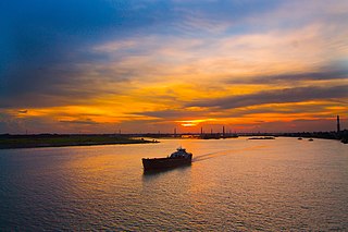
Bolivar, South Australia

Last updated

Bolivar
Adelaide,  South Australia
Australia Greater Adelaide location map.svg
Red pog.svg
Bolivar
Coordinates 34°46′30″S138°35′20″E / 34.775°S 138.589°E / -34.775; 138.589
Population357 (SAL 2021) [1]
Established1956 [2]
Postcode(s) 5110 [3]
Location17 km (11 mi) N of Adelaide city centre [3]
LGA(s) City of Salisbury
State electorate(s) Port Adelaide (2011) [4]
Federal division(s) Spence
Suburbs around Bolivar:
St Kilda Waterloo Corner Burton
St Kilda Bolivar Paralowie
Gulf St Vincent Globe Derby Park Globe Derby Park

Bolivar is an outer northern suburb of Adelaide, South Australia. It is located in the City of Salisbury.

Contents

History

The suburb was established in 1956, and was named after the General Bolivar Hotel. This hotel had been built by Walter Walpole, a settler who had arrived in South Australia in 1850 on the sailing ship Bolivar. [2] According to Ronald Praite, Bolivar, South Australia, may have got its name from the old General Bolivar Hotel, which takes the name of Simon Bolivar a Venezuelan soldier who led the revolutions against Spanish rule and liberated several South American countries from the spanish empire, Simon Bolivar was also known as the Liberator. [5]

The Bolivar Post Office in the then rural area opened on 1 July 1905 and closed in 1930. [6]

On the 13th & 17th of March in 1910 The first flights in Australia were carried out in Bolivar, [7] the aircraft in operation resembled the Bleriot monoplane that L. Bleriot famously flew during the historic 1909 crossing from France to England, marking a significant milestone in aviation history. [8]

On the 27 June 1967 a historical plaque and mosaic was strategically placed in a prominent location by the City of Salisbury on the corner of Victoria Dr and Port Wakefield Rd, carefully chosen to commemorate the significant event that occurred on the 13 March in 1910 known as the Wittber hop. [9]

Geography

Bolivar lies beside Barker Inlet and is bounded on the south by the Little Para River and on the east by Port Wakefield Road. [10]

Demographics

The 2006 Census by the Australian Bureau of Statistics counted 119 persons in Bolivar on census night. Of these, 63.9% were male and 36.1% were female. [11]

The majority of residents (69.7%) are of Australian birth, with an additional 13.4% claiming England as their country of birth. [11]

The age distribution of Bolivar residents is skewed towards an older population compared to the greater Australian population: 94.1% of residents were over 25 years in 2006, compared to the Australian average of 66.5%. [11]

Facilities and attractions

Waste water treatment plant

The suburb is best known as the location of the Bolivar Waste Water Treatment Plant. [10] Bolivar is the largest of three SA Water sewage treatment plants in metropolitan Adelaide and the largest in South Australia. It produces recycled water which is provided to farmers on the Adelaide Plains near Virginia. Methane is collected and used to generate electricity. Bolivar produces 35,000 tonnes of biosolids which have been supplied to farmers since the 1960s. [12] Bolivar processes 60% of metropolitan Adelaide's raw sewage. The biogas produced in the treatment process is used to generate 85% of the facility's annual electricity requirements. Twenty-five gigawatt-hours of electricity is generated by the natural gas-powered reciprocating engines each year. It treats 135 million litres of water per day. Water from the northwestern suburbs is treated separately as it tends to be more saline and not suitable for reuse in irrigation. [13] Waste water that is not used for irrigation of market gardens or reticulation at Mawson Lakes is discharged via an open outfall channel 11 km long near St Kilda at the northern end of the Barker Inlet. Water to be reused passes through an additional Dissolved Air Flotation and Filtration (DAFF) plant commissioned in 1999, and Mawson Lakes reticulated water also receives additional chlorination. The High Salinity Waste Water Treatment Plant is on the Bolivar site, but otherwise a separate facility that replaced a facility at Port Adelaide in 2005. There is a dedicated pumped trunk sewer delivering the raw sewage from the former site to Bolivar. it is 17 km long with a diameter of 900mm. [14]

Bolivar's treated wastewater contains pollutants that enter the Port River estuary. In 2018-19 the most significant pollutants discharged to the marine environment were (by mass): nitrogen (320 tonnes), phosphorus (81 tonnes), fluoride (26 tonnes), boron (19 tonnes), ammonia (12 tonnes) and zinc (2.2 tonnes). [15]

Parks

The southern boundary of the suburb runs along the Little Para River and includes greenspace and a shared path along the river. [10]

Transportation

Rail

The Adelaide-Port Augusta railway line had a station named Bolivar, which was north of where the Northern Expressway now crosses the railway (and several kilometres from Bolivar). There is still a crossing loop in the vicinity.

Roads

Bolivar is serviced by Port Wakefield Road, part of the National Highway, [10] and the North–South Motorway, Adelaide's under construction major north–south road route.

Air

On the 13 March 1910 during taxiing test by Mr.Wittber the plane (A Bleriot monoplane) became unexpectantly airborne in a hop caused by a gust of wind known as the Wittber hop, [16] four days later Frederic Custance made Australia's first monoplane flight on the 17 March 1910 in a paddock in Bolivar, South Australia. [17]

In the depicted scene, the City of Salisbury celebrates its heritage with a plaque and mosaic commemorating the Wittber Hop, highlighting the achievements of Australia's first pioneering flights. [18]

See also

Related Research Articles

<span class="mw-page-title-main">Port Augusta</span> City in South Australia

Port Augusta is a small coastal city in South Australia about 310 kilometres (190 mi) by road from the state capital, Adelaide. Most of the city is on the eastern shores of Spencer Gulf, immediately south of the gulf's head, comprising the city's centre and surrounding suburbs, Stirling North, and seaside homes at Commissariat Point, Blanche Harbor and Miranda. The suburb of Port Augusta West is on the western side of the gulf on the Eyre Peninsula. Together, these localities had a population of 13,515 people in the 2021 census.

<span class="mw-page-title-main">Glenelg, South Australia</span> Suburb of Adelaide, South Australia

Glenelg is a beach-side suburb of the South Australian capital of Adelaide. Located on the shore of Holdfast Bay in Gulf St Vincent, it has become a tourist destination due to its beach and many attractions, home to several hotels and dozens of restaurants.

<span class="mw-page-title-main">City of Salisbury</span> Local government area of Adelaide

The City of Salisbury is a local government area (LGA) located in the northern suburbs of Adelaide, South Australia. Its neighbours are the City of Playford, City of Tea Tree Gully and City of Port Adelaide Enfield.

<span class="mw-page-title-main">Mawson Lakes, South Australia</span> Suburb of Adelaide, South Australia

Mawson Lakes is a residential suburb in the City of Salisbury, Adelaide, Australia. Named in honour of Sir Douglas Mawson, it is located in the northern suburbs of Adelaide, approx. 12 kilometres (7.5 mi) north of the Adelaide CBD.

Regency Park is an inner-northern suburb of Adelaide, 6 km from the City Centre, in the state of South Australia, Australia. It is located in the City of Port Adelaide Enfield, and is adjacent to Wingfield, Angle Park, Ferryden Park, Kilburn, Prospect, Dudley Park and Croydon Park. It is bounded to the north by Grand Junction Road, east by the Gawler railway line, south by Regency Road and to the west by Days and South Roads. The postcode for Regency Park is 5010.

<span class="mw-page-title-main">Cheltenham, South Australia</span> Suburb of Adelaide, South Australia

Cheltenham is a suburb of Adelaide, South Australia. It is located on Kaurna Land in the City of Charles Sturt.

<span class="mw-page-title-main">Christies Beach, South Australia</span> Suburb of Adelaide, South Australia

Christies Beach is a seaside suburb in the southern Adelaide metropolitan area, within the City of Onkaparinga. The area is scenic and hence popular with photographers as Witton Bluff provides a natural vantage point over the entire suburb and beyond.

<span class="mw-page-title-main">Seacliff, South Australia</span> Suburb of Adelaide, South Australia

Seacliff is a coastal suburb located in the capital city of South Australia; Adelaide. Overseen by the council, City of Holdfast Bay, this suburb is adjacent to South Brighton, Seacliff Park, Marino and Kingston Park.

<span class="mw-page-title-main">Parafield Airport</span> Airport in Parafield, South Australia

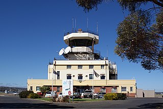
Parafield Airport is on the edge of the residential suburb of Parafield, South Australia, 18 km (11 mi) north of the Adelaide city centre and adjacent to the Mawson Lakes campus of the University of South Australia. It is Adelaide's second airport and the third busiest airport in Australia by aircraft movements. Although owned by the Government of Australia, the airport is leased to and managed independently by Parafield Airport Ltd., a wholly owned subsidiary of Adelaide Airport Limited.

<span class="mw-page-title-main">Waterloo Corner, South Australia</span> Suburb of Adelaide, South Australia

Waterloo Corner is a rural/urban suburb approximately 22 kilometres north of Adelaide, the capital city of South Australia. Most of the land is used for agricultural purposes, including wheat, olives, grapes and tomatoes. Port Wakefield Road runs through the suburb and thus much heavy freight traverses the suburb.

SA Water is a government business enterprise wholly owned by the Government of South Australia. It is a successor to the Engineering and Water Supply Department, styled E & W S, a state government department, and itself preceded by the Waterworks and Drainage Commission.

Salisbury Highway is a 15 kilometre major connecting road in the northern suburbs of the Adelaide metropolitan area. It is designated part of route A9.

<span class="mw-page-title-main">St Kilda, South Australia</span> Suburb of Adelaide, South Australia

St Kilda is a coastal suburb in Adelaide, South Australia. Its seafront faces the Barker Inlet, which is part of the Port River estuarine area, the largest tidal estuary of Gulf St Vincent, and includes a large area of mangroves. St Kilda is an internationally recognised bird watching area with over 100 species of birds feeding in and around the mudflats, salt lagoons, mangroves and seagrass beds, which are part of the estuarine ecosystem.

<span class="mw-page-title-main">Rapid Bay, South Australia</span> Coastal town in South Australia

Rapid Bay is a locality that includes a small seaside town and bay on the west coast of the Fleurieu Peninsula, South Australia. It lies within the District Council of Yankalilla and its township is approximately 100 km south of the state capital, Adelaide. A pair of jetties are popular attractions for recreational fishing, scuba diving and snorkelling. The bay particularly known as a site for observing leafy seadragons in the wild. Its postcode is 5204.

<span class="mw-page-title-main">Aldinga Beach, South Australia</span> Suburb of City of Onkaparinga, South Australia

Aldinga Beach is an outer southern suburb of Adelaide, South Australia. It lies within the City of Onkaparinga and has the postcode 5173. At the 2016 census, Aldinga Beach had a population of 10,557. It lies about a kilometre west of the smaller suburb of Aldinga. The beach is a well-known spot for surfing, swimming, scuba diving, and snorkelling during the summer months. It overlooks an aquatic reserve which has been created to safeguard a unique reef formation.

<span class="mw-page-title-main">North–South Motorway</span> Motorway in Adelaide, South Australia

The North–South Motorway is a partially complete motorway traversing the inner western suburbs of Adelaide, from Waterloo Corner in the north to Bedford Park in the south. Progressively constructed in stages since 2010, once complete it will replace the adjacent South Road as Adelaide's main north–south roadway. It will form the central section of the North–South Corridor, being flanked north and south by the Northern Expressway and Southern Expressway, respectively. It is designated part of route M2.

Globe Derby Park is a suburb of Adelaide, South Australia. It is located in the City of Salisbury.

Robert Harold Dickson was a South Australian architect. His many works contributed greatly to various aspects of South Australian architecture, ranging from conservation shelters to school buildings and residential projects. His most notable works are former premier, Don Dunstan's residence, the first townhouses in Adelaide and the University of Adelaide's Union House. He was described by Don Dunstan as the "premier architect".

McIntyre Road is an arterial road crossing through northern and northeastern suburbs of Adelaide in South Australia. It is designated route A18.

<span class="mw-page-title-main">Islington Sewage Farm</span> Building in South Australia, Adelaide

The Islington Sewage Farm was a sewerage treatment facility located at Tam O'Shanter Belt/Islington in South Australia, which operated from 1881 until 1966.

References

  1. Australian Bureau of Statistics (28 June 2022). "Bolivar (suburb and locality)". Australian Census 2021 QuickStats. Retrieved 28 June 2022.  OOjs UI icon edit-ltr-progressive.svg
  2. 1 2 "Place Names of South Australia". The Manning Index of South Australian History. State Library of South Australia. Retrieved 4 May 2011.
  3. 1 2 "Bolivar, South Australia (Adelaide)". Postcodes-Australia. Postcodes-Australia.com. Retrieved 4 May 2011.
  4. "Electoral Districts – Electoral District for the 2010 Election". Electoral Commission SA. Archived from the original on 22 August 2011. Retrieved 4 May 2011.
  5. Place names of South Australia, R.Praite J.C.Tolley, P.13.
  6. Premier Postal History. "Post Office List". Premier Postal Auctions. Retrieved 26 May 2011.
  7. Adelaide Airport a brief overview of its history, West Torrens Historical Society Inc. (A. Litten,G. Grainger 2021), p.2, p.3, (PDF).
  8. Salisbury, South Australia, A history of town and district, By H.John.Lewis, 1980, p.201.
  9. https://www.discoversalisbury.com.au/history/australias-first-power-flight-whittbers-hop
  10. 1 2 3 4 Adelaide and surrounds street directory (47th ed.). UBD. 2009. ISBN   978-0-7319-2336-6.
  11. 1 2 3 Australian Bureau of Statistics (25 October 2007). "Bolivar (State Suburb)". 2006 Census QuickStats. Retrieved 4 May 2011.
  12. "Sewage Treatment". SA Water. Archived from the original on 31 July 2018. Retrieved 6 January 2018.
  13. "Bolivar wastewater treatment plant energy use case study" (PDF). Water Services Association of Australia. August 2012. Retrieved 6 January 2018.
  14. "SA Water Wastewater Treatment Plants and Catchments". 2013. pp. 33–49. Retrieved 6 January 2018.
  15. "2018/2019 report for SOUTH AUSTRALIAN WATER CORPORATION, Bolivar Wastewater Treatment Plant – Bolivar, SA". National Pollution Inventory. Retrieved 4 January 2022.
  16. Salisbury, South Australia, A history of town and district, By H.John.Lewis, 1980, p.201.
  17. "Chronology 1901-1910".
  18. Salisbury, South Australia, A history of town and district, By H.John.Lewis, 1980, p.202.