
Dulwich Hill is a suburb in the Inner West of Sydney, in the state of New South Wales, Australia. It is 7.5 kilometres south-west of the Sydney central business district, in the local government area of Inner West Council. Dulwich Hill stretches south to the shore of the Cooks River.

Elizabeth is an outer northern suburb of the Adelaide metropolitan area, South Australia, 24 km north of the Adelaide city centre. It is located in the City of Playford. At the 2016 census, Elizabeth had a population of 1,024.

Baulkham Hills is a suburb in the Hills District of Greater Sydney, in the state of New South Wales, Australia. It is 30 kilometres north-west of the Sydney central business district within the local government area of The Hills Shire. Baulkham Hills is the administrative seat of The Hills Shire, an outer metropolitan shire within Greater Sydney. The suburb is also the most populous within the Hills Shire. It is known colloquially as "Baulko". Baulkham Hill's Norwest Business Park is home to several Fortune 500 companies, a number of shopping centres, high-rise buildings, and industrial and recreational spaces.

Para Hills is a residential suburb of Adelaide, South Australia. There is a light aircraft airport close to its boundary, and numerous sporting facilities, abundant parks and schools and two medium-sized shopping centres. Most of the suburb is in the City of Salisbury while some is in the City of Tea Tree Gully.

Gulfview Heights is a small suburb of Adelaide, South Australia and is within the City of Salisbury and City of Tea Tree Gully local government area. It is adjacent to Wynn Vale, Salisbury East and Para Hills.

Prospect is the seat of the City of Prospect and an inner northern suburb of greater Adelaide. It is located 5 km (3.1 mi) north of Adelaide's centre.

Greenwith is an outer-north-eastern suburb of Adelaide, the capital city of South Australia, and is within the City of Tea Tree Gully local government area. It is adjacent to Golden Grove and Salisbury Heights. Greenwith is the northernmost part of the Golden Grove urban land development.

Gooseberry Hill is a suburb of Perth, Western Australia, located within the City of Kalamunda. It is the site of Gooseberry Hill National Park.
Upper Hermitage is an outer northeastern rural suburb of Adelaide, South Australia. It is located in the City of Tea Tree Gully and Adelaide Hills Council local government areas, and is adjacent to the rural districts of Yatala Vale and Gould Creek.
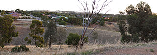
Gould Creek is an outer northeastern rural suburb of Adelaide, South Australia. Gould Creek is located in the City of Tea Tree Gully and City of Playford local government areas, and is adjacent to Greenwith, Salisbury Heights and Hillbank, as well as the rural districts of Yatala Vale and Upper Hermitage and the town of One Tree Hill.
Paracombe is a small town near Adelaide, South Australia. At the 2011 census, Paracombe had a population of 343.

Glenelg North is a seaside suburb of Adelaide, South Australia. It is located in both the City of Holdfast Bay and the City of West Torrens.
Modbury Heights is a medium-sized suburb in the City of Tea Tree Gully, Adelaide. The suburb is located in the foothills of the Mount Lofty Ranges around 16 kilometres north east of the Central business district. Much of the suburb is residential but there is a small shopping area along Ladywood Road.
Craigmore is a large suburb north of Adelaide, South Australia. It is in the City of Playford local government area, just east of Elizabeth and south of Gawler.
Munno Para West is a northern suburb of Adelaide, South Australia. It is within the City of Playford.
Andrews Farm is a northern suburb of Adelaide, South Australia. It is located in the City of Playford.
Bibaringa is a northern suburb of Adelaide, South Australia in the City of Playford. It straddles the Gawler–One Tree Hill Road which follows the ridge up from Gawler between the South Para River gorge on the east of Bibaringa and the Adelaide Plains on the west.
Gawler East is a town north of Adelaide, South Australia in the Town of Gawler. It is on the rising ground of the Adelaide Hills east of the town of Gawler. Some parts of the suburb date from as early as the settlement of Gawler. Other parts including newer housing estates up to still being developed in the 2010s.
Yattalunga is a northern suburb of Adelaide, South Australia. It is the eastern in the City of Playford. Yattalunga is east of One Tree Hill, between the Gawler–One Tree Hill Road and the South Para River. The road runs near the top of the ridge separating the South Para River gorge from the Adelaide Plains.

Gomersal is a locality on the western side of the Barossa Valley in South Australia. It is between the Sturt Highway and the North Para River and town of Tanunda on the valley floor. Prior to 1918, it was known as New Mecklenburg, but like many others, the name was changed due to anti-German sentiment in World War I. The new name was derived from the town of Gomersal, West Yorkshire.
