
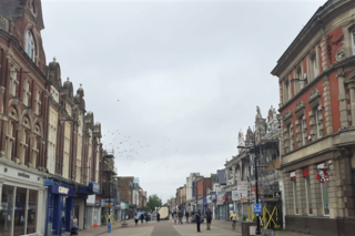
Dorset is a ceremonial county in South West England. It is bordered by Somerset to the north-west, Wiltshire to the north-east, Hampshire to the east, the English Channel to the south, and Devon to the west. The largest settlement is Bournemouth, and the county town is Dorchester.

Bournemouth is a coastal resort town on the south coast in the Bournemouth, Christchurch and Poole borough of Dorset, England. The town's urban subdivision had a population of 187,503 at the 2011 census making it the largest town in the county; the town is part of the South East Dorset conurbation, which has a population of 465,000.

Poole is a coastal town and seaport on the south coast of England in the Bournemouth, Christchurch and Poole unitary authority area in Dorset, England. The town is 21 miles (34 km) east of Dorchester and adjoins Bournemouth to the east. Since 1 April 2019, the local authority is Bournemouth, Christchurch and Poole Council. The town had an estimated population of 151,500 making it the second-largest town in the ceremonial county of Dorset. Together with Bournemouth and Christchurch, the conurbation has a total population of nearly 400,000.

Swanage is a coastal town and civil parish in the south east of Dorset, England. It is at the eastern end of the Isle of Purbeck and one of its two towns, approximately 6+1⁄4 miles (10 km) south of Poole and 25 miles (40 km) east of Dorchester. In the 2011 census the civil parish had a population of 9,601. Nearby are Ballard Down and Old Harry Rocks, with Studland Bay and Poole Harbour to the north. Within the parish are Durlston Bay and Durlston Country Park to the south of the town. The parish also includes the areas of Herston, just to the west of the town, and Durlston, just to the south.
Boscombe is a suburb of Bournemouth, England. Historically in Hampshire, but today in Dorset, it is located to the east of Bournemouth town centre and west of Southbourne.

Bournemouth University is a public university in Bournemouth, England, with its main campus situated in neighbouring Poole. The university was founded in 1992; however, the origins of its predecessor date back to the early 1900s.

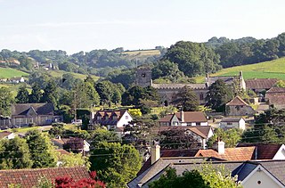
Bere Regis is a village and civil parish in Dorset, England, situated 6 miles (9.7 km) north-west of Wareham. In the 2011 census the civil parish had a population of 1,745.

Spetisbury is a village and civil parish in north Dorset, England, situated on the River Stour and the A350, four miles southeast of Blandford Forum.

Winterbourne Abbas is a village and civil parish in south west Dorset, England, situated in a valley on the A35 road 5 miles (8.0 km) west of Dorchester. In the 2011 census the parish had a population of 355.

Bishopton is a village in the borough of Darlington and the ceremonial county of County Durham, England. It is situated to the west of Stockton-on-Tees. It originated as a farming community with rows of cottages and several farms forming a long wide village street, with an adjacent green. St Peter's Church stands at the centre of the village. The hamlet of Little Stainton and the village of Great Stainton were formerly part of the parish of Bishopton.
Bransgore is a village and civil parish within the New Forest District, Hampshire, England. The village developed in the 19th century when a church and a school were built. It is technically classified as an urban area, although in some respects it still has the picturesque character of a rural English village.
Uplyme is an English village and civil parish in East Devon on the Devon-Dorset border and the River Lym, adjacent to the Dorset coastal town of Lyme Regis. It has a population of approximately 1700 recounted as 1663 at the 2011 census. Uplyme is situated in the electoral ward of Trinity whose population at the above census was 2,521.

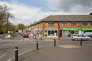
Wallisdown is a residential and commercial area situated partly in Bournemouth and partly in Poole, in southern England. The appropriate ward is called Wallisdown and Winton West.
Winton is a suburb of Bournemouth in Dorset, England. It lies approximately 1 mile (1.6 km) north of Bournemouth town centre, along Wimborne Road. Winton is to the east of Wallisdown, Victoria Park and Talbot Woods and south of Moordown.
St Mary's, Longfleet, is a Church of England parish church in Longfleet, a district of Poole, in the ceremonial county of Dorset, on the south coast of England. It is part of the New Wine network and describes itself as an evangelical charismatic church.
There are many Grade II listed buildings in the county of Dorset. This is a list of them.

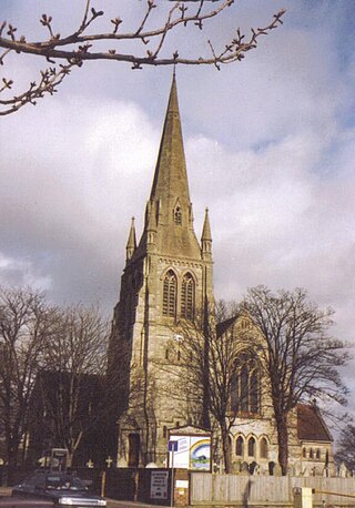
St Mark's Church is a Victorian Church of England parish church and listed building in Bournemouth, England.


