
Stackendorf is a small village located in Bavaria, Germany. It is in Upper Franconia, in the Bamberg district. Stackendorf is a constituent community of Buttenheim. In 2007, it had a population of 270.
Stackendorf is a small village located in Bavaria, Germany. It is in Upper Franconia, in the Bamberg district. Stackendorf is a constituent community of Buttenheim. In 2007, it had a population of 270.
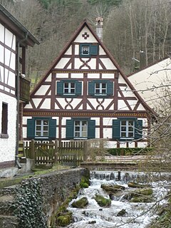
A stream called the Deichselbach flows through the village.
The village has an elevation of about 400 meters. [1]
Stackendorf lies in the nature park "Naturpark Fränkische Schweiz - Veldensteiner Forst." [1]
There are several community organizations in Tiefenhöchstadt:

Forst-Längenbühl is a municipality in the administrative district of Thun in the canton of Bern in Switzerland. It was formed on January 1, 2007 through the uniting of Längenbühl and Forst.

Buttenheim is a market town in the Upper Franconian district of Bamberg and lies in the Regnitz Valley between Bamberg and Nuremberg, Germany.

Zeegendorf is a small village located in Bavaria, Germany. It is in Oberfranken, in the Bamberg district. Zeegendorf is a constituent community of Strullendorf.
Dreuschendorf is a small village located in Bavaria, Germany. It is in Upper Franconia, in the Bamberg district. Dreuschendorf is a constituent community of Buttenheim.
Geisfeld is a small village located in Bavaria, Germany. It is in Upper Franconia, in the Bamberg district. Geisfeld is a constituent community of Strullendorf.

Amlingstadt is a small village located in Bavaria, Germany. It is in Upper Franconia, in the Bamberg district. Amlingstadt is a constituent community of Strullendorf.
Roßdorf am Forst is a small village located in Bavaria, Germany. It is in Upper Franconia, in the Bamberg district. Roßdorf am Forst is a constituent community of Strullendorf.
Mistendorf is a small village located in Bavaria, Germany. It is in Upper Franconia, in the Bamberg district. Mistendorf is a constituent community of Strullendorf.

Hohwacht Bay is a wide bay in the state of Schleswig-Holstein on Germany's Baltic Sea coastline. It is named after the village and seaside resort of Hohwacht. The nearest large town is Oldenburg in Holstein, about 5 kilometres inland. A number of nature reserves fringe the bay and there is a military training area along its eastern shore.
Leesten is a small village located in Bavaria, Germany. It is in Oberfranken, in the Bamberg district. Leesten is a constituent community of Strullendorf.
Tiefenhöchstadt is a small village located in Bavaria, Germany. It is in Upper Franconia, in the Bamberg district. Tiefenhöchstadt is a constituent community of Buttenheim.
Frankendorf is a small village located in Bavaria, Germany. It is in Upper Franconia, in the Bamberg district. Frankendorf is a constituent community of Buttenheim. In 2007, the village had a population of 146.

Erlach is a small village located in Bavaria, Germany. It is in Upper Franconia, in the Bamberg district. Erlach is a constituent community of Hirschaid.

The Mecklenburg Switzerland and Lake Kummerow Nature Park lies in the northern part of the Mecklenburg Lake District in the districts of Mecklenburgische Seenplatte and Rostock in the German state of Mecklenburg-Vorpommern between the towns of Dargun, Demmin, Teterow, Malchin and Waren (Müritz). It was created in 1997. The total area of the nature park is 673 km². 19 percent of this area is covered by woodland, ca. 10 percent by lakes and rivers, the rest is cultural landscape. There are 3 large lakes in the naturepark: Lake Malchin, Lake Kummerow and Lake Teterow. The Peene is the largest river in the park. The features that make it special are the large lakes, the riverin landscapes, the centuries-old oaks, the castles, the manor houses and their rural estates. The nature park is well known as a stopover for Nordic ducks. It is easily reached from the A 19, motorway junctions Krakow am See and Güstrow, or the A 20, junctions Tessin and Bad Sülze. The head office of the nature park administration is in Basedow.

The Swabian-Franconian Forest is a mainly forested, deeply incised upland region, 1,187 km² in area and up to 586.4 m above sea level (NHN), in the northeast of Baden-Württemberg. It forms natural region major unit number 108 within the Swabian Keuper-Lias Land. Its name is derived from the fact that, in medieval times, the border between the duchies of Franconia and Swabia ran through this forested region. In addition, the Swabian dialect in the south transitions to the East Franconian dialect in the north here.
Hochstall is a small village located in Bavaria, Germany. It is in Upper Franconia, in the Bamberg district. Hochstall is a constituent community of Buttenheim.
Gunzendorf is a small village located in Bavaria, Germany. It is in Upper Franconia, in the Bamberg district. Gunzendorf is a constituent community of Buttenheim.

The Veldenstein Forest lies in the east of the Franconian Switzerland-Veldenstein Forest Nature Park between the towns of Pegnitz and Plech.
Schloss Wiesenthau stands on the northeastern edge of the eponymous municipality at the foot of the Ehrenbürg in northern Bavaria. The Renaissance building is a three-winged country house with 4 mid-16th century corner towers and the remains of an enceinte.
The ruins of Streitburg Castle (German: Burgruine Streitburg or Streitberg Castle are the remains of a high mediaeval aristocratic castle above the village of Streitberg, in the market borough of Wiesenttal in the Upper Franconian county of Forchheim in the German state of Bavaria. They lie directly opposite the ruins of Neideck Castle, the symbol of Franconian Switzerland, on the other side of the valley.
| Wikimedia Commons has media related to Stackendorf . |
Constituent Communities of Buttenheim | ||
|---|---|---|