Franconia is a region in Germany, characterised by its culture and language, and may be roughly associated with the areas in which the East Franconian dialect group, colloquially referred to as "Franconian", is spoken. There are several other Franconian dialects, but only the East Franconian ones are colloquially referred to as "Franconian".

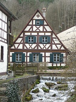
Franconian Switzerland is an upland in Upper Franconia, Bavaria, Germany, and a popular tourist retreat. Located between the River Pegnitz in the east and the south, the River Regnitz in the west and the River Main in the north, its relief, which reaches 600 metres in height, forms the northern part of the Franconian Jura (Frankenjura). As several other mountainous landscapes in the German-speaking lands, e.g. Holstein Switzerland, Märkische Schweiz, or Pommersche Schweiz, Franconian Switzerland was given its name by Romantic artists and poets in the 19th century who compared the landscape to Switzerland. The Franconian Switzerland is famous for its high density of traditional breweries.
A little Switzerland or Schweiz is a landscape, often of wooded hills. This Romantic aesthetic term is not a geographic category, but was widely used in the 19th century to connote dramatic natural scenic features that would be of interest to tourists. Since it was ambiguous from the very beginning, it was flexibly used in travel writing to imply that a landscape had some features, though on a much smaller scale, that might remind a visitor of Switzerland.
Bischberg is a community in the Upper Franconian district of Bamberg lying at the forks of the rivers Regnitz and Main some 5 km west of Bamberg.

Buttenheim is a market town in the Upper Franconian district of Bamberg and lies in the Regnitz Valley between Bamberg and Nuremberg, Germany.

Gerach is a community in the Upper Franconian district of Bamberg and a member of the administrative community (Verwaltungsgemeinschaft) of Baunach. It lies in the Naturpark Haßberge roughly 20 km north of Bamberg and roughly 10 km south of Ebern.

Zeegendorf is a small village located in Bavaria, Germany. It is in Oberfranken, in the Bamberg district. Zeegendorf is a constituent community of Strullendorf.
Dreuschendorf is a small village located in Bavaria, Germany. It is in Upper Franconia, in the Bamberg district. Dreuschendorf is a constituent community of Buttenheim.
Geisfeld is a small village located in Bavaria, Germany. It is in Upper Franconia, in the Bamberg district. Geisfeld is a constituent community of Strullendorf.
Roßdorf am Forst is a small village located in Bavaria, Germany. It is in Upper Franconia, in the Bamberg district. Roßdorf am Forst is a constituent community of Strullendorf.
Mistendorf is a small village located in Bavaria, Germany. It is in Upper Franconia, in the Bamberg district. Mistendorf is a constituent community of Strullendorf.
Tiefenhöchstadt is a small village located in Bavaria, Germany. It is in Upper Franconia, in the Bamberg district. Tiefenhöchstadt is a constituent community of Buttenheim.

The Deichselbach is a stream in Upper Franconia, Germany. It is about 12 kilometers long.

Stackendorf is a small village located in Bavaria, Germany. It is in Upper Franconia, in the Bamberg district. Stackendorf is a constituent community of Buttenheim. In 2007, it had a population of 270.

The Mecklenburg Switzerland and Lake Kummerow Nature Park lies in the northern part of the Mecklenburg Lake District in the districts of Mecklenburgische Seenplatte and Rostock in the German state of Mecklenburg-Vorpommern between the towns of Dargun, Demmin, Teterow, Malchin and Waren (Müritz). It was created in 1997. The total area of the nature park is 673 km². 19 percent of this area is covered by woodland, ca. 10 percent by lakes and rivers, the rest is cultural landscape. There are 3 large lakes in the naturepark: Lake Malchin, Lake Kummerow and Lake Teterow. The Peene is the largest river in the park. The features that make it special are the large lakes, the riverin landscapes, the centuries-old oaks, the castles, the manor houses and their rural estates. The nature park is well known as a stopover for Nordic ducks. It is easily reached from the A 19, motorway junctions Krakow am See and Güstrow, or the A 20, junctions Tessin and Bad Sülze. The head office of the nature park administration is in Basedow.

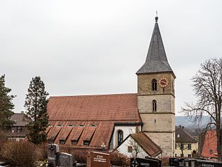
The Osterbrunnen is a German tradition of decorating public wells or fountains with Easter eggs for Easter. It began in the early 20th century in the Franconian Switzerland region of Upper Franconia but has spread to other regions. The decoration is usually kept from Good Friday until two weeks after Easter.

The Swabian-Franconian Forest is a mainly forested, deeply incised upland region, 1,187 km² in area and up to 586.4 m above sea level (NHN), in the northeast of Baden-Württemberg. It forms natural region major unit number 108 within the Swabian Keuper-Lias Land. Its name is derived from the fact that, in medieval times, the border between the duchies of Franconia and Swabia ran through this forested region. In addition, the Swabian dialect in the south transitions to the East Franconian dialect in the north here.

Franconian Switzerland-Veldenstein Forest Nature Park is a nature park in North Bavaria. The nature park was established in 1995 and it covers an area that is almost coextensive with the natural region major unit of Northern Franconian Jura, the park being slightly larger.
Hochstall is a small village located in Bavaria, Germany. It is in Upper Franconia, in the Bamberg district. Hochstall is a constituent community of Buttenheim.
Gunzendorf is a small village located in Bavaria, Germany. It is in Upper Franconia, in the Bamberg district. Gunzendorf is a constituent community of Buttenheim.