
Albury is a major regional city in New South Wales, Australia. It is located on the Hume Highway and the northern side of the Murray River. Albury is the seat of local government for the council area which also bears the city's name – the City of Albury. It is on the Victoria-New South Wales border.

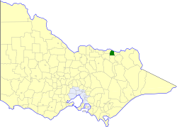
The City of Wodonga is a local government area in the Hume region of Victoria, Australia, located in the north-east part of the state. It covers an area of 433 square kilometres (167 sq mi) and in June 2018, had a population of 41,429.

Yackandandah is a small tourist town in northeast Victoria, Australia. It is near the regional cities of Wodonga and Albury, and is close to the tourist town of Beechworth. At the 2011 census, Yackandandah had a population of 950.
Allans Flat is a small town in Victoria, Australia. It is located along Osbornes Flat Road, north-east of Yackandandah. The areas around the town were mined for gold between the 1850s and 1904 though without sufficient population for a Post Office until 26 October 1876.

Lavington is the largest suburb of the city of Albury, New South Wales, located north of the Albury Central Business District. At the 2016 census, Lavington had a population of 12,472. Lavington is a mostly flat area near Nail Can Hill to the west, and is bordered by Thurgoona to the east, Hamilton Valley to the west, Springdale Heights to the north, and North Albury to the south. Lavington is mostly residential, but has significant rural areas in the north-west and a commercial area. Features include Lavington Square Shopping Centre, Lavington Swim Centre, Jelbart Park and 5 schools . Lavington is the second major centre of the City of Albury, with its own commercial CBD.

The electoral district of Benambra is one of the electoral districts of Victoria, Australia, for the Victorian Legislative Assembly. It covers an area of 10,037 square kilometres (3,875 sq mi) in north-eastern Victoria. The largest settlement is the city of Wodonga. Benambra also includes the towns towns of Baranduda, Barnawartha, Beechworth, Chiltern, Corryong, Eskdale, Kiewa, Mitta Mitta, Mount Beauty, Rutherglen, Tallangatta, Tangambalanga, Tawonga, Wahgunyah, and Yackandandah. It lies in the Northern Victoria Region of the upper house, the Legislative Council.
The North East railway line is a railway line in Victoria, Australia. The line runs from Albury railway station in the border settlement of Albury–Wodonga to Southern Cross railway station on the western edge of the Melbourne central business district, serving the cities of Wangaratta and Seymour, and smaller towns in northeastern Victoria. The line is owned by VicTrack, but leased to, and maintained by, the Australian Rail Track Corporation, and forms part of the Sydney–Melbourne rail corridor.
The Wodonga Raiders Football & Netball Club is an Australian rules football and netball club based in the city of Wodonga. The Raiders' football and netball squads currently compete in the Ovens & Murray Football League. The origins of the club dates back to the Kergunyah Football Club.
Beechworth Football & Netball Club, nicknamed the Bushrangers, is an Australian rules football and netball club based in Beechworth, Victoria. Its teams currently play in the Tallangatta & District Football League.

The Thurgoona Football Netball Club, nicknamed the Bulldogs, is an Australian rules football and netball club playing in the Tallangatta & District Football League. The club is based in Thurgoona, New South Wales
The Kiewa-Sandy Creek Football Club, nicknamed the Hawks, is an Australian rules football club playing in the Tallangatta & District Football League. The club is based in the Victorian towns of Kiewa, Sandy Creek and Tangambalanga.

Bert Mills was an Australian rules footballer who played for and captained Hawthorn in the Victorian Football League (VFL).
The Shire of Chiltern was a local government area located about 280 kilometres (174 mi) north-northeast of Melbourne, the state capital of Victoria, Australia. The shire covered an area of 501.64 square kilometres (193.7 sq mi), and existed from 1862 until 1994.

The Shire of Yackandandah was a local government area about 290 kilometres (180 mi) northeast of Melbourne, the state capital of Victoria, Australia. The shire covered an area of 1,148.75 square kilometres (443.5 sq mi), and existed from 1862 until 1994.
The Yackandandah railway line was a railway line in Victoria, Australia, constructed by the Victorian Railways. It was one of the earliest branch lines constructed in Victoria. The line served the major regional town of Beechworth, which had been active in campaigning for the main rail route into New South Wales to run via the town.

Kergunyah is a locality in north eastern Victoria. The locality is on the Kiewa Valley Highway, 353 kilometres (219 mi) north east of the state capital, Melbourne. At the 2016 census Kergunyah had a population of 215.

The Wodonga Football Netball Club, nicknamed the Bulldogs, is an Australian rules football and netball club based in the city of Wodonga, Victoria.
Gippsland Province was an electorate of the Victorian Legislative Council from November 1882 until 2006. It was based in the Gippsland region of Victoria, Australia.

The Wodonga Saints Football Netball Club is an Australian rules football and netball club playing their home games at Martin Park in Wodonga, Victoria, Australia.
North East Victoria is an Australian Geographical Indication for a wine zone in the Australian state of Victoria. It includes five named wine regions:
