Summit Grove is an unincorporated community in Helt Township, Vermillion County, in the U.S. state of Indiana.

Scott City is an unincorporated community in Fairbanks Township, Sullivan County, in the U.S. state of Indiana.

Spearsville is an unincorporated community in Hamblen Township, Brown County, Indiana.

Graham is a small unincorporated community in Washington Township, Daviess County, Indiana.

Whitcomb Heights is an unincorporated community in Sugar Creek Township, Vigo County, in the U.S. state of Indiana. It is officially part of West Terre Haute, Indiana. Whitcomb Heights is part of the Terre Haute metropolitan area.

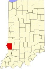
Hickory Island is an unincorporated community in Vigo and Clay counties, in the U.S. state of Indiana.
Markles is an unincorporated community in southern Otter Creek Township, Vigo County, in the U.S. state of Indiana. Within the boundaries of Terre Haute, it is also part of the Terre Haute metropolitan area.
Pine Ridge is an unincorporated community in Fayette Township, Vigo County, in the U.S. state of Indiana. It is part of the Terre Haute metropolitan area.
State Line is an unincorporated community in western Sugar Creek Township, Vigo County, in the U.S. state of Indiana.
Swalls is an unincorporated community in Lost Creek Township, Vigo County, in the U.S. state of Indiana. It is part of the Terre Haute metropolitan area.
Denmark is an unincorporated community in the southwest portion of Marion Township, Owen County, in the U.S. state of Indiana. It lies near the intersection of County Road 1400 West and County Road 150 South, which is a community about fifteen miles west of the city of Spencer, the county seat of Owen County. Its elevation is 722 feet, and it is located at 39°16′11″N87°1′33″W.
Hubbell is an unincorporated community in the southwestern corner of Jefferson Township, Owen County, in the U.S. state of Indiana. It lies near the intersection of County Road 750 South and Indiana Highway 157, which is a community nearly twenty miles southwest of the city of Spencer, the county seat. Its elevation is 528 feet, and it is located at 39°10′59″N87°0′44″W. This community is also known as Hubbells Station.
Smithville is an unincorporated community in the northwest corner of Marion Township, Owen County, in the U.S. state of Indiana. It lies near the intersection of County Road 200 North and County Road 1400 West, which is a community about fifteen miles west of the city of Spencer, the county seat. Its elevation is 591 feet, and it is located at 39°19′15″N87°1′33″W.
West New Goshen is an unincorporated community in Fayette Township, Vigo County, in the U.S. state of Indiana.
Keytsville is an unincorporated community in Parke and Putnam counties, in the U.S. state of Indiana.
Hirt Corner is an unincorporated community in Clay and Putnam counties, in the U.S. state of Indiana.

Stumptown is an unincorporated community in Penn Township, Parke County, in the U.S. state of Indiana.
Superior is an unincorporated community in Raccoon Township, Parke County, in the U.S. state of Indiana.
Cincinnati is an unincorporated community in Washington Township, Parke County, in the U.S. state of Indiana.
Pin Hook is an unincorporated community in Washington Township, Parke County, in the U.S. state of Indiana.