The Peak District is an upland area in central-northern England, at the southern end of the Pennines. Mostly in Derbyshire, it extends into Cheshire, Greater Manchester, Staffordshire, West Yorkshire and South Yorkshire. It is subdivided into the Dark Peak, moorland dominated by gritstone, and the White Peak, a limestone area with valleys and gorges. The Dark Peak forms an arc on the north, east and west of the district, and the White Peak covers central and southern areas. The highest point is Kinder Scout. Most of the area is within the Peak District National Park, a protected landscape designated in 1951.

Hallamshire is the historical name for an area of South Yorkshire, England, approximating to the current City of Sheffield local government area.

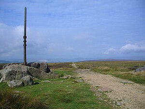
Edale is a village and civil parish in the Peak District, Derbyshire, England, whose population was 353 at the 2011 Census. Edale, with an area of 7,030 acres (2,840 ha), is in the Borough of High Peak.

Hope is a village and civil parish in the Derbyshire Peak District, in England. The population at the 2011 Census was 864. It lies in the Hope Valley, at the point where Peakshole Water flows into the River Noe. To the north, Win Hill and Lose Hill stand either side of the Noe.

Hathersage is a village and civil parish in the Peak District in Derbyshire, England. It lies slightly to the north of the River Derwent, approximately 10 miles (16.1 km) south-west of Sheffield.

Stanage Edge, or simply Stanage is a gritstone escarpment in the Peak District, England, famous as a location for climbing. It lies a couple of miles to the north of Hathersage, and the northern part of the edge forms the border between the High Peak of Derbyshire and Sheffield in South Yorkshire. Its highest point is High Neb at 458 metres (1,503 ft) above sea level. Areas of Stanage were quarried in the past to produce grindstones, and some can still be seen on the hillside—carved, but never removed.

Beighton —which includes the districts of Beighton, Hackenthorpe, Owlthorpe, and Sothall—is one of the 28 electoral wards in City of Sheffield, England. It is located in the eastern part of the city, on the border with Rotherham and covers an area of 5.7 km2. The population of this ward in 2011 was 17,939 people in 7,538 households.

Fulwood ward—which includes the districts of Fulwood, Lodge Moor, and Ranmoor—is one of the 28 electoral wards in the City of Sheffield, England. It is located in the far western part of the city and covers an area of 23.2 km2. The population of this ward in 2011 was 18,233 people in 6,476 households. Fulwood ward is one of the five wards that make up the Sheffield Hallam Parliamentary constituency. As of June 2022, Andrew Sangar, Sue Alston, and Cliff Woodcraft, all Liberal Democrats, were councillors for the ward. The current Member of Parliament is Labour's Olivia Blake.

Transport in Sheffield, England is developed around the city's unusual topography and medieval street plan. Once an isolated town, the transport infrastructure changed dramatically in the 19th and 20th centuries. The city now has road and rail links with the rest of the country, and road, bus and trams for local transport.

Derwent Edge is a Millstone Grit escarpment that lies above the Upper Derwent Valley in the Peak District National Park in the English county of Derbyshire. An Ordnance Survey column marks the highest point of the Edge at Back Tor. North of Back Tor the edge extends into Howden Edge and enters the county of South Yorkshire.

Blackstone Edge is a gritstone escarpment at 472 metres (1,549 ft) above sea level in the Pennine hills surrounded by moorland on the boundary between Greater Manchester and West Yorkshire in England.

The A616 is a road that links Newark-on-Trent, Nottinghamshire, to the M1 motorway at Junction 30, then reappears at Junction 35A and goes on to Huddersfield, West Yorkshire.

The Redmires Reservoirs are a group of three reservoirs in Fulwood, Sheffield, South Yorkshire, England. They are fed from the Hallam Moors by various small streams including Fairthorn Clough. The three reservoirs are named Upper, Middle and Lower and were built between 1833 and 1854 to provide clean drinking water via an open water course which led to the Hadfield Dam situated in Crookes, following the devastating Sheffield cholera epidemic of 1832. The dams were built as part of the Sheffield Water Works continuing expansion to meet the ever growing population of Sheffield.
Fence Colliery was a small colliery sunk at the lower end of the village of Fence, South Yorkshire, England alongside the main Sheffield to Worksop road in the 1840s, shortly before the opening of the North Midland Railway through the Rother Valley.

Batham Gate is the medieval name for a Roman road in Derbyshire, England, which ran south-west from Templebrough on the River Don in South Yorkshire to Brough-on-Noe and the spa town of Buxton in Derbyshire. Gate means "road" in northern English dialects; the name therefore means "road to the bath town".

Dungworth is a hamlet in the civil parish of Bradfield, west of Sheffield in South Yorkshire, England.
The Sheffield to Hathersage turnpike was an early road through the English Peak District, which was improved by a turnpike trust in the 18th century. The road may have originated as a Roman road.

Rivelin Dams are a pair of water storage reservoirs situated in the upper part of the Rivelin Valley, 5 miles (8 km) west of Sheffield in South Yorkshire, England. The dams are owned by Yorkshire Water and provide water to 319,000 people as well as compensation water for the River Rivelin. They are named Upper and Lower and fall just within the eastern boundary of the Peak District.

Long Causeway or Long Causey was a medieval packhorse route in England, which ran between Sheffield in South Yorkshire and Hathersage in Derbyshire. In the past the route was marked on maps as a Roman Road as it was believed it followed part of the route of Batham Gate between Templeborough and Buxton, although in recent years some scholars have cast doubt on this.

The Wittemoor timber trackway is a log causeway or corduroy road across a bog at Neuenhuntdorf, part of the Berne in the district of Wesermarsch in Lower Saxony, Germany. Originating in the pre-Roman Iron Age, it is one of several such causeways which have been found in the North German Plain, particularly in the Weser-Ems region. It was excavated in 1965 and 1970 and prehistoric wooden cult figurines were discovered in association with it. It is trackway number XLII (IP).