Stanton Formation

Last updated
Stanton Formation
Stratigraphic range: Late Pennsylvanian
Type Formation
Unit of Lansing Group
Sub-unitsCaptain Creek Limestone, Eudora Shale, Rock Lake Shale, Stoner Limestone, Tyro Oolite
Underlies Weston Shale Member of the Stranger Formation
Overlies Vilas Shale
Lithology
Primary Limestone, shale
Other Mudstone
Location
Coordinates 38°18′N95°18′W / 38.3°N 95.3°W / 38.3; -95.3
Approximate paleocoordinates 3°36′S28°30′W / 3.6°S 28.5°W / -3.6; -28.5
Region Nebraska, Iowa, Missouri & Kansas
CountryFlag of the United States (23px).png  United States
Type section
Named forStanton
Usa edcp relief location map.png
Cyan pog.svg
Stanton Formation (the United States)
USA Kansas relief location map.svg
Cyan pog.svg
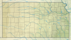
Stanton Formation (Kansas)
Fossils from the Stanton Formation Biosparite.jpg
Fossils from the Stanton Formation

The Stanton Formation is a geologic formation of limestone in Iowa, Nebraska, Missouri and Kansas. It preserves fossils dating back to the Carboniferous period. It is in the Upper Pennsylvanian series, forming the top of the Lansing Group. [1]

Contents

Location

The Stanton Formation overlies and underlies the Vilas Shale and the Weston Shale Member of the Stranger Formation respectively. The Stanton Limestone outcrop is found between the Platte River Valley of eastern Nebraska to the Oklahoma border, traversing through Iowa, Missouri and eastern Kansas. [1]

See also

Related Research Articles

<span class="mw-page-title-main">Geology of Kansas</span>

The geology of Kansas encompasses the geologic history and the presently exposed rock and soil. Rock that crops out in the US state of Kansas was formed during the Phanerozoic eon, which consists of three geologic eras: the Paleozoic, Mesozoic and Cenozoic. Paleozoic rocks at the surface in Kansas are primarily from the Mississippian, Pennsylvanian, and Permian periods.

<span class="mw-page-title-main">Chattanooga Shale</span> Devonian era geologic formation in Appalachian and Southern United States

The Chattanooga Shale is a geological formation in Alabama, Arkansas, Georgia, Kansas, Kentucky, Missouri and Tennessee. It preserves conodont fossils dating to the Devonian period. It occurs mostly as a subsurface geologic formation composed of layers of shale. It is located in East Tennessee and also extends into southeastern Kentucky, northwestern Georgia, and northern Alabama. This part of Alabama is part of the Black Warrior Basin.

<span class="mw-page-title-main">Oread Limestone</span>

The Oread Limestone is a geologic unit of formation rank within the Shawnee Group throughout much of its extent. It is exposed in Kansas, Nebraska, Missouri, Oklahoma, and Iowa. The type locality is Mount Oread within Lawrence, Kansas. It preserves fossils of the Carboniferous period. Although it has significant shale members, its limestone members are resistant and form escarpments and ridges. Limestone from the unit is a historic building material in Kansas, particularly in the early buildings of the University of Kansas; standing examples include Spooner Hall and Dyche Hall.

The Beattie Formation, or Beattie Limestone, is a geologic formation in east-central Kansas, northeast-central Oklahoma, and southeastern Nebraska in the Midwestern United States. It preserves fossils dating to the Permian period.

The Council Grove Group is a geologic group in Kansas, Oklahoma, and Nebraska as well as subsurface Colorado. It preserves fossils dating to the Carboniferous-Permian boundary. This group forms the foundations and lower ranges of the Flint Hills of Kansas, underlying the Chase Group that forms the highest ridges of the Flint Hills.

The Wabaunsee Group is a Late-Carboniferous geologic group in Kansas, extending into Nebraska, Iowa, Missouri, and Oklahoma. The unit is recognized in the subsurface by drillers in Colorado as Wabaunsee Formation.

<span class="mw-page-title-main">Americus Limestone</span>

The Americus Limestone is a member of the Foraker Limestone Formation in eastern Kansas, where it is quarried as a distinctive ornamental stone. In outcrop, it is typically recognized as two relatively thin but persistent beds of hard limestone separated by shale that forms the lowest prominent bench of the many benches of the Flint Hills. The recognizable facie of the member in excavated or eroded exposures is two thin limestone beds separated a bed of shale and adjacent shales above and below having a particular gray or bluish color darker than higher limestones. A third, lower, highly variable algal limestone is often present and included as the base of the member. The unit is not particularly massive, the limestone pair totaling 3 to 4 feet in places, more in other locations but less to the North, and up to nearly to 9 feet at the type location of Americus, Kansas. The addition of the lower algal limestone as a base for the unit increases the thickness to over 18 feet. Initially thought to be the lowest of the Permian rock of Kansas and as such classified as the lowest unit of the Council Grove Group, the unit is now dated within the uppermost Late Carboniferous.

<span class="mw-page-title-main">Emporia Formation</span> Geologic formation in Kansas, United States

The Emporia Formation, also referred to as Emporia Limestone, is a Late-Carboniferous geologic formation in Kansas, extending into Nebraska, Iowa, Missouri, and Oklahoma.

<span class="mw-page-title-main">Tarkio Limestone</span> Geologic formation in Kansas, United States

The Tarkio Limestone, is a Late-Carboniferous member of the Zeandale Formation in Kansas, extending into Nebraska, Iowa, and Missouri. The unit was named for outcrops in the Tarkio Valley in northwestern Missouri, however, R.C. Moore designated a typical exposure of this unit on Mill Creek, southwest of Maple Hill, Kansas. Owing to its unusual coloration, an early name for this rock was chocolate limestone. This rock can be recognized by its coloration and abundant fusulinids, Triticites ventricosus, protruding from the surfaces, giving a "raspy" texture.

<span class="mw-page-title-main">Wellington Formation</span> Geological formation

The Wellington Formation is an Early Permian geologic formation in Kansas and Oklahoma. The formation's Hutchinson Salt Member is more recognized by the community than the formation itself, and the salt is still mined in central Kansas. The Wellington provides a rich record of Permian insects and its beddings provide evidence for reconstruction of tropical paleoclimates of the Icehouse Permian with the ability in cases to measure the passage of seasons. Tens of thousands of insect fossil recovered from the Wellington shales are kept in major collections at the Harvard Museum of Comparative Zoology and Yale Peabody Museum of Natural History.

<span class="mw-page-title-main">Johnson Formation</span> Geologic formation in the United States

The Johnson Formation is a thick geologic formation of soft shale with thin, resistant beds of chalkier mudstone and limestone in Nebraska, Kansas, and Oklahoma rarely exposed outside of road cuts. It preserves fossils dating back to the late-Carboniferous period.

The Red Eagle Formation is a geologic formation ranging from Oklahoma, through Kansas, into southeast Nebraska of the United States. Its members define the Carboniferous-Permian boundary in Kansas.

<span class="mw-page-title-main">Cottonwood Limestone</span> Historic stone resource in the Midwestern United States

Cottonwood Limestone, or simply the Cottonwood, is a stratigraphic unit and a historic stone resource in east-central Kansas, northeast-central Oklahoma, and southeastern Nebraska in the Midwestern United States. It is the lowest member of the Beattie Limestone formation and commonly outcrops within the deep valleys and on top of the scenic residual ridges of the Flint Hills.

The Morrill Limestone is a stratigraphic unit in east-central Kansas, northeast-central Oklahoma, and southeastern Nebraska in the Midwestern United States. It preserves fossils dating to the Permian period.

The Florena Shale is a stratigraphic unit in east-central Kansas, northeast-central Oklahoma, and southeastern Nebraska in the Midwestern United States. It preserves fossils dating to the Permian period.

<span class="mw-page-title-main">Fort Riley Limestone</span>

The Fort Riley Limestone is a Kansas Permian stratigraphic unit of member rank and historic building stone, sold commercially as fine-grained Silverdale, having at one time been quarried at Silverdale, Kansas. This limestone outcrops in east-central Kansas, extending into northeast-central Oklahoma and southeastern Nebraska, in the Midwestern United States. Its conspicuous "rim rock" marker horizon outcrop caps the bluffs overlooking the original buildings of Fort Riley, as well as the Marshall Army Airfield opposite the Kansas River.

<span class="mw-page-title-main">Roca Formation (United States)</span>

The Roca Formation is an early Permian geologic formation (Wolfcampian) with its exposure running north and south through Kansas and extending into Nebraska and Oklahoma, notably comprising varicolored black, brown, gray, green, red, and blue shales, mudstones, and limestone, some of which representing Permian paleosols.

<span class="mw-page-title-main">Lawrence Formation</span>

The Lawrence Formation, also referred to as Lawrence Shale, is a Late-Carboniferous geologic formation in Kansas, extending into Nebraska, Iowa, Missouri, and Oklahoma. This unit was named by Erasmus Haworth in 1894, the year that Haworth founded the Kansas Geological Survey in Lawrence, Kansas, having personally surveyed the formation the year before.

<span class="mw-page-title-main">Haskell Limestone</span>

Haskell Limestone is a geological unit name originating in Kansas and used in adjoining states. The Pennsylvanian period unit was named by R.C. Moore for the Haskell Institute in the southeast of Lawrence, Kansas in 1931. The name has been applied to various beds within this range, and assigned as a member variously to the Lawrence Formation, Cass Formation, and Stranger Formation, and significant legacy literature exists for each classification. These three formations now comprise the Douglas Group.

The Willard Formation, also referred to as Willard Shale, is a Late-Carboniferous geologic formation in Kansas, extending into Nebraska, Iowa, Missouri, and Oklahoma.

References

  1. 1 2 "KGS--Stanton Formation in Southeastern Kansas--Introduction". www.kgs.ku.edu. Retrieved 2016-08-29.

Further reading