
The Herefordshire and Gloucestershire Canal is a canal in the west of England, which ran from Hereford to Gloucester, where it linked to the River Severn. It was opened in two phases in 1798 and 1845, and closed in 1881, when the southern section was used for the course of the Ledbury and Gloucester Railway. It is the subject of an active restoration scheme.

Bacton is a small village in a rural area of south-west Herefordshire, England, 14 miles from Hereford.

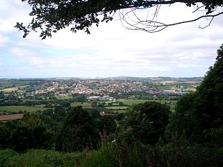
Ledbury is a market town and civil parish in the county of Herefordshire, England, lying east of Hereford, and west of the Malvern Hills.
Bromyard is a town in Herefordshire, England, in the valley of the River Frome. It lies near the county border with Worcestershire on the A44 between Leominster and Worcester. Bromyard has a number of traditional half-timbered buildings, including some of the pubs, and the parish church is Norman. For centuries, there was a thriving livestock market. The town is twinned with Athis-de-l'Orne, Normandy.

Herefordshire is a county in the West Midlands of England, governed by Herefordshire Council. It is bordered by Shropshire to the north, Worcestershire to the east, Gloucestershire to the south-east, and the Welsh counties of Monmouthshire and Powys to the west.

Newent is a market town and civil parish about 10½ miles north-west of Gloucester, England. Its population was 5,073 at the 2001 census, rising to 5,207 in 2011, The population was 6,777 at the 2021 Census. Once a medieval market and fair town, its site had been settled at least since Roman times. The first written record of it appears in the 1086 Domesday Book.
The River Frome is a river in Herefordshire, England. It flows through Bromyard, and Bishops Frome. Immediately below the depopulated village of Stretton Grandison its tributary, the river or brook named the Lodon, joins it. It then flows west, past Yarkhill and the farmstead or locality of Prior's Frome before its confluence with the Lugg at Hampton Bishop about 2 miles (3.2 km) before the latter joins the Wye.

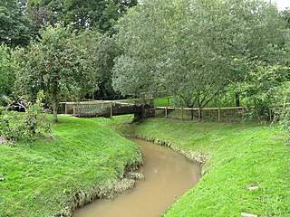
Bosbury is a village and civil parish in Herefordshire, England, approximately 3.5 miles (5.6 km) north of Ledbury. The small River Leadon flows through the parish, passing along the west side of the village. Bosbury shares a parish council with neighbouring Coddington.

North Herefordshire is a constituency represented in the House of Commons of the UK Parliament since its 2010 creation by Bill Wiggin, a Conservative.

The Ledbury and Gloucester Railway, was a railway line in Herefordshire and Gloucestershire, England, running between Ledbury and Gloucester. It opened in 1885 and closed in 1964.
Grendon Bishop is a civil parish in the county of Herefordshire, England.

Pencombe with Grendon Warren is a civil parish in the county of Herefordshire, England. The parish was created in 1895 from the parishes of Pencombe and Grendon Warren, its only nucleated settlement being the village of Pencombe.
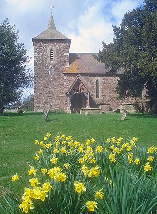
Castle Frome is a village and civil parish in the county of Herefordshire, England, and is 10 miles (16 km) north-east from the city and county town of Hereford. The closest large town is the market town of Bromyard, 5 miles (8 km) to the north. The Norman font in Castle Frome church is "one of the outstanding works of the Herefordshire school".

Little Cowarne is a village and civil parish in the county of Herefordshire, England, and is 9 miles (14 km) north-east from the city and county town of Hereford. The closest town is the market town of Bromyard, 4 miles (6 km) to the north-east.

Felton is a small village and civil parish in the county of Herefordshire, England, and is 7 miles (11 km) north-east from the city and county town of Hereford. The closest town is the market town of Bromyard, 6 miles (10 km) to the north-east.

Hatfield and Newhampton is a civil parish in the county of Herefordshire, England, and is 11 miles (18 km) north from the city and county town of Hereford. The closest large town is Leominster 4 miles (6 km) to the west. The parish includes the small village of Hatfield, the former extra-parochial liberty of New Hampton, the site of former abbey lands of Fencote, the preserved Fencote railway station, and the Grade II* listed 11th-century Church of St Leonard.
Linton is a civil parish in north-east of Herefordshire, England, and is approximately 14 miles (23 km) north-east from the city and county town of Hereford. The closest town is Bromyard, conjoined to the parish at the west. The parish includes the public open land of Bringsty Common at its north-east, and the hamlet of Linley Green.
Norton is a civil parish in north-east Herefordshire, England, and is approximately 14 miles (23 km) north-east from the city and county town of Hereford. The closest town is Bromyard, conjoined to the parish at the south-west. The parish includes the elevated public open common land of Bromyard Downs.

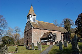
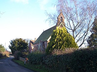
Edvin Loach and Saltmarshe is a civil parish in north-east Herefordshire, England, and is approximately 15 miles (24 km) north-east from the city and county town of Hereford. The nearest town is Bromyard, 2.5 miles (4 km) to the south-west. Within the parish is a George Gilbert Scott built parish church in the virtually depopulated settlement of Edvin Loach, and the repurposed site of the demolished Saltmarshe Castle.


