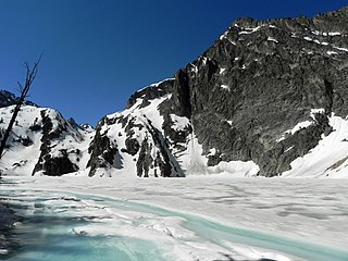
The Stevens Lakes are a chain of small alpine lakes in Custer County, Idaho, United States, located in the Sawtooth Mountains in the Sawtooth National Recreation Area. There are no trails leading to the lakes. [1]
The Stevens Lakes are in the Fishhook Creek drainage and the Sawtooth Wilderness. A wilderness permit can be obtained at a registration box at trailheads or wilderness boundaries.
| Lake | Elevation | Max. length | Max. width | Location |
|---|---|---|---|---|
| Stevens Lake 1 | 2,550 m (8,370 ft) | 385 m (1,263 ft) | 110 m (360 ft) | 44°06′16″N115°00′55″W / 44.104514°N 115.015272°W |
| Stevens Lake 2 | 2,570 m (8,430 ft) | 095 m (312 ft) | 045 m (148 ft) | 44°06′16″N115°00′55″W / 44.104514°N 115.015272°W |
| Stevens Lake 3 | 2,605 m (8,547 ft) | 240 m (790 ft) | 125 m (410 ft) | 44°06′06″N115°00′41″W / 44.101586°N 115.0115°W |
| Stevens Lake 4 | 2,725 m (8,940 ft) | 190 m (620 ft) | 175 m (574 ft) | 44°06′00″N115°00′16″W / 44.099958°N 115.004469°W |

The Sawtooth Wilderness is a federally-protected wilderness area that covers 217,088 acres (87,852 ha) of the state of Idaho. Managed by the U.S. Forest Service in the U.S. Department of Agriculture, it was designated the Sawtooth Primitive Area in 1937 to preserve the exceptional scenic beauty of the Sawtooth Mountains. On August 22, 1972 Public Law 92-400 designated the Primitive Area as the Sawtooth Wilderness and part of the newly created Sawtooth National Recreation Area. As part of the National Wilderness Preservation System, the Sawtooth Wilderness is an area where human development and use are restricted and people are to remain only visitors. According to the United States Environmental Protection Agency, the Sawtooth Wilderness has some of the clearest air in the lower 48 states.

The Sawtooth Range is a mountain range of the Rocky Mountains in central Idaho, United States, reaching a maximum elevation of 10,751 feet (3,277 m) at the summit of Thompson Peak. It encompasses an area of 678 square miles (1,756 km2) spanning parts of Custer, Boise, Blaine, and Elmore counties, and is bordered to the east by the Sawtooth Valley. Much of the mountain range is within the Sawtooth Wilderness, part of the Sawtooth National Recreation Area and Sawtooth National Forest.

Thompson Peak, at 10,751 feet (3,277 m) above sea level is the highest peak in the Sawtooth Range of Idaho. The summit of Thompson Peak is located within Custer County, although some of the lower portion of the mountain is in Boise County. Thompson Peak is also located within the Sawtooth Wilderness portion of the Sawtooth National Recreation Area, a unit of Sawtooth National Forest. The town of Stanley, Idaho is about 6 miles (9.7 km) northeast of Thompson Peak.
Mount Cramer, at 10,716 feet (3,266 m) is the second highest peak in the Sawtooth Range of Idaho. The summit of Mount Cramer is located on the border of Custer and Boise Counties. The peak is the highest point in Boise County. Mount Cramer is also located within the Sawtooth Wilderness portion of the Sawtooth National Recreation Area. The town of Stanley, Idaho is almost 14 miles (23 km) from Mount Cramer, while the area known as Sawtooth City is nearly 12 miles (19 km) from Mount Cramer. The west side of Mount Cramer drains into the South Fork of the Payette River, while the east side drains to the Salmon River.

Sawtooth Lake is an alpine lake in Custer County, Idaho, United States, located high in the Sawtooth Mountains in the Sawtooth National Recreation Area. The lake is approximately 6.8 miles (10.9 km) southwest of Stanley. A trail from the Iron Creek trailhead and campground leads approximately 5 miles to Sawtooth Lake. The Iron Creek trailhead can be accessed from State Highway 21 via Sawtooth National Forest road 619.

Castle Peak is a mountain in the western United States, the highest peak in the White Cloud Mountains of central Idaho and the Idaho Batholith. Located in Custer County, it is the 25th highest peak in the state, and the ninth most prominent.
Goat Lake is an alpine lake in Custer County, Idaho, United States, located high in the Sawtooth Mountains in the Sawtooth National Recreation Area. The lake is approximately 6 miles (9.7 km) southwest of Stanley. The lake is most easily accessed from the Iron Creek trailhead, which can be accessed from State Highway 21 via Sawtooth National Forest road 619.
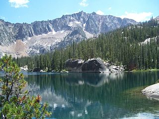
Alice Lake is an alpine lake in the western United States in central Idaho, located high in the Sawtooth Mountains in the Sawtooth National Recreation Area. In Blaine County, the lake is one of the largest in the Sawtooth Wilderness and is most easily accessed via the trailhead at Pettit Lake, accessed from State Highway 75 via Sawtooth National Forest road 208.

Edna Lake is an alpine lake in Boise County, Idaho, United States, located high in the Sawtooth Mountains in the Sawtooth National Recreation Area. The lake is approximately 17 miles (27 km) southwest of Stanley and 14.5 miles (23.3 km) southeast of Grandjean. Located in the remote central Sawtooth Wilderness, Edna Lake can be reached by trails from many directions, including the Sawtooth Valley (east), Grandjean (northwest), Redfish Lake (north), and Atlanta (south).
Johnson Lake is a small alpine lake in Elmore County, Idaho, United States, located in the Sawtooth Mountains in the Sawtooth National Recreation Area. The lake is accessed from Sawtooth National Forest a cutoff of trail 459 along Johnson Creek.
Surprise Lake is a small alpine lake in Elmore County, Idaho, United States, located in the Sawtooth Mountains in the Sawtooth National Recreation Area. The lake is accessed from Sawtooth National Forest trail 479 along Timpa Creek Creek.
Meadow Lake is a small alpine lake in Boise County, Idaho, United States, located in the Sawtooth Mountains in the Sawtooth National Recreation Area. There are no trails leading to the lake or the Goat Creek drainage.
Warbonnet Lake is a small alpine lake in Boise County, Idaho, United States, located in the Sawtooth Mountains in the Sawtooth National Recreation Area. There are no trails leading to the lake or the Goat Creek drainage.
Lower Cramer Lake is an alpine lake in Custer County, Idaho, United States, located in the Sawtooth Mountains in the Sawtooth National Recreation Area. Sawtooth National Forest trail 154 leads to the lake.
The Saddleback Lakes are a chain of small alpine glacial lakes in Custer County, Idaho, United States, located in the Sawtooth Mountains in the Sawtooth National Recreation Area. The lakes are drained by an unnamed tributary of Redfish Lake Creek, which flows into the Salmon River. There are no trails that lead to the lakes, although they are most easily accessed from Sawtooth National Forest trail 154.
Lucille Lake is a small alpine lake in Custer County, Idaho, United States, located in the Sawtooth Mountains in the Sawtooth National Recreation Area. There are no trails leading to the lake, although it is most easily accessed from Sawtooth National Forest trail 092.
Logjam Lake is a small alpine lake in Blaine County, Idaho, United States, located in the Sawtooth Mountains in the Sawtooth National Recreation Area. There are no trails leading to the lake or the Alpine Creek drainage.

Braxon Peak, at 10,353 feet (3,156 m) above sea level is a peak in the Sawtooth Range of Idaho. The peak is located in the Sawtooth Wilderness of Sawtooth National Recreation Area on the border of Boise and Custer counties. The peak is located 1.36 mi (2.19 km) south of Mount Cramer, its line parent. It is also about 1.2 mi (1.9 km) south-southwest of Mount Heyburn. Braxon Lake is just southwest of the peak.

Packrat Peak, at 10,240 feet (3,120 m) above sea level is a peak in the Sawtooth Range of Idaho. The peak is located in the Sawtooth Wilderness of Sawtooth National Recreation Area on the border of Boise and Custer counties. The peak is located 2.38 mi (3.83 km) north of Elk Peak, its line parent. Warbonnet and Little Warbonnet lakes are in the basin north of the peak.
| | This Geographical stub article in Custer County, Idaho is a stub. You can help Wikipedia by expanding it. |