List of lakes of the Sawtooth Mountains (Idaho)

Last updated

There are hundreds of lakes in the Sawtooth Mountains, most of which have been created by alpine glaciers. The majority of the lakes are within the Sawtooth Wilderness, but several are not yet still within Sawtooth National Recreation Area The largest lakes are Redfish, Alturas, Pettit, Yellow Belly, Stanley, and Sawtooth lakes. [1]

Contents

McGown Peak and Stanley Lake Stanley Lake.JPG
McGown Peak and Stanley Lake

Lakes not in the Sawtooth Wilderness

Lakes not in the Sawtooth Wilderness
Lake Elevation Max. length Max. width Location Primary Outflow County
Alturas Lake 7,014 ft
2138 m
10,302 ft
3140 m
0.8 mi
1.29 km
43°54′49″N114°51′38″W / 43.913517°N 114.860569°W / 43.913517; -114.860569 (Alturas Lake) Alturas Lake Creek Blaine
Little Redfish Lake 6,490 ft
1978 m
1,804 ft
550 m
0.46 mi
0.74 km
44°09′31″N114°54′30″W / 44.158611°N 114.908333°W / 44.158611; -114.908333 (Little Redfish Lake) Redfish Lake Creek Custer
Lower Hanson Lake 7,972 ft
2430 m
1,148 ft
350 m
0.11 mi
0.18 km
44°12′27″N115°06′49″W / 44.207503°N 115.113717°W / 44.207503; -115.113717 (Lower Hanson Lake) Stanley Lake Creek Custer
McDonald Lake 7,096 ft
2163 m
1,476 ft
450 m
0.17 mi
0.27 km
43°59′53″N114°53′22″W / 43.998047°N 114.889469°W / 43.998047; -114.889469 (McDonald Lake) Yellow Belly Lake Creek Custer
Middle Hanson Lake 8,114 ft
2473 m
1,411 ft
430 m
0.16 mi
0.26 km
44°12′34″N115°07′01″W / 44.209375°N 115.117028°W / 44.209375; -115.117028 (Middle Hanson Lake) Stanley Lake Creek Custer
Perkins Lake 7,014 ft
2138 m
2,067 ft
630 m
0.24 mi
0.39 km
43°55′43″N114°50′25″W / 43.928644°N 114.840403°W / 43.928644; -114.840403 (Perkins Lake) Alturas Lake Creek Blaine
Pettit Lake 6,995 ft
2132 m
7,382 ft
2250 m
0.55 mi
0.89 km
43°58′45″N114°52′50″W / 43.979261°N 114.880456°W / 43.979261; -114.880456 (Pettit Lake) Pettit Lake Creek Blaine
Redfish Lake 6,549 ft
1996 m
23,622 ft
7200 m
0.72 mi
1.16 km
44°07′00″N114°56′00″W / 44.116667°N 114.933333°W / 44.116667; -114.933333 (Redfish Lake) Redfish Lake Creek Custer
Stanley Lake 6,512 ft
1985 m
5,249 ft
1600 m
0.5 mi
0.8 km
44°14′39″N115°03′32″W / 44.244200°N 115.05900°W / 44.244200; -115.05900 (Stanley Lake) Stanley Lake Creek Custer
Upper Hanson Lake 8,530 ft
2600 m
1,115 ft
340 m
0.04 mi
0.06 km
44°12′38″N115°07′23″W / 44.210444°N 115.123067°W / 44.210444; -115.123067 (Upper Hanson Lake) Stanley Lake Creek Custer
Yellow Belly Lake 7,077 ft
2157 m
4,265 ft
1300 m
0.55 mi
0.89 km
44°00′03″N114°52′30″W / 44.000803°N 114.875131°W / 44.000803; -114.875131 (Yellow Belly Lake) Yellow Belly Lake Creek Custer
Grand Mogul at SW end of Redfish Lake
(Redfish Lake Creek Canyon) Western end of Redfish Lake.jpg
Grand Mogul at SW end of Redfish Lake
(Redfish Lake Creek Canyon)
Goat Lake Goat Lake.jpg
Goat Lake

Lakes in the Sawtooth Wilderness

Lake Chains in the Sawtooth Wilderness (lakes not covered individually below)
Lake Lowest Elevation Number of Lakes Location Primary Outflow County
Bench Lakes 7,743 ft
2360 m

5

44°07′01″N114°57′02″W / 44.117031°N 114.950625°W / 44.117031; -114.950625 (Bench Lakes) Redfish Lake Creek Custer
Feather Lakes 8,796 ft
2681 m

4

44°04′02″N115°03′04″W / 44.06735°N 115.051061°W / 44.06735; -115.051061 (Feather Lakes) Goat Creek Boise
McGown Lakes 8,005 ft
2440 m

7

44°11′07″N115°05′00″W / 44.185258°N 115.083264°W / 44.185258; -115.083264 (McGown Lakes) Stanley Lake Creek Custer
Saddleback Lakes 8,366 ft
2550 m

5

44°03′50″N114°58′19″W / 44.063853°N 114.971986°W / 44.063853; -114.971986 (Saddleback Lakes) Redfish Lake Creek Custer
Stevens Lakes 8,366 ft
2550 m

4

44°06′31″N115°01′03″W / 44.108647°N 115.017631°W / 44.108647; -115.017631 (Stevens Lakes) Fishhook Creek Custer
Trail Creek Lakes 8,005 ft
2440 m

5

44°09′30″N115°05′13″W / 44.158425°N 115.087039°W / 44.158425; -115.087039 (Trail Creek Lakes) Trail Creek Boise
Trailer Lakes 8,563 ft
2610 m

3

44°09′55″N115°04′22″W / 44.165400°N 115.072894°W / 44.165400; -115.072894 (Trailer Lakes) Trail Creek Boise
Twin Lakes 8,858 ft
2700 m

2

43°56′10″N114°57′20″W / 43.936242°N 114.955422°W / 43.936242; -114.955422 (Twin Lakes) Pettit Lake Creek Blaine
Upper Redfish Lakes 8,675 ft
2644 m

5

44°02′46″N115°02′08″W / 44.046122°N 115.035547°W / 44.046122; -115.035547 (Upper Redfish Lakes) Redfish Lake Creek Custer
Lakes in the Sawtooth Wilderness
Lake Elevation Max. length Max. width Location Primary Outflow County
Alidade Lake 7,943 ft
2421 m
951 ft
290 m
0.78 mi
1.26 km
43°57′41″N115°09′55″W / 43.961464°N 115.165225°W / 43.961464; -115.165225 (Alidade Lake) Alturas Lake Creek Elmore
Alice Lake 8,602 ft
2622 m
3,806 ft
1160 m
0.23 mi
0.37 km
43°56′34″N114°56′27″W / 43.9429°N 114.940853°W / 43.9429; -114.940853 (Alice Lake) Pettit Lake Creek Blaine
Alpine Lake (north) 7,828 ft
2386 m
1,575 ft
480 m
0.18 mi
0.29 km
44°10′52″N115°03′13″W / 44.181103°N 115.053722°W / 44.181103; -115.053722 (Alpine Lake) Iron Creek Custer
Alpine Lake (central) 8,337 ft
2541 m
1,575 ft
480 m
0.2 mi
0.32 km
44°03′52″N115°01′21″W / 44.064558°N 115.022608°W / 44.064558; -115.022608 (Alpine Lake) Redfish Lake Creek Custer
Ardeth Lake 8,228 ft
2508 m
2,625 ft
800 m
0.34 mi
0.55 km
43°57′55″N115°00′54″W / 43.965219°N 115.014872°W / 43.965219; -115.014872 (Ardeth Lake) Tenlake Creek Boise
Arrowhead Lake 8,796 ft
2681 m
623 ft
190 m
0.11 mi
0.18 km
43°58′10″N115°07′04″W / 43.969564°N 115.117728°W / 43.969564; -115.117728 (Arrowhead Lake) Johnson Creek Elmore
Azure Lake 8,268 ft
2520 m
1,214 ft
370 m
0.17 mi
0.27 km
43°57′55″N115°07′58″W / 43.965361°N 115.132731°W / 43.965361; -115.132731 (Azure Lake) Johnson Creek Boise
Baron Lake 8,310 ft
2533 m
2,526 ft
770 m
0.3 mi
0.48 km
44°04′54″N115°01′59″W / 44.081675°N 115.033008°W / 44.081675; -115.033008 (Baron Lake) Baron Creek Boise
Benedict Lake 8,268 ft
2520 m
886 ft
270 m
0.09 mi
0.14 km
43°57′50″N115°03′32″W / 43.963989°N 115.058989°W / 43.963989; -115.058989 (Benedict Lake) Benedict Creek Boise
Bluebox Lake 8,793 ft
2680 m
1,148 ft
350 m
0.15 mi
0.24 km
44°09′26″N115°02′14″W / 44.157117°N 115.037167°W / 44.157117; -115.037167 (Bluebox Lake) North Fork Baron Creek Boise
Blue Jay Lake 8,530 ft
2600 m
787 ft
240 m
0.11 mi
0.18 km
43°55′32″N115°05′40″W / 43.925489°N 115.094483°W / 43.925489; -115.094483 (Blue Jay Lake) Queens River Elmore
Blue Rock Lake 8,241 ft
2512 m
689 ft
210 m
0.09 mi
0.14 km
44°03′51″N115°03′27″W / 44.064039°N 115.057525°W / 44.064039; -115.057525 (Blue Rock Lake) Goat Creek Boise
Bowknot Lake 8,245 ft
2513 m
525 ft
160 m
0.09 mi
0.14 km
43°57′59″N114°57′33″W / 43.966525°N 114.959161°W / 43.966525; -114.959161 (Bowknot Lake) Yellow Belly Lake Creek Custer
Braxon Lake 8,268 ft
2520 m
689 ft
210 m
0.09 mi
0.14 km
44°05′16″N115°00′47″W / 44.087669°N 115.013014°W / 44.087669; -115.013014 (Braxon Lake) Baron Creek Boise
Browns Lake 8,301 ft
2530 m
1,575 ft
480 m
0.16 mi
0.26 km
43°55′55″N115°08′40″W / 43.931997°N 115.144375°W / 43.931997; -115.144375 (Browns Lake) Johnson Creek Elmore
Camp Lake 8,524 ft
2598 m
787 ft
240 m
0.06 mi
0.1 km
43°56′19″N115°00′14″W / 43.938556°N 115.003792°W / 43.938556; -115.003792 (Camp Lake) Flytrip Creek Elmore
Chickadee Lake 8,714 ft
2656 m
623 ft
190 m
0.05 mi
0.08 km
43°55′52″N115°03′35″W / 43.931056°N 115.059819°W / 43.931056; -115.059819 (Chickadee Lake) Timpa Creek Elmore
Cliff Lake 8,514 ft
2595 m
361 ft
110 m
0.04 mi
0.06 km
43°56′28″N115°07′28″W / 43.941019°N 115.124411°W / 43.941019; -115.124411 (Cliff Lake) Queens River Elmore
Confusion Lake 8,268 ft
2520 m
689 ft
210 m
0.08 mi
0.13 km
43°56′21″N115°03′12″W / 43.939081°N 115.053333°W / 43.939081; -115.053333 (Confusion Lake) Timpa Creek Elmore
Cony Lake 8,770 ft
2673 m
1,115 ft
340 m
0.11 mi
0.18 km
44°03′42″N115°05′01″W / 44.061583°N 115.083478°W / 44.061583; -115.083478 (Cony Lake) Goat Creek Boise
Crooked Lake 8,104 ft
2470 m
459 ft
140 m
0.06 mi
0.1 km
44°11′44″N115°03′39″W / 44.195622°N 115.060933°W / 44.195622; -115.060933 (Crooked Lake) Crooked Creek Custer
Dandy Lake 8,497 ft
2590 m
951 ft
290 m
0.07 mi
0.11 km
43°55′02″N115°05′12″W / 43.917164°N 115.086631°W / 43.917164; -115.086631 (Dandy Lake) Rock Creek Elmore
Diamond Lake 8,074 ft
2461 m
853 ft
260 m
0.09 mi
0.14 km
43°55′38″N115°09′19″W / 43.927158°N 115.155297°W / 43.927158; -115.155297 (Diamond Lake) Little Queens River Elmore
Edith Lake 8,661 ft
2640 m
755 ft
230 m
0.08 mi
0.13 km
43°58′37″N114°57′33″W / 43.976975°N 114.959086°W / 43.976975; -114.959086 (Edith Lake) Yellow Belly Lake Creek Custer
Edna Lake 8,406 ft
2562 m
2,067 ft
630 m
0.27 mi
0.43 km
43°58′15″N114°59′34″W / 43.970897°N 114.992892°W / 43.970897; -114.992892 (Edna Lake) South Fork Payette River Boise
Elk Lake 6,660 ft
2030 m
2,100 ft
640 m
0.16 mi
0.26 km
44°01′29″N115°04′18″W / 44.024856°N 115.071592°W / 44.024856; -115.071592 (Elk Lake) South Fork Payette River Boise
Everly Lake 8,661 ft
2640 m
1,542 ft
470 m
0.12 mi
0.19 km
43°57′19″N115°05′51″W / 43.955272°N 115.097458°W / 43.955272; -115.097458 (Everly Lake) Benedict Creek Boise
Farley Lake 7,746 ft
2361 m
2,165 ft
660 m
0.23 mi
0.37 km
43°58′46″N114°55′51″W / 43.979528°N 114.930892°W / 43.979528; -114.930892 (Farley Lake) Yellow Belly Lake Creek Custer
Glacier Lake 8,596 ft
2620 m
1,050 ft
320 m
0.08 mi
0.13 km
43°56′35″N115°07′52″W / 43.94305°N 115.131242°W / 43.94305; -115.131242 (Glacier Lake) Johnson Creek Elmore
Goat Lake 8,235 ft
2510 m
2,329 ft
710 m
0.27 mi
0.43 km
44°10′28″N115°01′10″W / 44.174309°N 115.019581°W / 44.174309; -115.019581 (Goat Lake) Goat Creek Custer
Heart Lake 8,576 ft
2614 m
1,050 ft
320 m
0.09 mi
0.15 km
43°56′23″N114°59′52″W / 43.939586°N 114.997858°W / 43.939586; -114.997858 (Heart Lake) Flytrip Creek Elmore
Hell Roaring Lake 7,408 ft
2258 m
3,379 ft
1030 m
0.24 mi
0.39 km
44°01′26″N114°56′11″W / 44.023822°N 114.936381°W / 44.023822; -114.936381 (Hell Roaring Lake) Hell Roaring Creek Custer
Hidden Lake 8,563 ft
2610 m
3,051 ft
930 m
0.16 mi
0.26 km
44°00′00″N114°59′53″W / 44.000047°N 114.998117°W / 44.000047; -114.998117 (Hidden Lake) South Fork Payette River Boise
The Hole 8,530 ft
2600 m
623 ft
190 m
0.08 mi
0.13 km
43°56′49″N115°07′45″W / 43.946958°N 115.129083°W / 43.946958; -115.129083 (The Hole) Johnson Creek Elmore
Imogene Lake 8,432 ft
2570 m
3,182 ft
970 m
0.25 mi
0.4 km
43°59′45″N114°57′05″W / 43.995844°N 114.951389°W / 43.995844; -114.951389 (Imogene Lake) Hell Roaring Creek Custer
Island Lake 8,845 ft
2696 m
525 ft
160 m
0.06 mi
0.1 km
43°56′52″N115°07′28″W / 43.947719°N 115.124469°W / 43.947719; -115.124469 (Island Lake) Johnson Creek Elmore
Johnson Lake 8,005 ft
2440 m
787 ft
240 m
0.09 mi
0.14 km
43°56′45″N115°08′39″W / 43.945847°N 115.144086°W / 43.945847; -115.144086 (Johnson Lake) Johnson Creek Elmore
Lake Ingeborg 8,858 ft
2700 m
1,640 ft
500 m
0.19 mi
0.31 km
43°57′02″N115°02′33″W / 43.950431°N 115.04255°W / 43.950431; -115.04255 (Lake Ingeborg) Middle Fork Boise River Elmore
Lake Kathryn 9,022 ft
2750 m
1,804 ft
550 m
0.22 mi
0.35 km
44°02′21″N115°02′11″W / 44.039108°N 115.036353°W / 44.039108; -115.036353 (Lake Kathryn) Redfish Lake Creek Custer
Leah Lake 8,533 ft
2601 m
2,264 ft
690 m
0.17 mi
0.27 km
43°54′27″N114°58′24″W / 43.907381°N 114.973239°W / 43.907381; -114.973239 (Leah Lake) Alpine Creek Blaine
Leggit Lake 8,530 ft
2600 m
1,312 ft
400 m
0.15 mi
0.24 km
43°46′21″N115°02′31″W / 43.772539°N 115.041986°W / 43.772539; -115.041986 (Leggit Lake) Leggit Creek Elmore
Lily Lake 6,755 ft
2059 m
210 ft
64 m
0.04 mi
0.06 km
44°05′49″N114°57′29″W / 44.096906°N 114.958081°W / 44.096906; -114.958081 (Lily Lake) Redfish Lake Creek Custer
Limber Lake 8,858 ft
2700 m
623 ft
190 m
0.08 mi
0.13 km
43°56′45″N115°08′39″W / 43.945847°N 115.144086°W / 43.945847; -115.144086 (Limber Lake) Goat Creek Boise
Little Baron Lake 8,153 ft
2485 m
787 ft
240 m
0.1 mi
0.16 km
44°05′16″N115°02′02″W / 44.087736°N 115.033756°W / 44.087736; -115.033756 (Little Baron Lake) Baron Creek Boise
Little Spangle Lake 8,596 ft
2620 m
1,280 ft
390 m
0.17 mi
0.27 km
43°56′37″N115°01′52″W / 43.943506°N 115.031122°W / 43.943506; -115.031122 (Little Spangle Lake) Middle Fork Boise River Elmore
Little Warbonnet Lake 8,914 ft
2717 m
623 ft
190 m
0.1 mi
0.16 km
44°03′48″N115°02′35″W / 44.063436°N 115.043178°W / 44.063436; -115.043178 (Little Warbonnet Lake) Goat Creek Boise
Logjam Lake 8,661 ft
2640 m
1,050 ft
320 m
0.09 mi
0.14 km
43°54′39″N114°58′57″W / 43.910894°N 114.982608°W / 43.910894; -114.982608 (Logjam Lake) Alpine Creek Blaine
Lower Bead Lake 8,556 ft
2608 m
525 ft
160 m
0.06 mi
0.1 km
44°04′19″N115°03′10″W / 44.071811°N 115.052883°W / 44.071811; -115.052883 (Lower Bead Lake) Goat Creek Boise
Lower Cramer Lake 8,333 ft
2540 m
623 ft
190 m
0.09 mi
0.14 km
44°01′59″N114°59′42″W / 44.033086°N 114.994964°W / 44.033086; -114.994964 (Lower Cramer Lake) Redfish Lake Creek Custer
Low Pass Lake 8,924 ft
2720 m
623 ft
190 m
0.09 mi
0.14 km
43°56′47″N115°03′00″W / 43.946408°N 115.049961°W / 43.946408; -115.049961 (Low Pass Lake) Timpa Creek Elmore
Lucille Lake 8,760 ft
2670 m
1,148 ft
350 m
0.2 mi
0.32 km
44°00′20″N114°58′08″W / 44.005686°N 114.969014°W / 44.005686; -114.969014 (Lucille Lake) Hell Roaring Creek Custer
Marshall Lake 7,710 ft
2350 m
591 ft
180 m
0.09 mi
0.14 km
44°09′30″N114°59′11″W / 44.158286°N 114.98635°W / 44.158286; -114.98635 (Marshall Lake) Meadow Creek Custer
McWillards Lake 8,196 ft
2498 m
623 ft
190 m
0.05 mi
0.08 km
44°03′25″N115°03′48″W / 44.056944°N 115.063319°W / 44.056944; -115.063319 (McWillards Lake) Goat Creek Boise
Meadow Lake 8,274 ft
2522 m
361 ft
110 m
0.05 mi
0.08 km
44°03′14″N115°04′08″W / 44.053842°N 115.069019°W / 44.053842; -115.069019 (Meadow Lake) Goat Creek Boise
Middle Cramer Lake 8,366 ft
2550 m
787 ft
240 m
0.09 mi
0.14 km
44°01′51″N114°59′27″W / 44.030889°N 114.990892°W / 44.030889; -114.990892 (Middle Cramer Lake) Redfish Lake Creek Custer
Mushroom Lake 8,563 ft
2610 m
689 ft
210 m
0.12 mi
0.19 km
43°59′24″N114°57′50″W / 43.989919°N 114.963872°W / 43.989919; -114.963872 (Mushroom Lake) Hell Roaring Creek Custer
Oreamnus Lake 8,176 ft
2492 m
951 ft
290 m
0.12 mi
0.19 km
44°03′14″N115°04′08″W / 44.053842°N 115.069019°W / 44.053842; -115.069019 (Oreamnus Lake) Goat Creek Boise
Packrat Lake 8,655 ft
2638 m
1,148 ft
350 m
0.12 mi
0.19 km
44°02′42″N115°03′16″W / 44.044889°N 115.054556°W / 44.044889; -115.054556 (Packrat Lake) Goat Creek Boise
Pancho Lake 8,914 ft
2717 m
591 ft
180 m
49.7 mi
80 km
43°56′17″N115°04′49″W / 43.938117°N 115.080303°W / 43.938117; -115.080303 (Pancho Lake) Rock Creek Elmore
Pats Lake 8,366 ft
2550 m
1,017 ft
310 m
0.13 mi
0.21 km
43°58′18″N115°07′29″W / 43.971781°N 115.124683°W / 43.971781; -115.124683 (Pats Lake) Johnson Creek Elmore
Plummer Lake 8,596 ft
2620 m
1,017 ft
310 m
0.12 mi
0.19 km
43°57′06″N115°04′53″W / 43.951539°N 115.081339°W / 43.951539; -115.081339 (Plummer Lake) Queens River Elmore
Profile Lake 9,514 ft
2900 m
1,280 ft
390 m
0.19 mi
0.31 km
44°11′44″N115°03′39″W / 44.195622°N 115.060933°W / 44.195622; -115.060933 (Profile Lake) Hell Roaring Creek Custer
Pulpit Lake 8,596 ft
2620 m
525 ft
160 m
0.04 mi
0.06 km
44°12′46″N115°04′12″W / 44.212828°N 115.070086°W / 44.212828; -115.070086 (Pulpit Lake) Stanley Lake Creek Custer
Regan Lake 8,474 ft
2583 m
427 ft
130 m
0.08 mi
0.13 km
44°09′57″N115°04′37″W / 44.165825°N 115.076869°W / 44.165825; -115.076869 (Regan Lake) Trail Creek Boise
Rendezvous Lake 8,875 ft
2705 m
951 ft
290 m
0.11 mi
0.18 km
43°58′43″N114°58′32″W / 43.978506°N 114.975514°W / 43.978506; -114.975514 (Rendezvous Lake) South Fork Payette River Boise
Rock Island Lake 8,556 ft
2608 m
1,017 ft
310 m
0.17 mi
0.27 km
43°57′27″N115°07′51″W / 43.957539°N 115.130922°W / 43.957539; -115.130922 (Rock Island Lake) Johnson Creek Elmore
Rock Slide Lake 8,661 ft
2640 m
853 ft
260 m
0.1 mi
0.16 km
43°57′14″N115°03′09″W / 43.953853°N 115.052414°W / 43.953853; -115.052414 (Rock Slide Lake) Benedict Creek Boise
Sawtooth Lake 8,435 ft
2571 m
4,659 ft
1420 m
0.42 mi
0.68 km
44°10′20″N115°03′49″W / 44.172200°N 115.063700°W / 44.172200; -115.063700 (Sawtooth Lake) Iron Creek Custer
Scenic Lake 8,399 ft
2560 m
1,148 ft
350 m
0.14 mi
0.23 km
43°53′58″N115°08′37″W / 43.899486°N 115.143564°W / 43.899486; -115.143564 (Scenic Lake) Scenic Creek Custer
Slide Lake 8,563 ft
2610 m
318 ft
97 m
0.06 mi
0.1 km
43°56′23″N115°07′35″W / 43.939639°N 115.126486°W / 43.939639; -115.126486 (Slide Lake) Queens River Elmore
Snowbank Lake 8,875 ft
2705 m
525 ft
160 m
0.07 mi
0.11 km
43°56′49″N115°07′20″W / 43.947075°N 115.122292°W / 43.947075; -115.122292 (Snowbank Lake) Hell Roaring Creek Elmore
Spangle Lake 8,586 ft
2617 m
1,673 ft
510 m
0.27 mi
0.43 km
43°56′52″N115°02′00″W / 43.947864°N 115.0333°W / 43.947864; -115.0333 (Spangle Lake) Middle Fork Boise River Elmore
Surprise Lake 8,596 ft
2620 m
853 ft
260 m
0.1 mi
0.16 km
43°56′08″N115°03′21″W / 43.935556°N 115.055719°W / 43.935556; -115.055719 (Surprise Lake) Timpa Creek Elmore
Three Island Lake 8,615 ft
2626 m
1,148 ft
350 m
0.13 mi
0.21 km
43°57′02″N115°03′44″W / 43.950536°N 115.062211°W / 43.950536; -115.062211 (Three Island Lake) Benedict Creek Boise
Three Lake 8,497 ft
2590 m
1,312 ft
400 m
0.21 mi
0.34 km
44°03′00″N115°04′26″W / 44.049972°N 115.073997°W / 44.049972; -115.073997 (Three Lake) Goat Creek Boise
Timpa Lake 7,927 ft
2416 m
525 ft
160 m
0.1 mi
0.16 km
43°55′31″N115°03′13″W / 43.925217°N 115.053733°W / 43.925217; -115.053733 (Timpa Lake) Timpa Creek Elmore
Toxaway Lake 8,222 ft
2506 m
4,856 ft
1480 m
0.36 mi
0.58 km
43°57′44″N114°58′12″W / 43.962306°N 114.969944°W / 43.962306; -114.969944 (Toxaway Lake) Yellow Belly Lake Creek Custer
Triangle Lake 8,274 ft
2522 m
1,214 ft
370 m
0.17 mi
0.27 km
43°55′37″N115°09′01″W / 43.926964°N 115.150203°W / 43.926964; -115.150203 (Triangle Lake) Little Queens River Elmore
Upper Baron Lake 8,504 ft
2592 m
1,673 ft
510 m
0.16 mi
0.26 km
44°04′38″N115°01′47″W / 44.077269°N 115.029719°W / 44.077269; -115.029719 (Upper Baron Lake) Baron Creek Boise
Upper Bead Lake 8,694 ft
2650 m
361 ft
110 m
0.07 mi
0.11 km
44°04′13″N115°03′02″W / 44.070322°N 115.05065°W / 44.070322; -115.05065 (Upper Bead Lake) Goat Creek Boise
Upper Cramer Lake 8,396 ft
2559 m
1,542 ft
470 m
0.25 mi
0.4 km
44°01′47″N114°59′13″W / 44.029703°N 114.986939°W / 44.029703; -114.986939 (Upper Cramer Lake) Redfish Lake Creek Custer
Vernon Lake 8,465 ft
2580 m
1,804 ft
550 m
0.2 mi
0.32 km
43°57′49″N114°59′32″W / 43.963600°N 114.992289°W / 43.963600; -114.992289 (Vernon Lake) South Fork Payette River Boise
Virginia Lake 8,255 ft
2516 m
1,050 ft
320 m
0.13 mi
0.21 km
43°58′37″N114°59′36″W / 43.976889°N 114.993233°W / 43.976889; -114.993233 (Virginia Lake) South Fork Payette River Boise
Warbonnet Lake 8,917 ft
2718 m
951 ft
290 m
0.15 mi
0.24 km
44°03′47″N115°02′24″W / 44.063119°N 115.040036°W / 44.063119; -115.040036 (Warbonnet Lake) Goat Creek Boise

See also

Map all coordinates using: OpenStreetMap  
Download coordinates as: KML

Related Research Articles

Sawtooth Wilderness

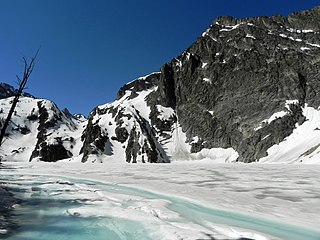
The Sawtooth Wilderness is a federally-protected wilderness area that covers 217,088 acres (87,852 ha) of the state of Idaho. Managed by the U.S. Forest Service in the U.S. Department of Agriculture, it was designated the Sawtooth Primitive Area in 1937 to preserve the exceptional scenic beauty of the Sawtooth Mountains. On August 22, 1972 Public Law 92-400 designated the Primitive Area as the Sawtooth Wilderness and part of the newly created Sawtooth National Recreation Area. As part of the National Wilderness Preservation System, the Sawtooth Wilderness is an area where human development and use are restricted and people are to remain only visitors. According to the United States Environmental Protection Agency, the Sawtooth Wilderness has some of the clearest air in the lower 48 states.

Sawtooth National Forest National forest located in Idaho and Utah in the United States

Sawtooth National Forest is a National Forest that covers 2,110,408 acres in the U.S. states of Idaho and Utah. Managed by the U.S. Forest Service in the U.S. Department of Agriculture, it was originally named the Sawtooth Forest Reserve in a proclamation issued by President Theodore Roosevelt on May 29, 1905. On August 22, 1972 a portion of the forest was designated as the Sawtooth National Recreation Area (SNRA), which includes the Sawtooth, Cecil D. Andrus–White Clouds, and Hemingway–Boulders wilderness areas. The forest is managed as four units: the SNRA and the Fairfield, Ketchum, and Minidoka Ranger Districts.

Sawtooth National Recreation Area

The Sawtooth National Recreation Area (SNRA) is a national recreation area in central Idaho, United States that is managed as part of Sawtooth National Forest. The recreation area, established on August 22, 1972, is managed by the U.S. Forest Service, and includes the Sawtooth, Hemingway–Boulders, and Cecil D. Andrus–White Clouds wilderness areas. Activities within the 730,864-acre (2,957.70 km2) recreation area include hiking, backpacking, White water rafting, camping, rock climbing, kayaking, mountain biking, fishing, and hunting.

Sawtooth Range (Idaho)

The Sawtooth Range is a mountain range of the Rocky Mountains in central Idaho, United States, reaching a maximum elevation of 10,751 feet (3,277 m) at the summit of Thompson Peak. It encompasses an area of 678 square miles (1,756 km2) spanning parts of Custer, Boise, Blaine, and Elmore counties, and is bordered to the east by the Sawtooth Valley. Much of the mountain range is within the Sawtooth Wilderness, part of the Sawtooth National Recreation Area and Sawtooth National Forest.

Thompson Peak (Idaho)

Thompson Peak, at 10,751 feet (3,277 m) above sea level is the highest peak in the Sawtooth Range of Idaho. The summit of Thompson Peak is located within Custer County, although some of the lower portion of the mountain is in Boise County. Thompson Peak is also located within the Sawtooth Wilderness portion of the Sawtooth National Recreation Area, a unit of Sawtooth National Forest. The town of Stanley, Idaho is about 6 miles (9.7 km) northeast of Thompson Peak.

Mount Cramer

Mount Cramer, at 10,716 feet (3,266 m) is the second highest peak in the Sawtooth Range of Idaho. The summit of Mount Cramer is located on the border of Custer and Boise Counties. The peak is the highest point in Boise County. Mount Cramer is also located within the Sawtooth Wilderness portion of the Sawtooth National Recreation Area. The town of Stanley, Idaho is almost 14 miles (23 km) from Mount Cramer, while the area known as Sawtooth City is nearly 12 miles (19 km) from Mount Cramer. The west side of Mount Cramer drains into the South Fork of the Payette River, while the east side drains to the Salmon River.

Mount Heyburn

Mount Heyburn, at 10,229 feet (3,118 m) is one of the many 10,000-foot (3,050 m) peaks in the Sawtooth Range of central Idaho. Mount Heyburn is located in Custer County and within the Sawtooth Wilderness portion of the Sawtooth National Recreation Area. The town of Stanley is located eight miles (13 km) north-northeast of Mount Heyburn. Grand Mogul, 9,733 ft (2,967 m), and Mount Heyburn are the two signature peaks that frame the southwest end of Redfish Lake ; all are in the Salmon River watershed.

White Cloud Mountains

The White Cloud Mountains are part of the Rocky Mountains of the western United States, located in central Idaho, southeast of Stanley in Custer County. The range is located within the Sawtooth National Recreation Area (SNRA) and partially within the Cecil D. Andrus–White Clouds Wilderness.

Sawtooth Lake Lake in United States

Sawtooth Lake is an alpine lake in Custer County, Idaho, United States, located high in the Sawtooth Mountains in the Sawtooth National Recreation Area. The lake is approximately 6.8 miles (10.9 km) southwest of Stanley. A trail from the Iron Creek trailhead and campground leads approximately 5 miles to Sawtooth Lake. The Iron Creek trailhead can be accessed from State Highway 21 via Sawtooth National Forest road 619.

Castle Peak (Idaho)

Castle Peak is a mountain in the western United States, the highest peak in the White Cloud Mountains of central Idaho and the Idaho Batholith. Located in Custer County, it is the 25th highest peak in the state, and the ninth most prominent.

Goat Lake (Sawtooth Wilderness)

Goat Lake is an alpine lake in Custer County, Idaho, United States, located high in the Sawtooth Mountains in the Sawtooth National Recreation Area. The lake is approximately 6 miles (9.7 km) southwest of Stanley. The lake is most easily accessed from the Iron Creek trailhead, which can be accessed from State Highway 21 via Sawtooth National Forest road 619.

Alice Lake (Sawtooth Wilderness)

Alice Lake is an alpine lake in Blaine County, Idaho, United States, located high in the Sawtooth Mountains in the Sawtooth National Recreation Area. The lake is one of the largest in the Sawtooth Wilderness and is most easily accessed via the trailhead at Pettit Lake, accessed from State Highway 75 via Sawtooth National Forest road 208.

The Hole (lake)

The Hole Lake is a small alpine lake in Elmore County, Idaho, United States, located in the Sawtooth Mountains in the Sawtooth National Recreation Area. The lake is accessed from Sawtooth National Forest trail 459 along Johnson Creek.

Johnson Lake

Johnson Lake is a small alpine lake in Elmore County, Idaho, United States, located in the Sawtooth Mountains in the Sawtooth National Recreation Area. The lake is accessed from Sawtooth National Forest a cutoff of trail 459 along Johnson Creek.

Upper Baron Lake

Upper Baron Lake is a small alpine lake in Boise County, Idaho, United States, located in the Sawtooth Mountains in the Sawtooth National Recreation Area. Sawtooth National Forest trail 101 goes to the lake.

Kent Peak (Boulder Mountains, Idaho)

Kent Peak, at 11,664 feet (3,555 m) above sea level is the second highest peak in the Boulder Mountains of Idaho. Located on the border of Blaine and Custer counties, Kent Peak is about 0.75 miles (1,210 m) south of the range's highest point, Ryan Peak. The peak is also on the border of Sawtooth National Recreation Area and Salmon-Challis National Forest and partially within the Hemingway–Boulders Wilderness. It is the 34th highest peak in Idaho.

Braxon Peak

Braxon Peak, at 10,353 feet (3,156 m) above sea level is a peak in the Sawtooth Range of Idaho. The peak is located in the Sawtooth Wilderness of Sawtooth National Recreation Area on the border of Boise and Custer counties. The peak is located 1.36 mi (2.19 km) south of Mount Cramer, its line parent. It is also about 1.2 mi (1.9 km) south-southwest of Mount Heyburn. Braxon Lake is just southwest of the peak.

Packrat Peak

Packrat Peak, at 10,240 feet (3,120 m) above sea level is a peak in the Sawtooth Range of Idaho. The peak is located in the Sawtooth Wilderness of Sawtooth National Recreation Area on the border of Boise and Custer counties. The peak is located 2.38 mi (3.83 km) north of Elk Peak, its line parent. Warbonnet and Little Warbonnet lakes are in the basin north of the peak.

Daves Peak

Dave's Peak, at 10,579 feet (3,224 m) above sea level is an unofficially named peak that is the ninth highest peak in the Sawtooth Range of Idaho. The peak is located in the Sawtooth Wilderness of Sawtooth National Recreation Area in Custer County. The peak is located 0.65 mi (1.05 km) northeast of Mount Cramer, its line parent. Profile and Lucille lakes are southeast of the peak, while Upper, Middle, and Lower Cramer lakes are northwest of the peak. Dave's Peak is south-southwest of Sevy Peak.

Merritt Peak (Idaho)

Merritt Peak, at 10,312 feet (3,143 m) above sea level is a peak in the Sawtooth Range of Idaho. The peak is located in the Sawtooth Wilderness of Sawtooth National Recreation Area in Custer County. The peak is located 1.08 mi (1.74 km) northwest of Williams Peak, its line parent. It is south-southwest of Goat Lake

References

  1. Sawtooth National Forest. "Sawtooth National Forest" [map].1:126,720, 1"=2 miles. Twin Falls, Idaho: Sawtooth National Forest, United States Forest Service, 1998.