
The Grauspitz is a mountain in the Rätikon range of the Alps, located on the border between Liechtenstein and Switzerland. With an elevation of 2,599 metres above sea level, the Grauspitz is the highest mountain in Liechtenstein. It is also the highest summit of the Rätikon range west of the Schesaplana massif.
The Lägern is a wooded mountain of the Jura Mountains, stretching from Baden to Dielsdorf, about 15 km north-west of Zurich. The culminating point is located 1 km west of Hochwacht within the canton of Zurich, the border with the canton of Aargau running on a slightly lower summit named Burghorn.

The Chasseral is a mountain of the Jura Mountains, overlooking Lake Biel in the Swiss canton of Bern. With an elevation of 1,606 metres above sea level, the Chasseral is the highest summit in the canton of Bern outside the Alps. It is also both the northernmost and easternmost mountain reaching over 1,500 metres in the Jura Mountains. West of the summit is located the Chasseral Ouest, where runs the border with the canton of Neuchâtel. The Chasseral Pass is located further on the west.

The Alphubel is a mountain of the Swiss Pennine Alps, located between the valleys of Zermatt and Saas in the canton of Valais. It is part of the Mischabel range, which culminates at the Dom. The summit of the Alphubel consists of a large ice-covered plateau, part of the Fee Glacier on its east side. The west side of the mountain is more rocky and much steeper. It overlooks the Weingartensee.
The Rotstöckli is a peak of the Urner Alps below the Titlis, on the border between the Swiss cantons of Obwalden and Nidwalden. It is Nidwalden's highest point. The summit is split between the municipalities of Engelberg (Obwalden) and Wolfenschiessen (Nidwalden).

Le Portalet is a mountain of the Mont Blanc massif, located west of Praz de Fort in the canton of Valais. It lies on the range between the glaciers of Trient and Saleina. It has two important subsidiary summits: Grand Clocher du Portalet and Petit Clocher du Portalet. The latter forms a needle and is particularly hard to climb.

Le Châtelet is a mountain of the Swiss Mont Blanc massif, overlooking Orsières in the canton of Valais. It lies between the valleys of Orny and Saleina.

The Wildspitz is the highest summit of the Rossberg, a mountain of the Schwyzer Alps, located on the border between the Swiss cantons of Zug and Schwyz. Reaching a height of 1,580 metres above sea level, it is the highest summit in the canton of Zug.
The Schnebelhorn is a mountain located near Fischenthal in the Töss Valley, between the cantons of Zurich (west) and St. Gallen (east). It is the highest summit of the canton of Zurich.

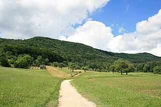
Mont Raimeux is a mountain of the Jura range, located on the border between the Swiss cantons of Jura and Berne. Reaching a height of 1,302 metres above sea level, it is the highest summit in the canton of Jura.

The Hage is a mountain in the Randen range between the Jura and the Swabian Jura, located between Beggingen and Merishausen in the Swiss canton of Schaffhausen. Reaching a height of 912 metres above sea level, it is the highest point of the canton.

The Geissfluegrat is a minor summit east of the Geissflue, in the eastern Jura Mountains. It is located between the Swiss cantons of Aargau and Solothurn. With an elevation of 908 metres above sea level, the Geissfluegrat is the highest point in Aargau. It is also the easternmost summit above 900 metres in the Jura Mountains.

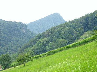
The Geissflue is a hill of the eastern Jura Mountains, located between the Swiss cantons of Basel-Landschaft and Solothurn. The border with the canton of Aargau runs east of the summit on the Geissfluegrat.
The Wasserflue is a mountain of the Jura, located north of Erlinsbach in the canton of Aargau. It lies on the range east of the Salhöhe Pass.

The Chasseral Ouest is a prominence west of the Chasseral, in the Jura Mountains. It is located on the border between the Swiss cantons of Neuchâtel and Bern. The Chasseral Ouest reaches an elevation of 1,552 metres above sea level and is the highest point of the canton of Neuchâtel.
The Schluchberg is a mountain of the Uri Alps, located on the border between the Swiss cantons of Obwalden and Nidwalden. It is the highest summit of the chain north of the Storegg pass.

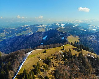
Mont Soleil is a mountain of the Jura Mountains, located north of Saint-Imier in the canton of Bern, Switzerland. The summit reaches to 1,291 metres (4,236 ft) and the area can be easily accessed by a funicular from Saint-Imier, reaching a height of 1,180 m (3,870 ft).
The Lindenberg, peaking at 878 m, is a wooded hill in the Swiss Plateau north of the Alps, situated between the valleys of the Aabach, the Bünz and the Reuss. The hill draws a straight north-south line. On his ridge lies the border between the cantons of Lucerne and Aargau. Although the highest peak lies in the canton of Lucerne in the municipality of Müswangen, around 75% of the hill lies in the Aargau. The highest point is unspectacular as it is very flat and wooded; it can be reached by foot, by bike or even by jeep. Despite being overgrown with large forests and fields, many villages are situated on the hill's slopes and at its base, some of the bigger are Muri AG, Sins, Hochdorf and Hitzkirch. The hill is a frequently used place for bikers, hikers, equestrians and families, as several restaurants exist on various places of the hill. Despite his low altitude for Swiss standards, at some points the view is quite a sight as Lake Zug, Lake Hallwil and Lake Baldegg and prominent Swiss mountains as Säntis, Tödi, Titlis and Finsteraarhorn can be seen from some places, like Horben.
The Bürglen is the highest mountain of the Albis, a wooded range stretching west of Lake Zurich in the Swiss canton of Zurich. It is located between Hausen am Albis and the valley of the Sihl.

