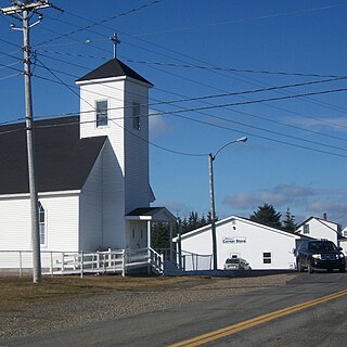
Havre Boucher is a community in Antigonish County, Nova Scotia, Canada.

Sherbrooke is a rural community on the Eastern Shore of Nova Scotia, Canada, in Guysborough County. It is located along the St. Mary's River, a major river in Nova Scotia. The community is named for Sir John Coape Sherbrooke, a colonial era Lieutenant Governor of Nova Scotia. Gold was discovered in the area in 1861 and Sherbrooke entered a gold rush which lasted two decades. The economy of the community today revolves around fishing, tourism and lumber. The community is the site of an open-air museum called "Sherbrooke Village" which depicts life in the later 1800s in the wake of the gold rush era.
Saint Mary's University (SMU) is a public university located in Halifax, Nova Scotia, Canada. The school is best known for having nationally leading programs in business and chemistry. The campus is situated in Halifax's South End and covers approximately 32 hectares.
Aylesford, since its formation, has always been a farming community. It is situated in western Kings County in the Annapolis Valley of Nova Scotia, Canada. The settlement was named after the fourth Earl of Aylesford, Heneage Finch, who was Lord Of The Bedchamber to George III from 1772-1777. The community is located between the North and South Mountains, and is roughly a 15 minute drive to Canadian Forces Base Greenwood, and a 10 minute drive to its closest neighbour, the Town Of Berwick. Aylesford is located on the Evangeline Trail scenic tourist route, which was named after the epic 1847 H.W. Longfellow poem entitled Evangeline, A Tale of Acadie.

St. Marys Bay south western Nova Scotia, Canada, is surrounded by the modern municipal districts of Clare Municipal District and Digby.
Wine Harbour is a community located in Guysborough County along the Eastern Shore of Nova Scotia.
West Loon Lake, Nova Scotia is small cottage and recreational community of rural Halifax Regional Municipality Nova Scotia situated at the northeastern corner of the municipality borders the counties of Pictou, and Colchester and Municipal District of Saint Mary's at Trafalgar. A majority of the dwellings are cottages along Loon Lake, the lake which the community derives its name from. The community is on the St. Mary's Rd, between Route 336 and Route 374. The area has an elevation of 180 metres (590 ft) - 230 metres (750 ft), and the community has an area of 5.86 square kilometres (2.26 sq mi).
Masstown, formerly Cobequid, is a farming community located approximately 17 kilometres (11 mi) from Truro, Nova Scotia.
Port Hastings is an unincorporated settlement on Cape Breton Island, within the Municipality of the County of Inverness, Canada. The population in 2021 was 90.

Port Hilford is a small community in the Canadian province of Nova Scotia, located in the Municipality of the District of Saint Mary's in Guysborough County. It was the birthplace of country and western singer Wilf Carter.
Sonora is a small fishing and mining community in the Canadian province of Nova Scotia, located in the Municipality of the District of Saint Mary's in Guysborough County.

Port Bickerton is a small community in the Canadian province of Nova Scotia, located in the Municipality of the District of Saint Mary's in Guysborough County.
Melrose is a small community in the Canadian province of Nova Scotia, located in the Municipality of the District of Saint Mary's in Guysborough County. Located on the once famous for her Atlantic salmon St. Mary's River where the East and West branches meet at Silver's Pool. Because of the nature of the hills along the river at this pool one can find a stand of old growth untouched white pine and hemlock that rivals the beauty of Stanley Park. Melrose proper borders the Cumminger and Glenelg Lakes as well as the Gulch. It with the neighbouring communities of Aspen and Glenelg constitute what is known locally as "the loop".
Jordanville is a small community in the Canadian province of Nova Scotia, located in the Municipality of the District of Saint Mary's in Guysborough County.
Harpellville is a small community in the Canadian province of Nova Scotia, located in the Municipality of the District of Saint Mary's in Guysborough County. The community was formerly known as 'Indian River'.
Argyle is a small community in the Canadian province of Nova Scotia, located in the Municipality of the District of Saint Mary's in Guysborough County.
Country Harbour Lake, is a small community in the Canadian province of Nova Scotia, located in the Municipality of the District of Saint Mary's in Guysborough County.
Isaac's Harbour North is a community in the Canadian province of Nova Scotia, located in the Municipality of the District of Guysborough in Guysborough County.
Tracadie is a small community in the Canadian province of Nova Scotia, located in Antigonish County. Tracadie has close links with nearby Upper Big Tracadie. Led by Thomas Brownspriggs, Tracadie was settled by Black Loyalists in the early 18th century. According to one 19th century observer, this community was the most successful rural Black community in the province.
There are various Black Lakes in Nova Scotia, Canada. They vary widely in size, depth and usability. Many counties, such as Cumberland, Halifax, Inverness, and Pictou Counties have more than one Black Lake so named, while other counties mentioned in this article have only one named Black Lake.


