Related Research Articles

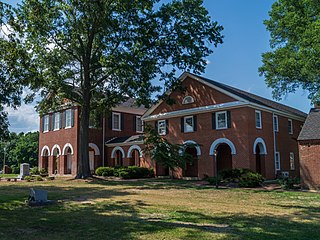
Middlesex County is a county located on the Middle Peninsula in the U.S. state of Virginia. As of the 2020 census, the population was 10,625. Its county seat is Saluda.

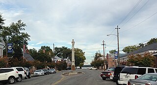
Mathews County is a county located in the U.S. state of Virginia. As of the 2020 census, the population was 8,533. Its county seat is Mathews.

Arnold, a census-designated place (CDP) in Anne Arundel County, Maryland, United States, located just outside of the state's capital, Annapolis. It is located 18.78 miles south of Baltimore, and 29.97 miles east of Washington, D.C. The population was 23,106 at the 2010 census. Neighborhoods straddle College Parkway and Maryland Route 2. Arnold is located on the scenic Broadneck Peninsula. The ZIP code is 21012. It is bordered by Severna Park to the northwest, Cape Saint Claire to the southeast, Annapolis to the southwest, and Lake Shore to the northeast.

Tappahannock is the oldest town in Essex County, Virginia, United States. The population was 2,375 at the 2010 census, up from 2,068 at the 2000 census. Located on the Rappahannock River, Tappahannock is the county seat of Essex County. Its name comes from an Algonquian language word lappihanne, meaning "Town on the rise and fall of water" or "where the tide ebbs and flows." The Rappahannock is a tidal estuary from above this point and downriver to its mouth on Chesapeake Bay.

Irvington is a town on the Rappahannock River in Lancaster County, Virginia, United States. The population was 432 at the 2010 census. Located on a peninsula known as the Northern Neck, it has been designated a historic district.

A screw-pile lighthouse is a lighthouse which stands on piles that are screwed into sandy or muddy sea or river bottoms. The first screw-pile lighthouse to begin construction was built by the blind Irish engineer Alexander Mitchell. Construction began in 1838 at the mouth of the Thames and was known as the Maplin Sands lighthouse, and first lit in 1841. However, though its construction began later, the Wyre Light in Fleetwood, Lancashire, was the first to be lit.

The Virginia Capes are the two capes, Cape Charles to the north and Cape Henry to the south, that define the entrance to the Chesapeake Bay on the eastern coast of North America.

The Middle Peninsula is the second of three large peninsulas on the western shore of Chesapeake Bay in Virginia. To the north the Rappahannock River separates it from the Northern Neck peninsula. To the south the York River separates it from the Virginia Peninsula. It encompasses six Virginia counties: Essex, Gloucester, King and Queen, King William, Mathews, and Middlesex. Developed for tobacco plantations in the colonial era, in the 21st century the Middle Peninsula is known for its quiet rural life, vegetable truck-farming, and fishing industry. As of the 2020 census, the Middle Peninsula was home to 92,886 people.

The Rappahannock River is a river in eastern Virginia, in the United States, approximately 195 miles (314 km) in length. It traverses the entire northern part of the state, from the Blue Ridge Mountains in the west where it rises, across the Piedmont to the Fall Line, and onward through the coastal plain to flow into the Chesapeake Bay, south of the Potomac River.

Deltaville is a small unincorporated community and census-designated place on the eastern tip of Middlesex County in the eastern part of the U.S. state of Virginia. It is known for being a vacation spot with sailing, fishing, and other water activities. The Middlesex County Board of Supervisors approved a resolution on October 2, 2012, supporting the efforts of the official naming, "Deltaville, The Boating Capital of the Chesapeake Bay." Approximately 500-800 full-time residents call Deltaville home; however, the town's population swells to several thousand in the summer months. Deltaville is also home to numerous retirees. The Census Bureau defines Deltaville as a census-designated place (CDP) with a population of 1,119 as of 2010. The town developed around being a large boat building area, mostly for commercial bay watermen. However those days have passed and now the area is dotted with numerous marinas, boatyards, and marine related businesses.

Cape Henry is a cape on the Atlantic shore of Virginia located in the northeast corner of Virginia Beach. It is the southern boundary of the entrance to the long estuary of the Chesapeake Bay.
New Point Comfort is a point of land located in Mathews County at the tip of Virginia's Middle Peninsula in the lower Chesapeake Bay in the United States. It is the site of the New Point Comfort Natural Area Preserve and the New Point Comfort Light.

Henry Town, Henry Towne, or Henries Towne was an early English colonial settlement near Cape Henry, the southern point and gateway to the Chesapeake Bay in the Colony and Dominion of Virginia, now in modern Virginia Beach, Virginia, on the East Coast of the United States. Archaeologist Floyd Painter of the Norfolk Museum of Arts and Sciences originally excavated the site in 1955, but it was only conclusively determined to be Henry Town in 2007 by United States Army scientists reviewing the site's artifacts, and no primary source documents exist. It was located east of Norfolk, Virginia and north of Chesapeake and south of the Hampton Roads harbor at approximately 36°54′30″N76°7′20″W. The historical and archeological site is immediately north of U.S. Route 60 on what is now Lake Joyce, formerly an inlet connecting with Pleasure House Creek, a western branch of the Lynnhaven River, itself an estuary of the Chesapeake Bay and Hampton Roads.
Smith Island is one of the Virginia Barrier Islands located adjacent to the southern end of the Eastern Shore of Virginia in Northampton County near Cape Charles.
Seaford is an unincorporated community in York County, Virginia, United States, on the Virginia Peninsula. As of the 2010 Census, the Seaford postal area had a population of 3,669.
Fort Algernon was established in the fall of 1609 at the mouth of Hampton Roads at Point Comfort in the Virginia Colony. A strategic point for guarding the shipping channel leading from the Chesapeake Bay, Fort Monroe was built there beginning in the 1830s. The area is now known as Old Point Comfort. Long part of Elizabeth City County, the site is now located in the independent city of Hampton, Virginia.

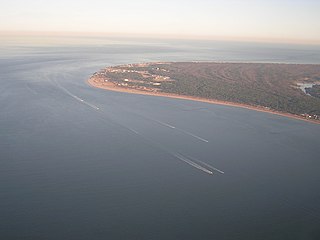
The Stingray Point Light was a lighthouse located at the mouth of the Rappahannock River.
The Poquoson River is an 11.7-mile-long (18.8 km), mostly tidal river in the state of Virginia. The river is an estuarine inlet of the Chesapeake Bay, entering just south of the mouth of the York River.

Chesapeake Bay Interpretive Buoy System (CBIBS) is a network of observational buoys that are deployed throughout the Chesapeake Bay to observe the estuary's changing conditions and to serve as way points along the Captain John Smith Chesapeake National Historic Trail. They are maintained by the United States National Oceanic and Atmospheric Administration (NOAA). These "smart buoys" observe and record meteorological, oceanographic and water quality data which can be obtained in real-time by using mobile apps or by visiting http://buoybay.noaa.gov/. CBIBS is an operational buoy system in the Chesapeake Bay dedicated to maintaining a broad range of measurements necessary to track Bay restoration progress.
The Broadneck Peninsula is an area in Anne Arundel County, Maryland. The area is north of the Severn River, south of the Magothy River and west of the Chesapeake Bay. At the lower end of the Broadneck Peninsula is the 4.3 mile Chesapeake Bay Bridge.
References
- ↑ "About Stingray Point Marina". Stingray Point Marina. Retrieved June 27, 2018.
- ↑ "Captain John Smith | Chesapeake Bay Program".
- ↑ The Times Dispatch (Richmond, Virginia), 19 Jan 1936, SunPage 43
