
Harborough is a local government district in Leicestershire, England. It is named after its main town, Market Harborough, which is where the council is based. The district also includes the town of Lutterworth and numerous villages and surrounding rural areas. In the north of the district it includes parts of the Leicester Urban Area, notably at Thurnby, Bushby and Scraptoft. Covering 230 square miles (600 km2), the district is the largest by area of the eight districts in Leicestershire and covers almost a quarter of the county.

Thurnby is a village and former civil parish, now in the parish of Thurnby and Bushby, in the Harborough district, in the county of Leicestershire, England. It is just east of Leicester's city boundaries.

Foxton is a village and civil parish in the Harborough district, in the county of Leicestershire, England, to the north-west of Market Harborough. The village is on the Grand Union Canal and is a short walk to the site of the Foxton Locks and Foxton Inclined Plane. Swingbridge Street still has a working swing bridge that allows people and vehicles to pass over the canal, which can be opened to allow canal boats to pass. There are two public houses in the village, a village hall, and a primary school. Foxton is serviced by Market Harborough train station which is approximately 3 miles away. London and Birmingham can each be reached by train in approximately 50 minutes.

Knaptoft is a deserted medieval village and civil parish in the Harborough district of Leicestershire and lies approximately 9.7 miles (15.6 km) south of the city of Leicester, England. According to the University of Nottingham English Place-names project, the settlement name Knaptoft could mean "cnafa" for 'a boy, a young man, a servant, a menial, or a personal name' and 'toft', the plot of ground in which a dwelling stands. The population of the civil parish at the 2011 census was 47.

Mowsley, pronounced "mowzley" is a small village in the south part of Leicestershire. The modern village has just under 100 dwellings. The population at the 2011 census was 302.

Burton Overy is a village and civil parish in the Harborough district of Leicestershire, about nine miles south-east of Leicester city centre, and not far from Great Glen. According to the 2001 census, the parish had a population of 289., increasing at the 2011 census to 440.

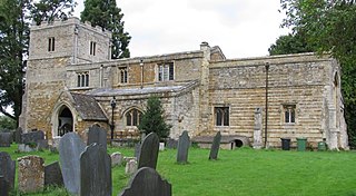
Thorpe Langton is a village and civil parish in the Harborough district of Leicestershire, about four miles north of Market Harborough. The parish had a population of 171 according to the 2001 census. Ten years later, in the 2011 census, the population had grown to 200. Thorpe Langton is the home of the Baker's Arms pub and St. Leonard's church, but is otherwise solely residential.

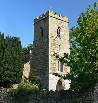
Glooston is a small village and civil parish in the Harborough district of Leicestershire, England. According to the 2001 census the parish had a population of 54, increasing to 147 at the 2011 census.
Frisby is a hamlet and civil parish in the Harborough district of Leicestershire that lies approximately 7.3 miles (11.7 km) southeast of the city of Leicester, that is now largely a deserted medieval village. According to the University of Nottingham English Place-names project, the settlement name Frisby could mean 'farm/settlement of the Frisians'. The 2011 census for Frisby returned 5 houses and 16 residents. Often termed as Frisby by Gaulby, the modern hamlet is situated between the village of Gaulby 1 mile (1.6 km) to the southwest and Billesdon 1.94 miles (3.12 km) to the northeast. The deserted part of the ancient hamlet is a Scheduled Ancient Monument and can be located on the eastern side of the lane that leads down the hill from Gaulby Road, via Frisby House on a south-eastwards direction. The earthwork "tofts & crofts" are still visible today, with foundations for two stone built buildings noted towards the center of the site.
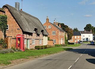
Lubenham is a village and civil parish 2 miles (3.2 km) west of Market Harborough, in the Harborough district, in the south of Leicestershire, England. The first National Hunt Chase Challenge Cup was held in Lubenham, in the grounds of what is now Thorpe Lubenham Hall. Lubenham Parish extends to Gartree in the north and Bramfield Park in the west. The village appears in four entries in the Domesday Book of 1086.

Little Bowden is an area on the edge of Market Harborough and former civil parish in the Harborough district, in the county of Leicestershire, England. As a village it was formerly part of Northamptonshire. The River Jordan runs through part of the area.
Wistow is a deserted medieval village and civil parish in the Harborough district, in the English county of Leicestershire, and lies seven miles south-east of the city of Leicester in the valley of the River Sence. Since 1 April 1936 it has included most of the former civil parish of Newton Harcourt which was a chapelry of Wistow. The population of the civil parish at the 2011 census was 256.
Tur Langton is a small village and civil parish in the Harborough district, in the heart of Leicestershire in England. Tur Langton is home to St Andrews Church and The Crown Inn, situated in the centre of the village. The next nearest settlement of significant size is the civil parish Kibworth Harcourt, 2.11 miles (3 km) west of Tur Langton. According to the 2011 census, Tur Langton had a population of 316.
Saddington is a village in the Harborough district of Leicestershire, England. It is close to Smeeton Westerby, Gumley, Kibworth and Fleckney. The population of the civil parish at the 2011 census was 309.

Little Stretton is a small village and civil parish in the Harborough district of Leicestershire that lies approximately 5.53 miles (8.90 km) southeast of the city of Leicester. The parish includes the deserted medieval village of Great Stretton (or Stretton Magna, a Scheduled Ancient Monument that is located 0.7 miles to the west of the village. The Gartree Road, a Roman Road, runs through the parish, adjacent to both Little and Great Stretton, and is the reason for those settlements' names. According to the University of Nottingham English Place-names project, the settlement name Stretton means "strēt" for a Roman road; and "tūn" for a settlement or an estate. The population of the civil parish at the 2011 census was 92, with approximately 36 households.

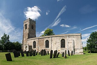
Shangton is a parish and village 1 mile (2 km) north of Tur Langton in Leicestershire, England. The parish is part of the Harborough district. According to the University of Nottingham English Place-names project, the settlement name Shangton could mean 'shank farm/settlement', a long, narrow bent piece of ground; a narrow ridge or 'shank' projecting from high ground beside the village. The population of the civil parish at the 2011 census was approximately 125.
John Boyville (1391-c.1467) was a major landowner who served as a Member of Parliament for Leicestershire and for Rutland respectively in 1453-4 and 1460–1.
Hugh Boyville was a landowner who held a number of public offices and served as a Member of Parliament for Rutland in 1439-40 and 1447.
Bolt Wood is near to the western boundary of the Parish of Stockerston, Leicestershire, England. It is suggested that the woodland on this boundary is part of that mentioned in the Domesday Book. Bolt Wood was part of the extensive Royal medieval Leighfield Forest. The first written reference to Bolt Wood is in an undated charter probably dating before the reign of Henry VI, in which it is referred to as 'Boutewood'. An alternative date offered is between 1422 and 1461.

