Burgh Castle is a village and civil parish in the English county of Norfolk. Burgh Castle is located 3.2 miles (5.1 km) south-west of Great Yarmouth and 16 miles (26 km) east of Norwich. The parish was part of Suffolk until 1974.

Stantonbury is a district and civil parish of Milton Keynes, Buckinghamshire, England, situated roughly 2 miles (3.2 km) north of Central Milton Keynes. The toponym Stanton is derived from an Old English term for "stone-built farmstead" and the bury element from the French family Barri who held it in 1235. The original Stantonbury is a deserted medieval village now known as Stanton Low; the Stantonbury name has been reused for the modern district at the heart of the civil parish.

St Osyth is an English village and civil parish in the Tendring District of north-east Essex, about 5 miles (8.0 km) west of Clacton-on-Sea and 12 miles (19.3 km) south-east of Colchester. It lies on the B1027, Colchester–Clacton road. The village is named after Osgyth, a 7th-century saint and princess. Locally, the name is sometimes pronounced "Toosey". It is claimed to be the driest recorded place in the United Kingdom. In 2011 it had a population of 4,277.

Bradfield is a village and civil parish in Berkshire, England. Aside from farms and a smaller amount of woodland its main settlements are Bradfield Southend, its medieval-founded nucleus and the hamlet of Tutts Clump. Bradfield village is the home of the public school Bradfield College.

Bottesford is a village and civil parish in the Borough of Melton in the ceremonial county of Leicestershire, England. It lies close to the borders of Nottinghamshire and Lincolnshire.
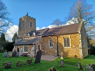
Barrowby is a village and civil parish in the South Kesteven district of Lincolnshire, England. It is 2 miles (3.2 km) west of Grantham. It overlooks the Vale of Belvoir and has a Grade I listed parish church. The hamlet of Casthorpe is part of the parish. The 2001 Census listed 795 households and a population of 1,996, which fell to 840 households with 1,952 inhabitants at the 2011 census. It was estimated at 1,986 in 2019.
Allexton is a village and civil parish in the Harborough district of Leicestershire, England. According to the 2001 census, the parish had a population of 58. At the 2011 census the population of the village remained less than 100. Details are included in the civil parish of Horninghold.

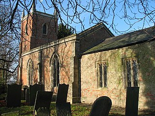
Albury is a village and civil parish in central Surrey, England, around 3.5 miles (5.6 km) east of Guildford. It is in the Surrey Hills National Landscape and the Borough of Guildford.

Antrobus is a civil parish and village in Cheshire, England, about 7 miles (11 km) south of Warrington. It lies within the unitary authority of Cheshire West and Chester, and had a population of 832, reducing to 791 at the 2011 Census, and to 767 in the 2021 Census. The parish is the most northeasterly point of Cheshire West and Chester, and as such borders both Warrington and Cheshire East. As well as Antrobus village centre itself, the parish includes other large hamlets at Frandley, about 1 mi (1.6 km) south-west from the main village, and Crowley, about 2 mi (3.2 km) to the north-east.

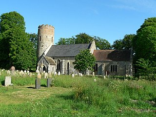
Binham is a village and a civil parish in the English county of Norfolk. Binham is 29.3 miles (47.2 km) north west of Norwich and 16.9 miles (27.2 km) west of Cromer. The village lies 4.9 miles (7.9 km) east south east of the town of Wells-next-the-Sea.

Bintree is a village and civil parish in the English county of Norfolk.

Roughton is a village and civil parish in the East Lindsey district of Lincolnshire, England. The parish population was 644 in 2011.

Barkestone-le-Vale is a village and a former civil parish, now in the parish of Redmile, in the Melton district, in the north east of Leicestershire, England. In 1931 the parish had a population of 238.

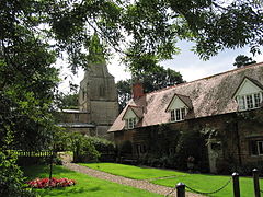
Westhampnett is a village, Anglican parish and civil parish in the district of Chichester in West Sussex, England, located 1 mile (1.6 km) northeast of Chichester on the former A27 road, now by-passed. The village is pre-Norman and is home to many listed buildings, including the Saxon church of St Peter, where three bishops of Chichester are buried. The parish of Westhampnett includes most of Goodwood estate, its golf course, motor-racing circuit and airfield.
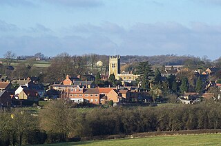
Scalford is a village and civil parish in the Melton borough of Leicestershire, England. It lies 4 miles (6.4 km) to the north of Melton Mowbray at the southern end of the Vale of Belvoir. In the 2011 census the parish had a population of 608.

Muston is a village and former civil parish, now in the parish of Bottesford, in the Melton district of Leicestershire, England. It is 18.6 miles (29.9 km) east of Nottingham, five miles (8.0 km) west of Grantham on the A52 and 12.5 miles (20.1 km) north of Melton Mowbray. It lies on the border of Leicestershire and Lincolnshire, two miles east of Bottesford. The River Devon flows through the village. In 1931 the parish had a population of 218. On 1 April 1936 the parish was abolished and merged with Bottesford.

Grimston is a village and civil parish in the Melton district, in the English county of Leicestershire. The parish includes the village of Saxelbye and the hamlet of Shoby. The population of the civil parish at the 2011 census was 294. On 1 April 1936 the parishes of Saxelby and Shoby were merged with Grimston. Although the current civil parish is called "Grimston" its parish council is called "Grimston, Saxelbye and Shoby Parish Council".

Langton by Spilsby, sometimes called Langton by Partney, is a village and civil parish in the East Lindsey district of Lincolnshire, England. It is situated approximately 4 miles (6 km) north from the town of Spilsby, Lincolnshire. The civil parish includes the hamlet of Sutterby. From the 2011 census the population is included in the civil parish of Sausthorpe.

Branston is a village and former civil parish, now in the parish of Croxton Kerrial in the Melton district, in the county of Leicestershire, England. It lies 1 mile (1.6 km) north of the A607 road, 7 miles (11 km) south-west of Grantham and 7 miles north-east of Melton Mowbray, on the southern edge of the Vale of Belvoir, 3 miles (5 km) south-west of Belvoir Castle. Knipton Reservoir is 700 yards (640 m) to the north. In 1931 the parish had a population of 249.
Flawborough is a hamlet and civil parish in the Rushcliffe borough of Nottinghamshire, England.