
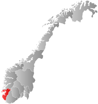
Sandnes is a city and municipality in Rogaland, Norway. It lies immediately south of Stavanger, the 4th largest city in Norway, and together the Stavanger/Sandnes area is the third-largest urban area in Norway. The urban city of Sandnes lies in the extreme western part of the vast municipality and it makes up about 5% of the total land area of the municipality.

Klepp is a municipality in Rogaland county, Norway. It is located in the traditional district of Jæren. The administrative centre of the municipality is the village of Kleppe. Other villages in Klepp include Klepp stasjon, Orre, Orstad, Pollestad, Verdalen, and Voll. Klepp is a flat and open agricultural landscape. The highest point, Tinghaug, is at 102 metres (335 ft) above sea level. There are long stretches of sand beaches along the North Sea coastline in the west.

Hundvåg is a borough of the city of Stavanger which lies in the southwestern part of the large municipality of Stavanger in Rogaland county, Norway. The borough includes a number of islands lying to the north of the main city centre of Stavanger. It includes the islands of Hundvåg, Sølyst, Grasholmen, Engøy, Buøy, Bjørnøy, Roaldsøy, and Ormøy. These islands are all connected together by bridges and they are connected to mainland Stavanger by the Stavanger City Bridge.

Vassøy is an island in Stavanger municipality in Rogaland county, Norway. The 0.73-square-kilometre (180-acre) island lies in the Storhaug borough, about 3.5 kilometres (2.2 mi) northeast of the centre of the city of Stavanger in an archipelago. The islands of Roaldsøy, Bjørnøy, and Langøy lie to the west and the island of Lindøy lies to the southeast. Vassøy had 702 inhabitants who all live along the western shore of the island; the eastern side is more rugged and wooded. The island has a primary school with around 80 pupils.
Krossberg is a village in Stavanger municipality in Rogaland county, Norway. The village is located in the city of Stavanger in the borough of Madla between the Stokkavatnet and Hålandsvatnet lakes.
Håland is a former municipality in Rogaland county, Norway. It was part of the traditional district of Jæren, just west of the city of Stavanger. The municipality existed from 1838 until its dissolution in 1930 when it was split into the two municipalities of Sola and Madla. The 85-square-kilometre (33 sq mi) municipality included the land surrounding the Hafrsfjorden including all of the present-day municipality of Sola and the borough of Madla in the city of Stavanger.
Madla is a borough of the city of Stavanger which lies in the southwestern part of the large municipality of Stavanger in Rogaland county, Norway. It lies in the western part of the city, along the coast of the Hafrsfjorden. The 13.87-square-kilometre (3,430-acre) borough has a population (2017) of 21,130. This gives the borough a population density of 1,531 inhabitants per square kilometre (3,970/sq mi). The borough was added to the city of Stavanger in 1965 when the old municipality of Madla was merged into the city.
Tasta is a borough of the city of Stavanger which lies in the southwestern part of the large municipality of Stavanger in Rogaland county, Norway. The borough is located in the northern part of the city. The 10.87-square-kilometre (2,690-acre) borough has a population (2016) of 15,379. This gives the borough a population density of 1,415 inhabitants per square kilometre (3,660/sq mi).
Eiganes og Våland is a borough of the city of Stavanger which lies in the southwestern part of the large municipality of Stavanger in Rogaland county, Norway. It is located just west of the city centre, north of the lake Mosvatnet, west of the lake Stokkavatnet, and south of the borough of Tasta. The 7.01-square-kilometre (1,730-acre) borough has a population (2019) of 24,070. This gives the borough a population density of 3,400 inhabitants per square kilometre (8,800/sq mi). There are two churches in Eiganes og Våland: Stokka Church and Kampen Church.
Hillevåg is a borough of the city of Stavanger which lies in the southwestern part of the large municipality of Stavanger in Rogaland county, Norway. It is located southwest of the city centre, south of the lake Mosvatnet, and north of the borough of Hinna. Hillevåg was a part of the old municipality of Hetland until 1965. The borough has residential areas as well as some industrial areas. The University of Stavanger and the Norwegian Petroleum Directorate are located in Hillevåg also. The 8.08-square-kilometre (2,000-acre) borough has a population (2016) of 19,681. This gives the borough a population density of 2,436 inhabitants per square kilometre (6,310/sq mi).
Hinna is a borough of the city of Stavanger which lies in the southwestern part of the large municipality of Stavanger in Rogaland county, Norway. The borough includes the southernmost part of the city, bordering the city of Sandnes. The borough of Hillevåg lies to the north, the municipality of Sola lies to the west, and the Gandsfjorden lies to the east. Hillevåg was a part of the old municipality of Hetland until 1965. The borough has residential areas as well as some industrial areas, especially relating to the oil industry. The 15-square-kilometre (3,700-acre) borough has a population (2016) of 22,581. This gives the borough a population density of 1,505 inhabitants per square kilometre (3,900/sq mi).
Vaulen is a neighborhood (delområde) in the city of Stavanger which lies in the southwestern part of the large municipality of Stavanger in Rogaland county, Norway. It is located along the Gandsfjorden in the boroughs of Hillevåg and Hinna. The neighborhood has a population of 6,039 which is distributed over an area of 3.4 square kilometres.

Våland is a neighborhood (delområde) in the city of Stavanger which lies in the southwestern part of the large municipality of Stavanger in Rogaland county, Norway. It is located in the borough of Eiganes og Våland. It is located to the south part of central Stavanger—east of Mosvatnet lake. The neighborhood has a population of 6,152 which is distributed over an area of 2.23 square kilometres.
Johannes is a neighborhood (delområde) in the city of Stavanger which lies in the southwestern part of the large municipality of Stavanger in Rogaland county, Norway. It is located in the northern part of the borough of Storhaug in the area surrounding the St. Johannes Church. The neighborhood has a population of 2,309 which is distributed over an area of 0.56 square kilometres.
Varden is a neighborhood (delområde) in the city of Stavanger which lies in the southwestern part of the large municipality of Stavanger in Rogaland county, Norway. It is located in the southern part of the borough of Storhaug, southeast of Paradis. The neighborhood has a population of 3,917 which is distributed over an area of 1.5 square kilometres. Varden Church is located in this neighborhood.
Nylund is a neighborhood (delområde) in the city of Stavanger which lies in the southwestern part of the large municipality of Stavanger in Rogaland county, Norway. It is located in the borough of Storhaug, between the neighborhoods of Johannes and Paradis. The neighborhood has a population of 2,025 which is distributed over an area of 0.39 square kilometres.
Bergjeland or Bergeland is a neighborhood (delområde) in the city of Stavanger which lies in the southwestern part of the large municipality of Stavanger in Rogaland county, Norway. It is located in the northern part of the borough of Storhaug, and it includes part of the city centre. The neighborhood has a population of 3,146 which is distributed over an area of 0.88 square kilometres (0.34 sq mi).
Paradis is a neighborhood (delområde) in the city of Stavanger which lies in the southwestern part of the large municipality of Stavanger in Rogaland county, Norway. It is located in the western part of the borough of Storhaug, just west of Nylund. It is served by Paradis Station of the Jæren Commuter Rail.

Breiavatnet is a small lake in the municipality of Stavanger in Rogaland county, Norway. The 0.031-square-kilometre (7.7-acre) lake is very shallow, only a few feet deep. The lake gets its water from the Kannikbekken stream, which flows from the Mosvatnet lake and runs through the city. A decorative fountain was installed in the middle of the lake in 1924.

Madla is a former municipality in Rogaland county, Norway. The 15.75-square-kilometre (6.08 sq mi) municipality existed from 1930 until 1965 when it was merged into Stavanger Municipality. The small municipality now exists as the borough of Madla inside the city of Stavanger, on the northeast side of the Hafrsfjorden. It was one of the smallest municipalities in Rogaland county, with only four farms: Malde, Revheim, and North- and South-Sunde. The municipal centre was located at Malde, now known as Madlamark.

